North Newport News , Virginia — The American South (Mid-Atlantic)
Lee Hall
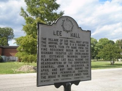
Photographed by Bill Coughlin, August 11, 2008
1. Lee Hall Marker
Erected 1970 by Newport News Historical Committee.
Topics and series. This historical marker is listed in these topic lists: Notable Places • War, US Civil. In addition, it is included in the Virginia, Corporation of Newport News series list. A significant historical month for this entry is May 1862.
Location. 37° 11.656′ N, 76° 34.313′ W. Marker is in Newport News, Virginia. It is in North Newport News. It is at the intersection of Elmhurst Street and Yorktown Road (Virginia Route 238), on the right when traveling west on Elmhurst Street. Touch for map. Marker is at or near this postal address: 40 Yorktown Road, Newport News VA 23603, United States of America. Touch for directions.

Regionally, this marker is on Virginia’s Peninsula,
this page online
Other nearby markers. At least 8 other markers are within walking distance of this marker: The Simon Reid Curtis House (within shouting distance of this marker); Lee Hall Village (within shouting distance of this marker); Lee Hall Depot (within shouting distance of this marker); C&O "Peninsula Extension" (within shouting distance of this marker); Chessie System Caboose (within shouting distance of this marker); a different marker also named Lee Hall (approx. 0.4 miles away); An Earthwork In Front (approx. 0.4 miles away); Largest and Most Valuable Estate in the County (approx. 0.4 miles away). Touch for a list and map
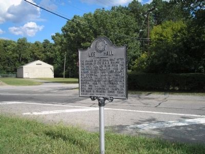
Photographed by Bill Coughlin, August 11, 2008
2. Lee Hall Marker
Another marker is no longer nearby. An Earthwork in Front (was approx. 0.4 miles away but has been replaced with another marker now near it).
Also see . . .
1. Lee Hall Mansion. (Submitted on August 14, 2008, by Bill Coughlin of Woodland Park, New Jersey.)
2. The Peninsula Campaign. (Submitted on August 14, 2008, by Bill Coughlin of Woodland Park, New Jersey.)
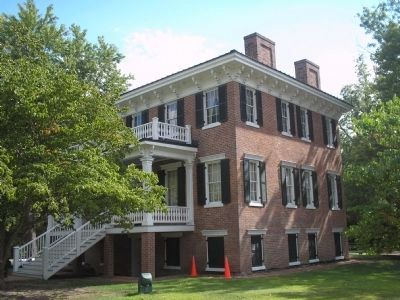
Photographed by Bill Coughlin, August 11, 2008
3. Lee Hall
This mansion was used as a headquarters building for Confederate Generals John B. Magruder and Joseph E. Johnston during the 1862 Peninsula Campaign.
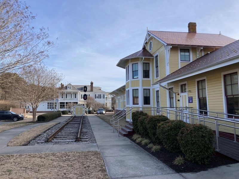
Photographed by Evan Dwyer, February 14, 2026
4. Village of Lee Hall
The 1880s train depot at right was moved to this site in 2009; it was originally on the west side of the tracks (out of frame to the far right). The large building across the street is the ca. 1896 Simon Reid Curtis House, the historic hub of community activity at the village.
Photographed by Evan Dwyer, February 14, 2026
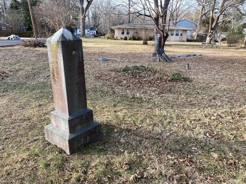
5. Lee Family Cemetery
Richard Decatur Lee, namesake of Lee Hall, is buried in the immediate foreground. The gravestone closest to the camera has his wife's name on the panel nearest, while his name is on the same stone but on the side facing the rest of the graves. This cemetery is between houses on Curtis Drive about 2000' Southwest of the Lee Hall Marker.
Credits. This page was last revised on April 13, 2026. It was originally submitted on August 14, 2008, by Bill Coughlin of Woodland Park, New Jersey. This page has been viewed 1,282 times since then and 55 times this year. Last updated on February 15, 2026, by Evan Dwyer of Richmond, Virginia. Photos: 1, 2, 3. submitted on August 14, 2008, by Bill Coughlin of Woodland Park, New Jersey. 4, 5. submitted on April 10, 2026, by Evan Dwyer of Richmond, Virginia. • Devry Becker Jones was the editor who published this page.
