Near Yoakum in Lavaca County, Texas — The American South (West South Central)
The United Methodist Church of Hope
Photographed by Dave W, February 14, 2026
1. The United Methodist Church of Hope Marker
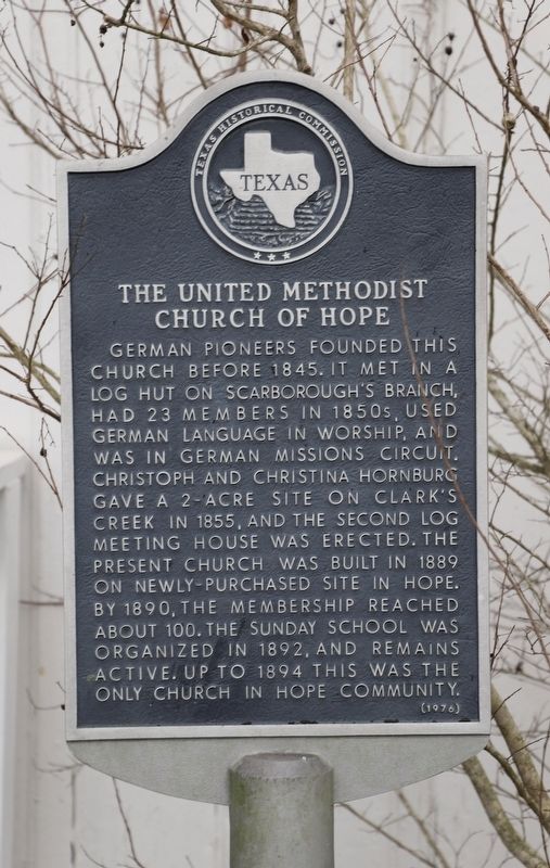
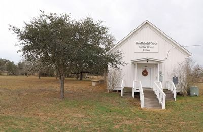
German pioneers founded this church before 1845. It met in a log hut on Scarborough's Branch, had 23 members in 1850s, used German language in worship, and was in German missions circuit. Christoph and Christina Hornburg gave a 2-acre site on Clark's Creek in 1855, and the second log meeting house was erected. The present church was built in 1889 on newly-purchased site in Hope. By 1890, the membership reached about 100. The Sunday School was organized in 1892, and remains active. Up to 1894 this was the only church in Hope Community.
Erected 1976 by Texas Historical Commission. (Marker Number 5443.)
Topics. This historical marker is listed in these topic lists: Immigration • Religion & Religious Structures • Settlements & Settlers. A significant historical year for this entry is 1855.
Location. 29° 13.026′ N, 96° 59.945′ W. Marker is near Yoakum, Texas, in Lavaca County. It is at the intersection of County Road 413 and County Road 414, on the right when traveling east on County Road 413. Touch for map. Marker is at or near this postal address: 92 Co Rd 413, Yoakum TX 77995, United States of America. Touch for directions.

Regionally, this marker is in the American South and on the Gulf Coast. Globally, it is in North America, a Gulf of Mexico state, the Western Hemisphere, the Western World, and the Anglosphere. Historically, it finds itself in what was once New Spain, the Republic of Texas, one of the Confederate States of America, and the Antebellum South.
Other nearby markers. At least 8 other markers are within 8 miles of this marker, measured as the crow flies: Hope Baptist Church (about 400 feet away, measured in a direct line); Nancy Shows (approx. 4.8 miles away); Hebron Community (approx. 4.8 miles away); County Line School, Church, and Cemetery (approx. 5.3 miles away);
this page online
Photographed by Dave W, February 14, 2026
2. The United Methodist Church of Hope Marker
Credits. This page was last revised on February 15, 2026. It was originally submitted on February 15, 2026, by Dave W of Co, Colorado. This page has been viewed 63 times since then. Photos: 1, 2. submitted on February 15, 2026, by Dave W of Co, Colorado. • James Hulse was the editor who published this page.
