
Yorktown in York County, Virginia — The American South (Mid-Atlantic)
Royal Welch Fusiliers Redoubt
The 1781 Siege of Yorktown
| — | Colonial National Historical Park | — |
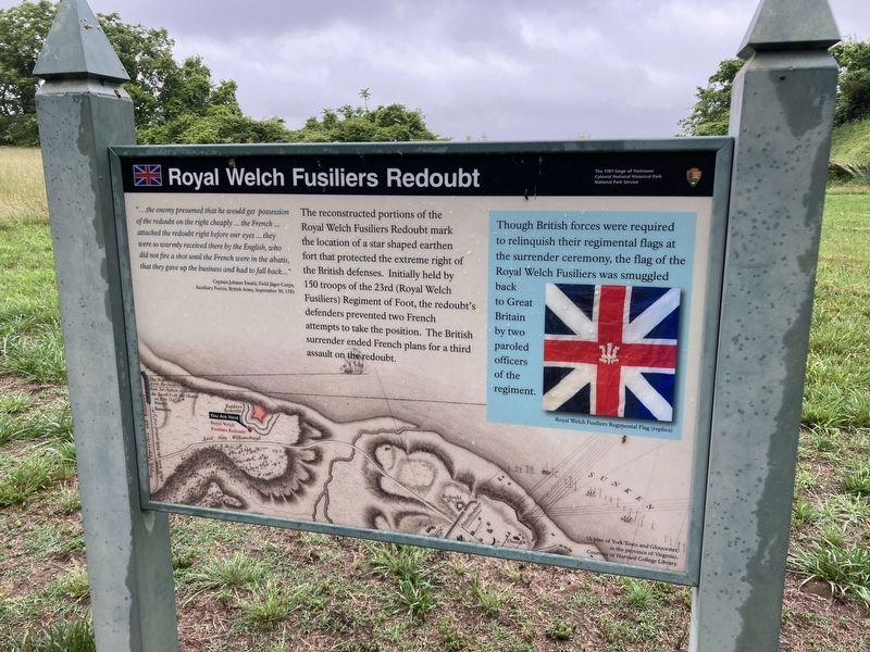
Photographed by Evan Dwyer, May 18, 2024
1. Royal Welch Fusiliers Redoubt Marker
Captain Johann Ewald, Field Jäger Corps, Auxiliary Forces, British Army, September 30, 1781
The reconstructed portions of the Royal Welch Fusiliers Redoubt mark the location of a star shaped earthen fort that protected the extreme right of the British defenses. Initially held by 150 troops of the 23rd (Royal Welch Fusiliers) Regiment of Foot, the redoubt's defenders prevented two French attempts to take the position. The British surrender ended French plans for a third assault on the redoubt.
(sidebar)
Though British forces were required to relinquish their regimental flags at the surrender ceremony, the flag of the Royal Welch Fusiliers was smuggled back to Great Britain by two paroled officers of the Regiment.
Erected by National Park Service, U.S. Department of the Interior.
Topics. This
this page online
Location. 37° 14.393′ N, 76° 31.055′ W. Marker is in Yorktown, Virginia, in York County. It can be reached from the intersection of Water Street and Fusiliers Redoubt Ramp, on the right when traveling west. Marker is on the riverwalk footpath where Water Street meets the Colonial Parkway on ramp in front of the American Revolution Museum at Yorktown (Victory Center). Touch for map. Marker is in this post office area: Yorktown VA 23690, United States of America. Touch for directions.

Regionally, this marker is on Virginia’s Peninsula, in Coastal Virginia, and in the Hampton Roads Metropolitan Area. It is also in the American South, specifically in the Upper South, in the Tidewater, and on the Eastern Seaboard. Globally, it is in the North Atlantic Region, North America, the Western Hemisphere, the Western World, and the Anglosphere. Historically, it finds itself in what was once the territory of the Mississippian Culture, one of the original Thirteen Colonies, one of the Confederate

Photographed by Evan Dwyer, May 18, 2024
2. Royal Welch Fusiliers Redoubt Marker
The reconstructed redoubt is beyond.
Other nearby markers. At least 8 other markers are within walking distance of this marker: New Hampshire (within shouting distance of this marker); South Carolina (within shouting distance of this marker); Maryland (within shouting distance of this marker); New York (within shouting distance of this marker); North Carolina (within shouting distance of this marker); Massachusetts (within shouting distance of this marker); Rhode Island (within shouting distance of this marker); Connecticut (within shouting distance of this marker). Touch for a list and map of all markers in Yorktown.
Also see . . . Colonial National Historical Park. National Park Service (Submitted on February 16, 2026.)

Photographed by Evan Dwyer, May 18, 2024
3. Royal Welch Fusiliers Redoubt
Erosion has impacted how much of the original redoubt site remains. The replica fortification is only partial as a result of the reduction in the size of the bluff.
Credits. This page was last revised on February 16, 2026. It was originally submitted on February 15, 2026, by Evan Dwyer of Richmond, Virginia. This page has been viewed 40 times since then. Photos: 1, 2, 3. submitted on February 15, 2026, by Evan Dwyer of Richmond, Virginia. • Bernard Fisher was the editor who published this page.
