Veronetta in Verona in Provincia di Verona, Venetia, Italy — Southern and Western Europe (Mediterranean)
Libro Percorso - una città ritrova il suo fiume
⎯⎯⎯
Book Route - a city finds its river again
Photographed by James Hulse, June 11, 2025
1. Libro Percorso - una città ritrova il suo fiume / Book Route - a city finds its river again Marker

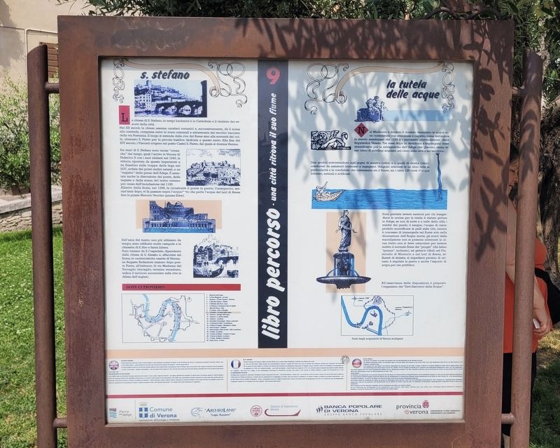
s. stefano
La chiesa di S. Stefano, in tempi barbarici è la Cattedrale e il cimitero dei vescovi della città. Nel XII secolo la chiesa assume caratteri romanici e, successivamente, dà il nome alla contrada, compresa entro le mura comunali e attraversata dal vecchio tracciato della via Postumia. Il luogo si estende dalla riva del fiume sino alla sommità del colle, chiamato S. Pietro per la piccola basilica dedicata a questo santo. Alla fine del XIV secolo, i Visconti erigono sul posto Castel S. Pietro, dal quale si domina Verona.
Sui muri di S. Stefano sono incise "cronache" dei tempi, quali l'arrivo in Verona di Federico II con i suoi elefanti nel 1245, la vittoria riportata da questo imperatore e da Ezzelino sulle truppe della lega nel 1237, notizie dei primi mulini natanti, e un "registro" delle piene dell'Adige. È annotata anche la distruzione del ponte, delle regaste e della scena del teatro romano per causa dell'inondazione del 1195. Alberto della Scala, nel 1298, fa ricostruire il ponte in pietra; Cansignorio, settant'anni dopo, vi fa passare sopra l'acquedotto che porta l'acqua del Lori di Avesa
this page online
Sull'area del teatro, non più utilizzato da tempo, sono edificate molte casupole e la chiesetta di S. Siro e Santa Libera. Poco lontano da li l'ospedale, dipendente dalla chiesa di S. Alessio e, affacciate sul fiume, le caratteristiche casette di Verona. Le Regaste Redentore iniziano dopo ponte Pietra, all'imbocco di via Madonna del Terraglio (terraglio, termine veneziano, indica il terriccio accumulato sulla riva in difesa dell'argine).
la tutela delle acque
Nel Medioevo e durante il dominio veneziano le acque sono considerate con attenzione e rispetto, come testimonia lo statuto ezzeliniano del 1228 e i successivi provvedimenti della Repubblica Veneta. Tre mesi dopo la dedizione s'impongono tasse straordinarie per la salvaguardia dell'Adige che gravano, senza tener conto di privilegi acquisiti, sul clero, sulla città e sul territorio.
Due giudici sovrintendono agli argini di sinistra (ultra) e a quelli di destra (citra), coadiuvati da assistenti (viatores) e ingegneri. Vengono annotate in un libro tutte le particolarità e le condizioni che interessano sia il fiume, sia i circa
Photographed by James Hulse
2. Libro Percorso - una città ritrova il suo fiume / Book Route - a city finds its river again Marker
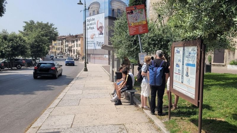
The view of the marker along the street.
Sono previste severe sanzioni per chi trasgredisce le norme per la tutela: è vietato gettare in Adige, se non di notte e a valle della città, i residui del guado, il sangue, l'acqua di calce; proibito scarnificare le pelli sulle rive, mentre è concesso di immergerle nel fiume solo nella diramazione dell'Acqua morta; gli scarti della macellazione non si possono eliminare in alcun tratto; non si deve ostacolare per nessun motivo il normale fluire dei "progni" (dal latino "pronus", inclinato), né gettarvi rifiuti; nel Fiumicello di Montorio e nel Lori di Avesa, affluenti di sinistra, si impedisce persino di urinare; è regolata la pesca e anche l'asporto di acqua per uso pubblico.
All'osservanza delle disposizioni è preposto l'organismo del "Savi Esecutori delle Acque".
Fonti degli acquedotti di Verona scaligera
9 Santo Stefano
During barbarian times the church of Santo Stefano is both cathedral and bishops' cemetery. In the XII century the church is refurbished according to Romanic criteria; later on the whole district - laying within the city walls and crossed
Photographed by James Hulse, June 11, 2025
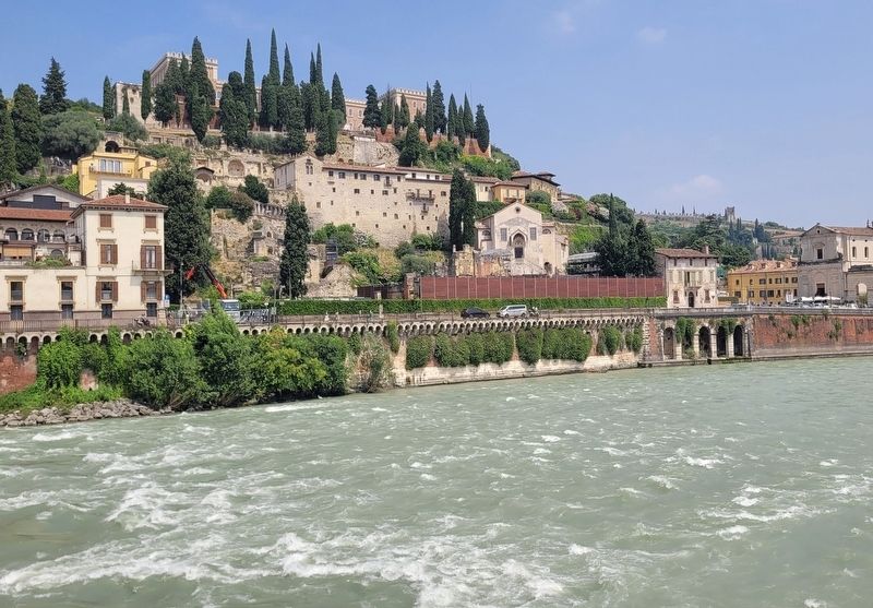
3. The view of the Adige River near the marker
The Protetion of the Waters
In the Middle Ages and during the Venetian domination the waters - rivers, canals, irrigation channels - are highly regarded and respected, as shown both in the Statute signed in 1228 by Ezzelino and in the measures taken by the Repubblica Veneta later on. In order to raise money for the preservation of the Adige river, extraordinary taxation measures are taken only three months after the dedication of the town of Verona to Venice; all citizens are involved - Church members, nobles, ordinary citizens, regardless of acquired privileges. Severe legal sanctions are applied to those who break the regulations for the protection of waters. A special committee called "Savi Esecutori
Photographed by James Hulse, June 11, 2025
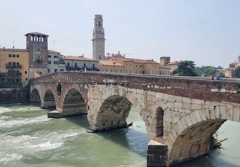
4. The Stone Bridge (Ponte Pietro) over the Adige River
9 S. Stefano
Pendant l'époque des barbares, l'église de Santo Stefano est en même temps cathédrale et cimetière des évêques de la ville. Au cours du XIIe siècle, l'église prend ses caractéristiques romanes; ensuite elle donne son nom au quartier qui l'entoure, traversé par l'ancienne Via Postumia. Sur les parois de Santo Stefano on retrouve des ciselures qui racontent des événements importants de l'époque, comme l'arrivée à Vérone de Frédéric II, accompagné par ses éléphants, en 1245, ou la victoire du même avec l'aide d’Ezzelino contre l'armée de la Ligue en 1237. Il y a aussi des notes concernant les premiers moulins flottants, un « registre » des crues de l’Adige, et un témoignage concernant la destruction du pont, des quais et des scènes du Teatro Romano à cause de l'inondation de 1195.
La sauvegarde des eaux
Au Moyen Âge et pendant la domination vénitienne, l'énorme importance des eaux — c'est-à-dire fleuves, canaux, lacs — est reconnue et mise en valeur, comme on le voit très bien dans le Statut de 1228, signé par Ezzelino da Romano, et ensuite dans les dispositions de la République de Venise. Trois mois après la dédition de Vérone à Venise, on établit une taxation extraordinaire — ne tenant compte d'aucun privilège d'exemption — visant à sauvegarder les eaux de l'Adige. On prévoit des sanctions très sévères pour les transgresseurs de la loi, car la tutelle des eaux est fondamentale. L'organisme vigilant sur la sauvegarde des eaux s'appelle « Savi Esecutori delle Acque ».
9 San Stefano
Die Kirche „San Stefano“ ist zu Zeiten der Barbaren Dom und Bischofsfriedhof für die Bischöfe der Stadt. Im 12. Jahrhundert nimmt sie romanische Züge an und gibt später ihren Namen an das Viertel weiter, das in den Stadtmauern liegt und von der alten Trasse der „Via Postumia“ durchquert wird. In die Mauern von „San Stefano“ sind Berichte eingemeißelt. Sie stammen aus den Zeiten, in denen „Federico II“ mit seinen Elefanten im Jahre 1245 in Verona ankam. Auch der wiedererlangte Sieg dieses Kaisers und der von „Ezzelino“ über die Truppen des Bundes (A.d.Ü.: gemeint ist der lombardische Städtebund) im Jahre 1237 sind festgehalten. Man findet Angaben über die ersten schwimmenden Mühlen und ein „Hochwasserverzeichnis“ der Etsch. Ebenfalls verzeichnet sind die Zerstörung der Brücke, der gemauerten Kaimauern und der Bühne des „Teatro Romano“ durch die Überschwemmung im Jahre 1195.
Wasserschutz
Im Mittelalter und während der venezianischen Herrschaft wird das Wasser mit Aufmerksamkeit und Respekt bedacht, wie die ezzelinische Satzung von 1228 und die darauf folgenden Maßnahmen der Republik Venedig bezeugen. Bereits drei Monate nach der Inkraftsetzung der venezianischen Herrschaft werden Sondersteuern für den Schutz der Etsch erhoben, die — ohne Berücksichtigung erworbener Privilegien — sowohl für den Klerus als auch für die Stadt sowie für das gesamte Hoheitsgebiet gültig sind. Zwei Richter stehen der Eintreibung der Steuer vor, die sowohl am linksseitigen Damm (genannt „ultra“) als auch am rechtsseitigen Damm (genannt „citra“) stattfindet, unterstützt durch Assistenten (sogenannte „viatores“) und Ingenieure. Alle Besonderheiten und der Zustand des Flusses sowie der etwa 125 natürlichen und künstlichen, abgabepflichtigen Wasserläufe werden in einem Buch festgehalten. Harte Sanktionen sind für diejenigen vorgesehen, die die Anweisungen zum Schutz des Wassers verletzen. Für die Einhaltung der Anordnungen ist die Organisation „Savi Esecutori delle Acque“ (deutsch etwa „die weisen oder vernünftigen Wasservollstrecker“) zuständig. Abbildung: Veronesische Wasserquellen zur Zeit der Herrschaft der Familie Scaliger.
Erected by Comune di Verona, "Archeo Land" "Lupo Azzurro", Camera di Commercio Verona, Banca Popolare di Verona Gruppo Banco Popolare and Provincia di Verona, Assessorato ai Beni Ambientali, Assessorato all'Ambiente. (Marker Number 9.)
Topics. This historical marker is listed in these topic lists: Forts and Castles • Waterways & Vessels. A significant historical year for this entry is 1245.
Location. 45° 26.91′ N, 11° 0.018′ E. Marker is in Verona, Veneto (Venetia), in Provincia di Verona. It is in Veronetta. It is at the intersection of Lungadige S. Giorgio and Via Santo Stefano, on the right when traveling west on Lungadige S. Giorgio. Touch for map. Marker is at or near this postal address: Via Santo Stefano 13, Verona, Veneto 37129, Italy. Touch for directions.

Regionally, it is in Europe, the European Union, the Schengen Area, a coastal Mediterranean country, and the Western World. Historically, it finds itself in what was once the Roman Empire and specifically also the Holy Roman Empire.
Other nearby markers. At least 8 other markers are within walking distance of this marker: Romea Postumia / Pilgrimage Route to Rome (about 90 meters away, measured in a direct line); Chiesa di Sant'Elena (secoli IX–XII) e Battistero di San Giovanni in Fonte (secolo XII) (approx. 0.2 kilometers away); Giuseppe Zamboni (approx. 0.3 kilometers away); Duomo di Santa Maria Matricolare (secolo XII) / Cathedral of Santa Maria Matricolare (12th century) (approx. 0.3 kilometers away); Basilica di Sant'Anastasia / Basilica of Saint Anastasia (approx. 0.4 kilometers away); Chiesa di San Giorgetto o San Pietro Martire / Church of San Giorgetto, or Saint Peter Martyr (approx. 0.4 kilometers away); Guglielmo Guarienti (approx. 0.4 kilometers away); Giuseppe Catterinetti Franco and Marianna Catterinetti Franco Fontana (approx. 0.6 kilometers away). Touch for a list and map of all markers in Verona.
Credits. This page was last revised on February 16, 2026. It was originally submitted on February 16, 2026, by James Hulse of Medina, Texas. This page has been viewed 44 times since then. Photos: 1, 2, 3, 4. submitted on February 16, 2026, by James Hulse of Medina, Texas.
