Darnestown in Montgomery County, Maryland — The American Northeast (Mid-Atlantic)
Darnestown
Confederate Visit
| — | Gettysburg Campaign | — |
Photographed by Craig Swain, July 7, 2007
1. Darnestown Marker
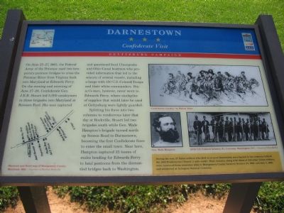
On June 25-27, 1863, the Federal Army of the Potomac used two temporary pontoon bridges to cross the Potomac River from Virginia back into Maryland at Edwards Ferry. On the evening and morning of June 27-28, Confederate Gen. J.E.B. Stuart led 5,000 cavalrymen in three brigades into Maryland at Rowsers Ford. His men captured and questioned local Chesapeake and Ohio Canal boatmen who provided information that led to the seizure of several vessels, including a barge with 150 U.S. Colored Troops and their white commanders. Stuart's men, however, never went to Edwards Ferry, where stockpiles of supplies that would later be used at Gettysburg were lightly guarded.
Splitting his force into two columns to rendezvous later that day at Rockville, Stuart led two brigades south while Gen. Wade Hampton's brigade turned north up Seneca Road to Darnestown, becoming the first Confederate force to enter the small town. Near here, Hampton captured 25 teams of mules heading for Edwards Ferry to haul pontoons from the dismantled bridges back to Washington.
(sidebar) During the war, 27 Union soldiers who died in or near Darnestown were buried
this page online
Topics and series. This historical marker is listed in this topic list: War, US Civil. In addition, it is included in the Chesapeake and Ohio (C&O) Canal, and the Maryland Civil War Trails series lists. A significant historical month for this entry is June 1862.
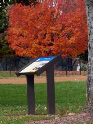
Location. 39° 6.361′ N, 77° 17.725′ W. Marker is in Darnestown, Maryland, in Montgomery County. It is on Darnestown Road (Maryland Route 28) 0.4 miles west of Seneca Road ( Route 112), on the right when traveling west. Located at the edge of the parking lot for Darnestown Park. Touch for map. Marker is at or near this postal address: 14211 Darnestown Road, Germantown MD 20874, United States of America. Touch for directions.

Regionally, this marker is in the Washington Metropolitan Area. It is also in the American Mid-Atlantic. Globally, it is in North America, the Western Hemisphere, the Western World, and
Photographed by Allen C. Browne, October 22, 2013
2. Darnestown Marker
Other nearby markers. At least 8 other markers are within walking distance of this marker: The Cliff Bland Recreation Area (about 300 feet away, measured in a direct line); The Signal Corps and Wartime Communications (approx. 0.3 miles away); The Civil War in Darnestown (approx. 0.3 miles away); Civil War Troops & Darnestown Residents (approx. 0.3 miles away); Darnestown: A Strategic Point of Defense (approx. 0.3 miles away); Disease, Death, and Medical Discoveries During the Civil War (approx. 0.3 miles away); Clues to the Past: Oral History and Archaeology (approx. 0.3 miles away); A 19th Century Crossroads (approx. 0.3 miles away). Touch for a list and map of all markers in Darnestown.
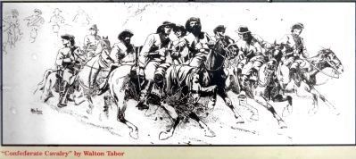
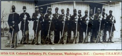
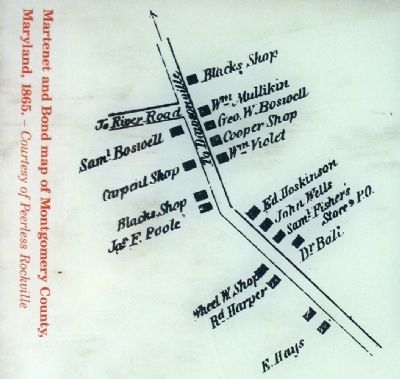
More about this marker. The marker features three pictures, a drawing by Walton Tabor titled “Confederate Cavalry,” a portrait of Gen. Wade Hampton, and a picture of the 107th U.S. Colored Infantry at Fort Corcoran, Washington, D.C. The marker also displays a bond map of Montgomery County.
Additional keywords. USCT
Photographed by Craig Swain, July 7, 2007
3. Darnestown Park Entrance
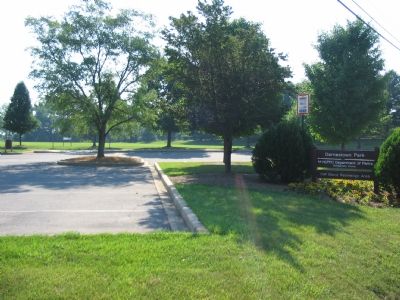
Marker can be seen past the parking area.
Photographed by Allen C. Browne, October 22, 2013
4. "Confederate Cavalry"
By Walton Tabor
By Walton Tabor
Photographed by Allen C. Browne, October 22, 2013
5. 107th U.S. Colored Infantry
Fort Corcoran, Washington D.C.
Fort Corcoran, Washington D.C.
The U.S Army Military History Institute
Photographed by Allen C. Browne, October 22, 2013
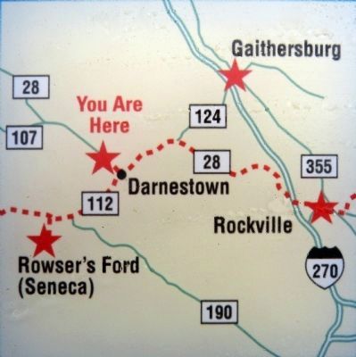
6. Map
You Are Here
You Are Here
July 7, 2007
7. Close Up of the Bond Map
Map has been rotated for easier reading. North is to the right.
Credits. This page was last revised on February 20, 2026. It was originally submitted on July 14, 2007, by Craig Swain of Leesburg, Virginia. This page has been viewed 2,400 times since then and 74 times this year. Last updated on February 20, 2026, by Carl Gordon Moore Jr. of North East, Maryland. Photos: 1. submitted on July 14, 2007, by Craig Swain of Leesburg, Virginia. 2. submitted on October 24, 2013, by Allen C. Browne of Silver Spring, Maryland. 3. submitted on July 14, 2007, by Craig Swain of Leesburg, Virginia. 4, 5, 6. submitted on October 24, 2013, by Allen C. Browne of Silver Spring, Maryland. 7. submitted on July 14, 2007, by Craig Swain of Leesburg, Virginia. • Devry Becker Jones was the editor who published this page.
