Pagosa Springs in Archuleta County, Colorado — The American Mountains (Southwest)
Pagosa Springs

Photographed by Cosmos Mariner, July 13, 2025
1. Pagosa Springs Marker
Geothermal Energy
Early settlers in Pagosa Springs took full advantage of the comforts afforded by the mineral waters. Many built special bathing rooms attached to their homes, the better to soak in privacy; others (beginning in the 1900s) tapped the 153-degree waters as a source of winter heat, piping them in directly via rudimentary plumbing systems. This practice gained widespread attention in the 1970s, when nationwide oil shortages raised the demand for cheap, renewable energy. Local officials moved quickly to harness the resource, launching a $1 million system in 1982 to heat downtown buildings and aid with sidewalk snow removal. The ground-breaking project demonstrated the great energy potential of Colorado's natural hot springs, which according to one estimate could heat up to 100,000 homes each winter.
Capt. John Macomb's 1859 wanderings in the San Juan Mountains brought him to one of the sacred Ute places — Pagosa, translated today as “healing waters.” His reverent descriptions of the hot springs attracted a trickle of white visitors whose presence the Utes tolerated in summertime but prohibited in winter, when
this page online
[photo captions]
• Pagosa Springs, 1890s
• Hot springs are created when heated underground water rises back to the surface through a fault. The hot water also can be tapped by digging wells.
• Lumber companies and sawmills proliferated around the Pagosa Springs area in the 1890s. When the resource was depleted, related industries also disappeared.
• In 1878 an army post was established at Pagosa Springs and named in honor of Lt. Col. W. H. Lewis, an officer who had been killed by Cheyennes the previous summer in Kansas. The fort occupied a site along the north side of the San Juan River until 1882, when it relocated north of Durango.
• Digging a new well,
Photographed by Cosmos Mariner, July 13, 2025
2. Pagosa Springs Marker
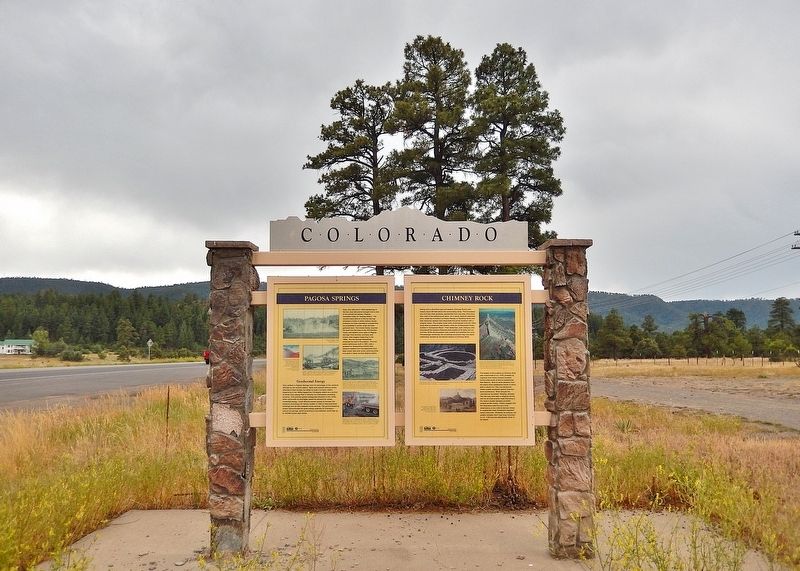
This marker is the leftmost of two interpretive panels on the east side of the Colorado Department of Transportation kiosk in Pagosa Springs.
Erected 2001 by Colorado Historical Society, Colorado Department of Transportation and Federal Highway Administration.
Topics and series. This historical marker is listed in these topic lists: Indigenous Peoples and Communities • Industry & Commerce • Settlements & Settlers. In addition, it is included in the History Colorado series list.
Location. 37° 13.887′ N, 107° 6.423′ W. Marker is in Pagosa Springs, Colorado, in Archuleta County. It is on U.S. 160 at milepost 136.9, just west of Hersch Avenue, on the right when traveling west. This marker is in the Pagosa Springs Colorado DOT Interpretive Kiosk, in a wayside on the north side of the highway. Touch for map. Marker is in this post office area: Pagosa Springs CO 81147, United States of America. Touch for directions.

Regionally, this marker is on the Continental Divide. It is also in the American Mountain West and at the Four Corners. Globally, it is in North America, the Rocky Mountains, the Western Hemisphere, the Western World, and the Anglosphere. Historically, it finds itself in what was once the territory of the Ancestral Puebloans.
Other nearby markers. At least 8 other markers are within 11 miles of this marker, measured as the crow flies: Chimney Rock (here, next to this marker); The Old Spanish Trail (here, next to this marker); a different marker also named Pagosa Springs (approx. 5.8 miles away); Hatcher Hardware (approx. 5.8 miles away); Metropolitan Hotel (approx. 5.9 miles away); Liberty Theatre (approx. 5.9 miles away); Goodman Building (approx. 5.9 miles away); People and Place (approx. 11 miles away). Touch for a list and map of all markers in Pagosa Springs.
Also see . . . Pagosa Springs (Wikipedia).
Excerpt: The town is named for a system of sulfur springs, Pagosa hot springs, located there, which includes the world's deepest geothermal hot spring. The “Mother” spring feeds primitive and developed hot springs located on the upper banks of the San Juan River, which flows through town. The primitive springs are freely accessible to the public but are generally not for entering or interacting with because of the extreme water temperature. Developed springs feed soaking pools that are hosted by three privately owned soaking locations within town. The water from the “Mother” spring is approximately 144 °F (62 °C).(Submitted on February 22, 2026, by Cosmos Mariner of Cape Canaveral, Florida.)
Local indigenous people used the hot springs for centuries; the area was considered “sacred ground.” In 1859, a white settler “discovered” the springs and developed them. In 1881, a bathhouse was first built there for paying customers. In the 1980s, Pagosa Springs received federal funding from the Department of Energy to drill two geothermal wells to heat buildings in the small downtown area of town. In the 1990s, the town built a new pipeline and municipal bridge to deliver mineral springs water to a new resort.
Credits. This page was last revised on February 22, 2026. It was originally submitted on February 20, 2026, by Cosmos Mariner of Cape Canaveral, Florida. This page has been viewed 63 times since then. Photos: 1. submitted on February 21, 2026, by Cosmos Mariner of Cape Canaveral, Florida. 2. submitted on February 22, 2026, by Cosmos Mariner of Cape Canaveral, Florida.
