Pagosa Springs in Archuleta County, Colorado — The American Mountains (Southwest)
The Old Spanish Trail
Photographed by Cosmos Mariner, July 13, 2025
1. The Old Spanish Trail Marker
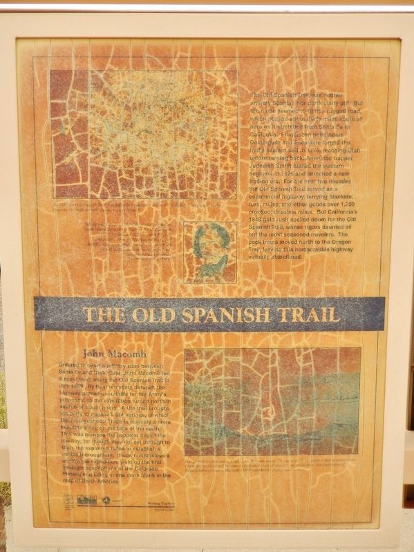
The Old Spanish Trail was neither entirely Spanish nor Particularly old. But the name seemed to fit this rugged road, which passed about thirty miles south of here as it stretched from Santa Fe to California. Franciscan pathfinders Dominguez and Escalante forged the trail’s eastern half in 1776, reaching Utah before turning back; American trapper Jedediah Smith blazed the western segment in 1826 and launched a new trading era. For the next two decades the Old Spanish Trail served as a commercial highway, ferrying blankets, furs, mules, and other goods over 1,200 crooked, desolate miles. But California’s 1849 gold rush spelled doom for the Old Spanish Trail, whose rigors daunted all but the most seasoned travelers. The pack trains moved north to the Oregon Trail, leaving this hardscrabble highway virtually abandoned.
John Macomb
Ordered to chart a military road between Santa Fe and Utah, Capt. John Macomb led a scout team along the Old Spanish Trail in July 1859. By then ten years defunct, the highway proved unsuitable for the Army’s purposes, so the expedition turned north in search of easier going. A Ute trail brought the
this page online
[photo captions]
• By 1850 the Old Spanish Trail had fallen into obscurity due to the inability of wagons to easily traverse its rough terrain.
• Setting out from Salt Lake City in 1826, Jedediah Smith blazed the western route of the Old Spanish Trail. His unusual hairline came from an encounter with a grizzly bear, which ripped Smith’s scalp open above his left eye. When the wound healed, the hair never grew back.
• In a prophetic observance, Capt. John Macomb noted, “It can scarcely be doubted that in future years [these hot springs] will become a celebrated place of resort.” An artist drew this illustration of Pagosa Springs during Macomb’s 1859 expedition.
Erected 2001 by Colorado Historical Society,
Photographed by Cosmos Mariner, July 13, 2025
2. The Old Spanish Trail Marker
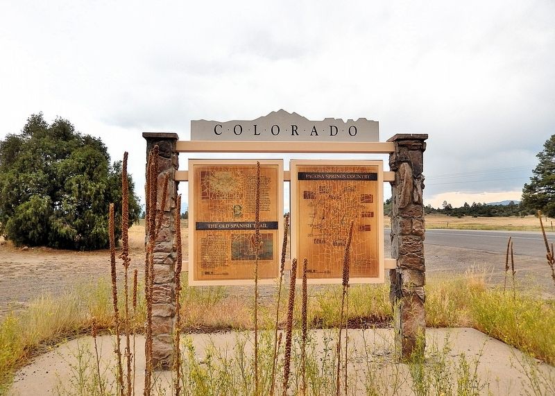
This marker is the leftmost of two interpretive panels on the west side of the Colorado Department of Transportation kiosk in Pagosa Springs.
Topics and series. This historical marker is listed in these topic lists: Exploration • Industry & Commerce • Roads & Vehicles. In addition, it is included in the History Colorado, and the Old Spanish National Trail series lists. A significant historical year for this entry is 1776.
Location. 37° 13.886′ N, 107° 6.425′ W. Marker is in Pagosa Springs, Colorado, in Archuleta County. It is on U.S. 160 at milepost 136.9, just west of Hersch Avenue, on the right when traveling west. This marker is in the Pagosa Springs Colorado DOT Interpretive Kiosk, in a wayside on the north side of the highway. Touch for map. Marker is in this post office area: Pagosa Springs CO 81147, United States of America. Touch for directions.

Regionally, this marker is on the Continental Divide. It is also in the American Mountain West and at the Four Corners. Globally, it is in North America, the Rocky Mountains, the Western Hemisphere, the Western World, and the Anglosphere. Historically, it finds itself in what was once the territory of the Ancestral Puebloans.
Other nearby markers. At least 8 other markers are within 11 miles of this marker, measured as the crow flies: Chimney Rock (here, next to this marker); Pagosa Springs (here, next to this marker); a different marker also named Pagosa Springs (approx. 5.8 miles away); Hatcher Hardware (approx. 5.8 miles away); Metropolitan Hotel (approx. 5.9 miles away); Liberty Theatre (approx. 5.9 miles away); Goodman Building (approx. 5.9 miles away); People and Place (approx. 11 miles away). Touch for a list and map of all markers in Pagosa Springs.
Also see . . .
1. Old Spanish Trail (Wikipedia).
Excerpt: Historic trade route that connected the Nuevo México settlements of (or near) Santa Fe with those of Los Angeles and the rest of Alta California. Approximately 700 mi long, the trail ran through areas of high mountains, arid deserts, and deep canyons. It is considered one of the most arduous of all trade routes ever established in the United States. Explored, in part, by Spanish explorers as early as the late 16th century, the trail was extensively used by traders with pack trains from about 1830 until the mid-1850s. The area was part of Mexico from Mexican independence in 1821 to the Mexican Cession to the United States in 1848. In 2002 this trail was designated by Congress as part of the National Trails System as Old Spanish National Historic Trail.(Submitted on February 22, 2026, by Cosmos Mariner of Cape Canaveral, Florida.)
2. Jedediah Strong Smith (Wikipedia).
Excerpt: American clerk, transcontinental pioneer, frontiersman, hunter, trapper, author, cartographer, mountain man and explorer of the Rocky Mountains, the Western United States, and the Southwest during the early 19th century. After 75 years of obscurity following his death, Smith was rediscovered as the American whose explorations led to the use of the 20-mile-wide South Pass as the dominant route across the Continental Divide for pioneers on the Oregon Trail.(Submitted on February 22, 2026, by Cosmos Mariner of Cape Canaveral, Florida.)
3. John Navarre Macomb Jr. (Wikipedia).
Excerpt: United States Army topographical engineer and explorer of the Colorado River. Captain Macomb led the 1859 San Juan Exploring Expedition, whose purpose was to find a military supply route from Santa Fe, New Mexico, to Utah and to map previously unexplored areas along the route. Macomb sought to find a route for military supplies from Santa Fe to central Utah, and also to map the unexplored regions along the route. Though originally political and military in nature, the expedition became "a quintessential scientific endeavor".(Submitted on February 22, 2026, by Cosmos Mariner of Cape Canaveral, Florida.)
Credits. This page was last revised on February 22, 2026. It was originally submitted on February 20, 2026, by Cosmos Mariner of Cape Canaveral, Florida. This page has been viewed 77 times since then. Photos: 1, 2. submitted on February 22, 2026, by Cosmos Mariner of Cape Canaveral, Florida.
