Hunter Mill District near Vienna in Fairfax County, Virginia — The American South (Mid-Atlantic)
A Fairfax Legacy
Ash Grove Historic Site
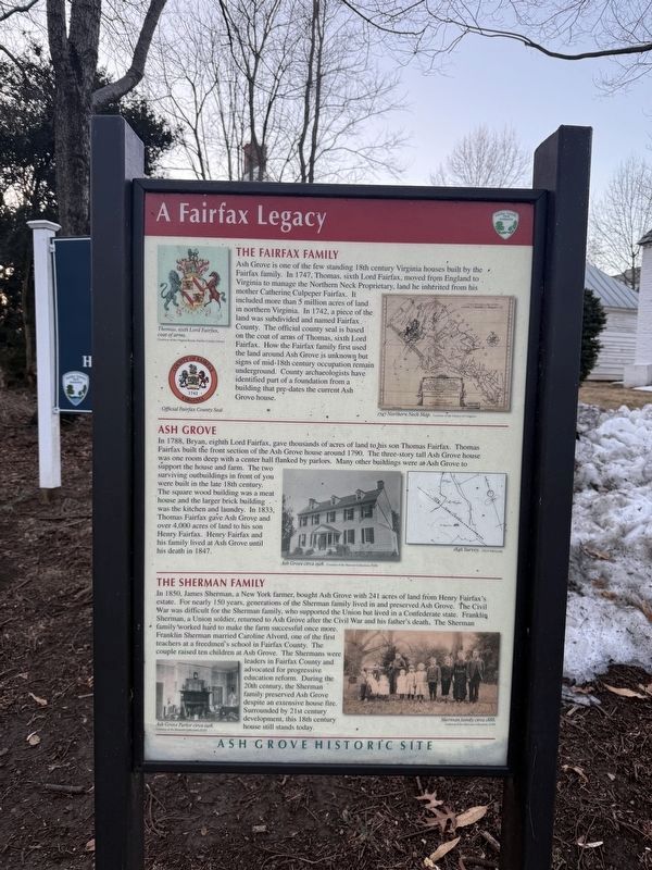
The Fairfax Family
Ash Grove is one of the few standing 18th century Virginia houses built by the Fairfax family. In 1747, Thomas, sixth Lord Fairfax, moved from England to Virginia to manage the Northern Neck Proprietary, land he inherited from his mother Catherine Culpeper Fairfax. It included more than 5 million acres of land in northern Virginia. In 1742, a piece of the land was subdivided and named Fairfax County. The official county seal is based on the coat of arms of Thomas, sixth Lord Fairfax. How the Fairfax family first used the land around Ash Grove is unknown but signs of the mid-18th century occupation remain underground. County archaeologists have identified part of a foundation from a building that pre-dates the current Ash Grove house.
Ash Grove
In 1788, Bryan, eighth Lord Fairfax, gave thousands of acres of land to his son Thomas Fairfax. Thomas Fairfax built the front section of the Ash Grove house around 1790. The three-story tall Ash Grove house was one room deep with a center hall flanked by parlors. Many other buildings were at Ash Grove to support the house and farm. The two surviving outbuildings
this page online
The Sherman Family
In 1850, James Sherman, a New York farmer, bought Ash Grove with 241 acres of land from Henry Fairfax's estate. For nearly 150 years, generations of the Sherman family lived in and preserved Ash Grove. The Civil War was difficult for the Sherman family, who supported the Union but lived in a Confederate state. Franklin Sherman, a Union soldier, returned to Ash Grove after the Civil War and his father's death. The Sherman family worked hard to make the farm successful once more. Franklin Sherman married Caroline Alvord, one of the first teachers at a freedman's school in Fairfax County. The couple raised ten children at Ash Grove. The Shermans were leaders in Fairfax County and advocated for progressive education reform. During the 20th century, the Sherman family preserved Ash Grove despite an extensive
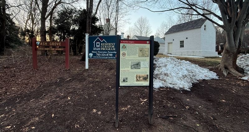
Erected by Fairfax County Park Authority.
Topics. This historical marker is listed in these topic lists: Architecture • Education • Settlements & Settlers • War, US Civil. A significant historical year for this entry is 1747.
Location. 38° 55.902′ N, 77° 14.965′ W. Marker is near Vienna, Virginia, in Fairfax County. It is in the Hunter Mill District. It is at the intersection of Ashgrove House Lane and Northern Neck Drive, on the left when traveling north on Ashgrove House Lane. Touch for map. Marker is at or near this postal address: 8866 Ashgrove House Ln, Vienna VA 22182, United States of America. Touch for directions.

Regionally, this marker is in the Washington Metropolitan Area and in Northern Virginia. It is also in the American South, specifically in the Upper South, in the Mid-Atlantic, and on the Eastern Seaboard. Globally, it is in the North Atlantic Region, North America, the Western Hemisphere, the Western World, and the Anglosphere. Historically, it finds itself in what was once the territory of the Mississippian Culture, one of the original Thirteen Colonies, one of the Confederate States of America, and the Antebellum South.
Other nearby markers. At least 8 other markers are within 2 miles of this marker, measured as the crow flies: Ash Grove (within shouting distance of this marker); Wolf Trap National Park for the Performing Arts (approx. one mile away); A Union Spy of Color? (approx. 1.1 miles away); Family Strength (approx. 1.1 miles away); A Tent Design Inspired by Native Americans (approx. 1.1 miles away); Outpost Life (approx. 1.1 miles away); Freedom Hill is a Droplet in an Ocean of History (approx. 1.1 miles away); Defending the Nation's Capital (approx. 1.1 miles away).
Another marker is no longer nearby. Freedom Hill Redoubt (was approx. 1.1 miles away but has been confirmed missing).
Credits. This page was last revised on February 20, 2026. It was originally submitted on February 20, 2026, by Devry Becker Jones of Washington, District of Columbia. This page has been viewed 79 times since then. Photos: 1, 2. submitted on February 20, 2026, by Devry Becker Jones of Washington, District of Columbia.
