
Lytle in Atascosa County, Texas — The American South (West South Central)
Trimble Cemetery
Photographed by Dave W, February 21, 2026
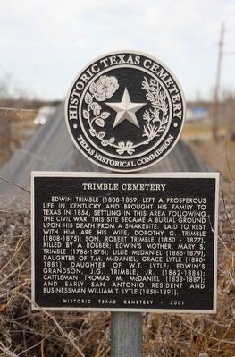
1. Trimble Cemetery Marker
Edwin Trimble (1808-1869) left a prosperous life in Kentucky and brought his family to Texas in 1854, settling in this area following the Civil War. This site became a burial ground upon his death from a snakebite. Laid to rest with him are his wife, Dorothy G. Trimble (1808-1875), killed by a robber; Edwin's mother, Mary S. Trimble (1786-1878); Son, Robert Trimble (1850-1877), Lillie McDaniel (1865-1879) Daughter of T.M. McDaniel; Grace Lytle (1880-1881), Daughter of W.T. Lytle; Edwin's grandson, J.G. Trimble, Jr. (1862-1884); Cattleman Thomas M. McDaniel (1838-1887); and early San Antonio resident and businessman William T. Lytle (1850-1891).
Erected 2001 by Texas Historical Commission. (Marker Number 17435.)
Topics. This historical marker is listed in these topic lists: Cemeteries & Burial Sites • Settlements & Settlers. A significant historical year for this entry is 1869.
Location. 29° 12.457′ N, 98° 48.728′ W. Marker is in Lytle, Texas, in Atascosa County. It is on Interstate 35 Access Road 1½ miles south of Benton City Road, on the right when traveling north. Touch for map. Marker is at or near this postal address: 4001 Interstate 35 Access Rd, Lytle TX 78052, United States of America. Touch for directions.

Regionally, this marker is in the Hill Country and in the San Antonio Metropolitan Area. Globally, it is in North America, a Gulf of Mexico state, the Western Hemisphere, the Western World, and the Anglosphere. Historically, it finds itself in what was once New Spain, the Republic of Texas, and one of the Confederate States of America.
Other nearby markers. At least 8 other markers are within 3 miles of this marker, measured as the crow flies: Robert Lee Bobbitt (approx. one mile away); a different marker also named Robert Lee Bobbitt (approx. 1.1
this page online
Photographed by Dave W, February 21, 2026
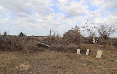
2. Trimble Cemetery Marker
Marker seen here with the few remaining headstones that are still present.
Photographed by Dave W, February 21, 2026
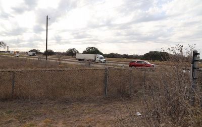
3. Trimble Cemetery Marker
Marker seen here on the far right looking out at I-35 and the frontage road with the nearest vehicles travelling north.
Credits. This page was last revised on February 22, 2026. It was originally submitted on February 22, 2026, by Dave W of Co, Colorado. This page has been viewed 44 times since then. Photos: 1, 2, 3. submitted on February 22, 2026, by Dave W of Co, Colorado. • Bernard Fisher was the editor who published this page.
