Near Pleasanton in Atascosa County, Texas — The American South (West South Central)
St. Joseph's Catholic Church
Photographed by Dave W, February 21, 2026
1. St. Joseph's Catholic Church Marker
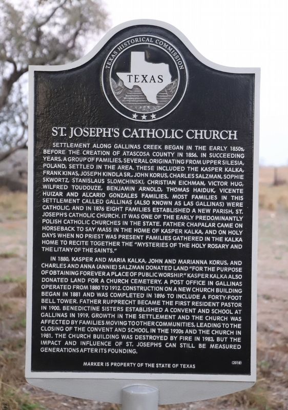
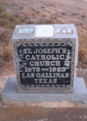
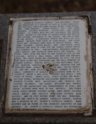
Settlement along Gallinas Creek began in the early 1850s, before the creation of Atascosa County in 1856. In succeeding years, a group of families, several originating from Upper Silesia, Poland, settled in the area. These included the Kasper Kalka, Frank Kinas, Joseph Kindla Sr., John Korus, Charles Salzman, Sophie Skwortz, Stanislaus Slomchinski, Christian Eichman, Victor Hug, Wilfred Toudouze, Benjamin Arnold, Thomas Haiduk, Vicente Huizar and Alcario Gonzales families. Most families in this settlement called Gallinas (also known as Las Gallinas) were Catholic and in 1876 eight families established a new parish, St. Joseph’s Catholic Church. It was one of the early predominantly Polish Catholic churches in the state. Father Chapalar came on horseback to say Mass in the home of Kasper Kalka, and on holy days when no priest was present families gathered in the Kalka home to recite together the “Mysteries of the Holy Rosary and the Litany of the Saints.”
In 1880, Kasper and Maria Kalka, John and Marianna Korus, and Charles and Anna (Annie) Salzman donated land “for the purpose of obtaining forever a place of public
this page online
Erected 2018 by Texas Historical Commission. (Marker Number 20093.)
Topics. This historical marker is listed in these topic lists: Disasters • Immigration • Religion & Religious Structures • Settlements & Settlers. A significant historical year for this entry is 1876.
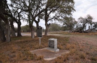
Location. 29° 6.775′ N, 98° 28.777′ W. Marker is near Pleasanton, Texas, in Atascosa County. It is at the intersection of North Las Gallinas and Farm to Market Road 536,
Photographed by Dave W, February 21, 2026
2. St. Joseph's Catholic Church Marker

Regionally, this marker is in the Hill Country and in the San Antonio Metropolitan Area. Globally, it is in North America, a Gulf of Mexico state, the Western Hemisphere, the Western World, and the Anglosphere. Historically, it finds itself in what was once New Spain, the Republic of Texas, and one of the Confederate States of America.
Other nearby markers. At least 8 other markers are within 7 miles of this marker, measured as the crow flies: Kings Highway Camino Real — Old San Antonio Road (approx. 1.4 miles away); a different marker also named Kings Highway Camino Real — Old San Antonio Road (approx. 2½ miles away); Shiloh Cemetery (approx. 3.8 miles away); a different marker also named Kings Highway Camino Real — Old San Antonio Road (approx. 3.9 miles away); Robert E. Neill (approx. 4.3 miles away); Thomas Ransdell Brite (approx. 4.3 miles away); Brite Cemetery (approx. 4.4 miles away); Gates Valley Community (approx.
Photographed by Dave W, February 21, 2026
3. St. Joseph's Catholic Church Marker
Another marker is no longer nearby. Battle of Medina (was approx. 3.6 miles away but has been confirmed missing).
Photographed by Dave W, February 21, 2026
4. St. Joseph's Catholic Church Marker
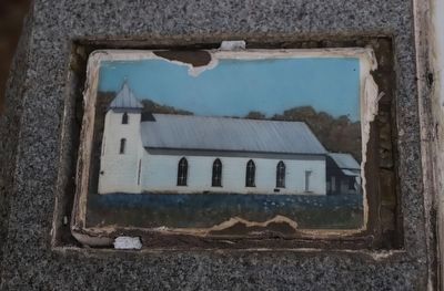
Picture of the church prior to be destroyed by fire in 1983.
Photographed by Dave W, February 21, 2026
5. St. Joseph's Catholic Church Marker
Photographed by Dave W, February 21, 2026
6. St. Joseph's Catholic Church Marker
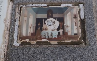
Picture of the inside of the church prior to being destroyed by fire in 1983.
Credits. This page was last revised on February 22, 2026. It was originally submitted on February 22, 2026, by Dave W of Co, Colorado. This page has been viewed 67 times since then. Photos: 1, 2, 3, 4, 5, 6. submitted on February 22, 2026, by Dave W of Co, Colorado. • James Hulse was the editor who published this page.
