Onalaska in La Crosse County, Wisconsin — The American Midwest (Great Lakes)
Onalaska: Past and Present
February 7, 2026
1. Onalaska: Past and Present Marker
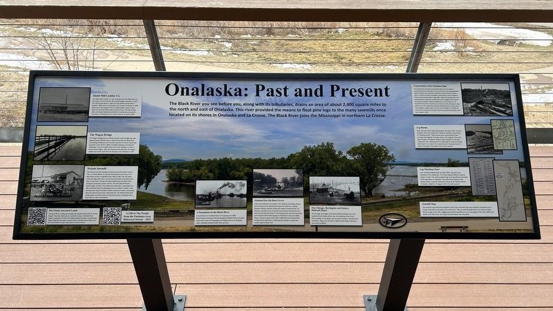
Island Mill Lumber Co.
The Island Mill Lumber Co. was located across the Black River on the shore of French Island. This sawmill began operation in 1872. The mill burned down in 1881 but was rebuilt shortly after. It closed in 1893, and its machinery was moved to Arkansas in 1895. What was once thought to be an inexhaustible supply of pine logs from the Black river basin proved wrong. The pine forests were eventually depleted and both the lumber and sawmill industries of Onalaska and La Crosse came to an end by 1905.
The Wagon Bridge
The Wagon Bridge was an entirely wooden plank bridge that was approximately 500 feet long. It stretched across the Black River connecting Onalaska to the northern portion of French Island (see log boom map). Built in 1868, it enabled residents and sawmill employees'
this page online
Nichols Sawmill
The economy of early Onalaska centered around the lumber industry. The C.H. Nichols & Co. Sawmill was located on the shore of the Black River and was in operation from 1856 to 1902. The mill sawed white pine logs which were cut from the pine forests of the Black River basin in the winter. The logs were then floated down the Black River during the spring and summer months. This mill produced boards, wood shingles, and lath. This lumber was sold locally or assembled into rafts and floated down the Mississippi River to southern markets. Later, railroads were used to transport lumber products to market. Steamboats were also used to push lumber rafts downriver. The Nichols family built a large Queen Ann-style home on 2nd Avenue North in Onalaska that is used today as a bed and breakfast.
Ho-Chunk Ancestral Lands
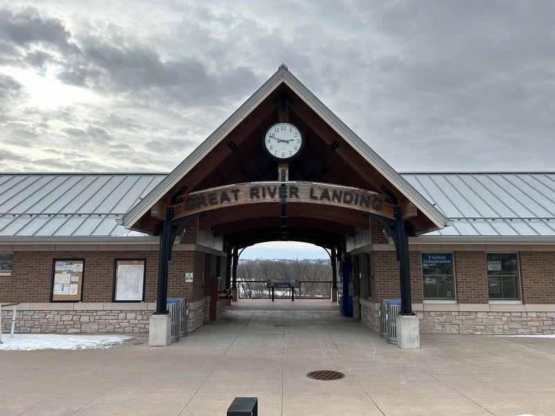
This Great River Landing site occupies the ancestral land of the Ho-Chunk People. They have lived here for hundreds
February 7, 2026
2. Onalaska: Past and Present Marker
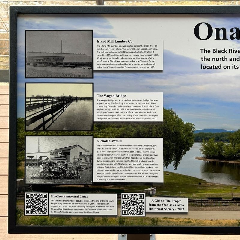
A Steamboat on the Black River
A steamboat on the Black River in Onalaska circa 1908. Steamboats traveling on the Mississippi and Black Rivers provided some early means of passenger and freight service to Onalaska. Later, railroads would provide these services.
Johnson/Sias Isle Boat Livery
A boat rental business was started in the 1920s by the George Johnson family along the river bank directly below the Great River Landing. Wooden rowboats could be rented and rowed on the Black River for fishing or recreational use. Later, Ben Sias took over the business with help from the Kocimski family. The thriving business was then purchased by the Schams family before going out of business in the early 2000s. Today, a self-serve kayak rental kiosk is offered by the Onalaska Parks and Recreation Department, continuing the tradition of watercraft rentals along the Black River.
The Chicago, Burlington and Quincy Railroad Depot
The
February 7, 2026
3. Onalaska: Past and Present Marker
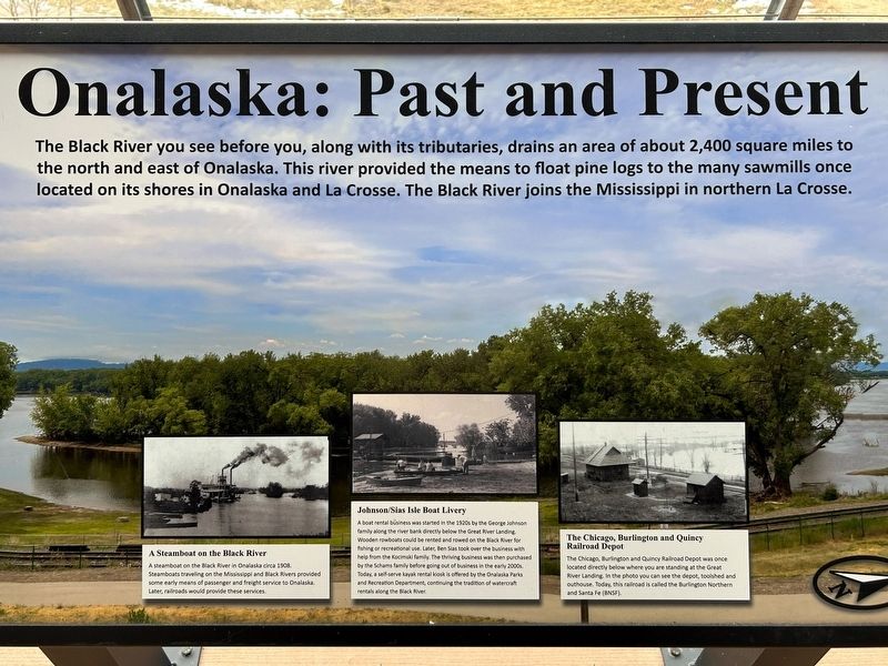
Construction of the Onalaska Dam
The Onalaska Dam was built across the Black River in the mid-1930s in conjunction with the construction of Lock and Dam #7 on the Mississippi River west of Onalaska, near La Crescent, Minnesota. Lock and Dam #7 created a "pool" or reservoir of water to establish a channel with a minimum depth of 9 feet to accommodate modern barge traffic. Without the Onalaska Dam, this pool would have drained into the Black River and a navigable channel would not have been possible. Today the Onalaska Dam, Lock and Dam #7, and thousands of linear feet of earthen dam create a four-mile-wide body of water which is one of the widest places along the Mississippi River. A water tower or "the standpipe" supplied water to the City from the 1890s to the 1960s and can be seen in the photo to the right. Reservoirs replaced the standpipe, and it was removed in 1966.
Log Booms
When
February 7, 2026
4. Onalaska: Past and Present Marker
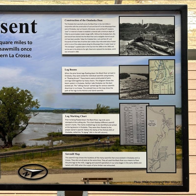
Log Marking Chart
Prior to being floated down the Black River, log ends were stamped at the cutting site. This chart displays different sawmill owner's marks. The marks enabled logs to be identified and sorted at the log booms in Onalaska. They were then floated to the proper owner's sawmill. Notice the stamp of the Nichols Mill of Onalaska, called the "N zigzag" (4th in the left column).
Sawmill Map
This sawmill shows the locations of the many sawmills that once existed in Onalaska and La Crosse. They did not all exist at the same time. They all used the Black River as a means to float the pine logs to the mills. Logging and sawmill operations
February 7, 2026
5. Onalaska: Past and Present Marker
Photo Work Courtesy of Bob Mulock
Erected 2023 by the Onalaska Area Historical Society.
Topics. This historical marker is listed in these topic lists: Bridges & Viaducts • Industry & Commerce • Railroads & Streetcars • Waterways & Vessels. A significant historical year for this entry is 1872.
Location. 43° 52.926′ N, 91° 14.087′ W. Marker is in Onalaska, Wisconsin, in La Crosse County. It can be reached from the intersection of 2nd Avenue South (State Highway 35) and Irvin Street, on the right when traveling south. Located at the Great River Landing. Touch for map. Marker is at or near this postal address: 101 Irvin St, Onalaska WI 54650, United States of America. Touch for directions.

Regionally, this marker is in Western Wisconsin. It is also in the American Midwest, in the Corn Belt, in the Driftless Area — Bluff Country, and in the Great River Road Region. Globally, it is in North America, the Western Hemisphere, the Western World, and the Anglosphere. Historically, it finds itself in what was
February 7, 2026
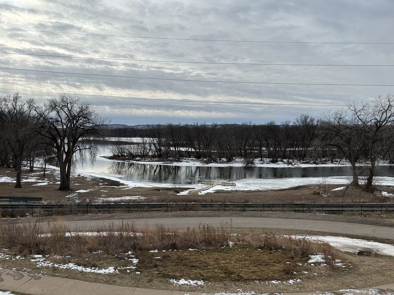
6. View of the Black River
Other nearby markers. At least 8 other markers are within 3 miles of this marker, measured as the crow flies: Onalaska: Present and Past (within shouting distance of this marker); Tim Gullikson (approx. 0.8 miles away); Campbell Cemetery G.A.R. Memorial (approx. 1.9 miles away); Wood and Hayes (approx. 1.9 miles away); The Valley View Site (approx. 2 miles away); George and Gohres (approx. 2.3 miles away); The Upper Mississippi (approx. 2.4 miles away); Wisconsin Veterans Memorial Highway (approx. 2.4 miles away). Touch for a list and map of all markers in Onalaska.
Also see . . . (QR Code) Hoocąk Land and Heritage | Onalaska Schools. (Submitted on February 23, 2026.)
Credits. This page was last revised on February 24, 2026. It was originally submitted on February 23, 2026. This page has been viewed 98 times since then. Photos: 1, 2, 3, 4, 5, 6. submitted on February 23, 2026.
