
Downtown Seattle in King County, Washington — The American West (Northwest)
Waterfront History
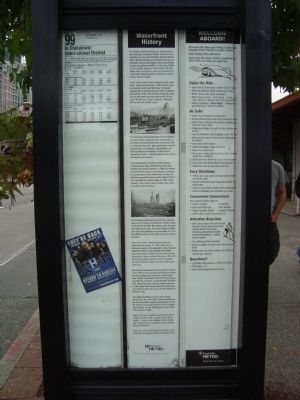
Photographed by Barry Swackhamer, September 13, 2011
1. Waterfront History Marker
The Seattle waterfront played and exciting role in the early days of pioneer Seattle. Where you are now standing once was tidal flats, edged by forests. Salish natives traveled up and down the coast in intricately carved cedar dugout canoes and fished, hunted and gathered shellfish. In the early 1800’s the first Seattle pioneers made friends with the Salish natives and built a town and waterfront on a peninsula extending into the tidelands south of today’s Pioneer Square.
In the 1850’s Henry Yesler emerged as the waterfront’s leading businessman. Yesler built his piers by dumping rocks into Elliot Bay. He hauled wagonloads of sawdust from his mills to stabilize the footings of the wharf. Ballast from ships from all over the world was also used as fill. In fact, some 40,000 tons of San Francisco’s Telegraph Hill lies beneath Seattle’s piers.
The waterfront soon became the center of Seattle’s business district. General stores, warehouses, a gristmill and sawmill jutted out over the bay. Piers were built to load coal, grain and timber onto tall masted ships and steamers. Shipbuilding and fishing industries flourished.
this page online
The pioneer men of Seattle, in their unique entrepreneurial style, decided that their town needed some pioneer women. In 1864, Asa Mercer recruited eleven women from Boston to come to the young town. They docked here on May 16, and have since been known as the “Mercer Girls.” Asa repeated the venture again in 1866. Unfortunately, most of the women jumped ship when it docked in San Francisco.
The bustling waterfront burned to the waterline along with 50 blocks of downtown Seattle during the Great Fire of 1889. But within a year, the piers and docks were rebuilt. An electric trolley to Ballard was built over Elliot Bay on a low bridge 20 to 60 feet offshore that was just high enough to escape the tides.
Shouts of “Gold!” echoed up and down the waterfront on August 17, 1887 when the S.S. Portland docked at Schwabacher’s Wharf (where Waterfront Park is now located) from Alaska carrying two tons of gold. For the next two years, thousands of fortune seekers lined up at the dock booking passage to Alaska. Visit the Klondike Museum in Pioneer Square
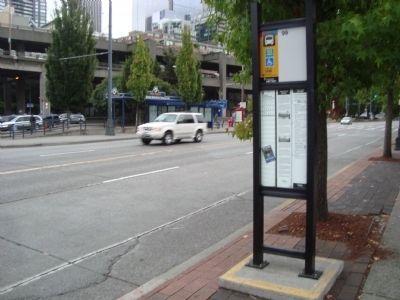
Photographed by Barry Swackhamer, September 13, 2011
2. Waterfront History Marker
Recreational development of the waterfront began in the 1970’s with conversion of older pier sheds to house shops and restaurants. At the same time, Seattle rehabilitated much of Pioneer Square and Pike Place Market, and built Myrtle Edwards Park, Waterfront Park, and the Seattle Aquarium. In 1982, these historical and waterfront attractions were linked together by service on the Waterfront Streetcar Line.
The implementation of a new urban design advanced in the mid-1990’s with the construction of the Port of Seattle’s modern headquarters at Pier 69 and the opening of its Bell Street Pier complex, which began serving Alaska-bound cruise ships in the spring of 2000.
Today, the Port of Seattle is one of the world’s largest container ports. Seattle is the closest major U.S. port to our neighbors in the Pacific Rim. Cargo from 125 countries passes through the port each year.
Enjoy your ride on the Waterfront Streetcar Line along this very important stretch of Seattle’s history.
Erected by King County Metro.
Topics. This historical marker is listed in this topic list: Waterways & Vessels. A significant historical date for this entry is May 16, 1864.
Location. Marker
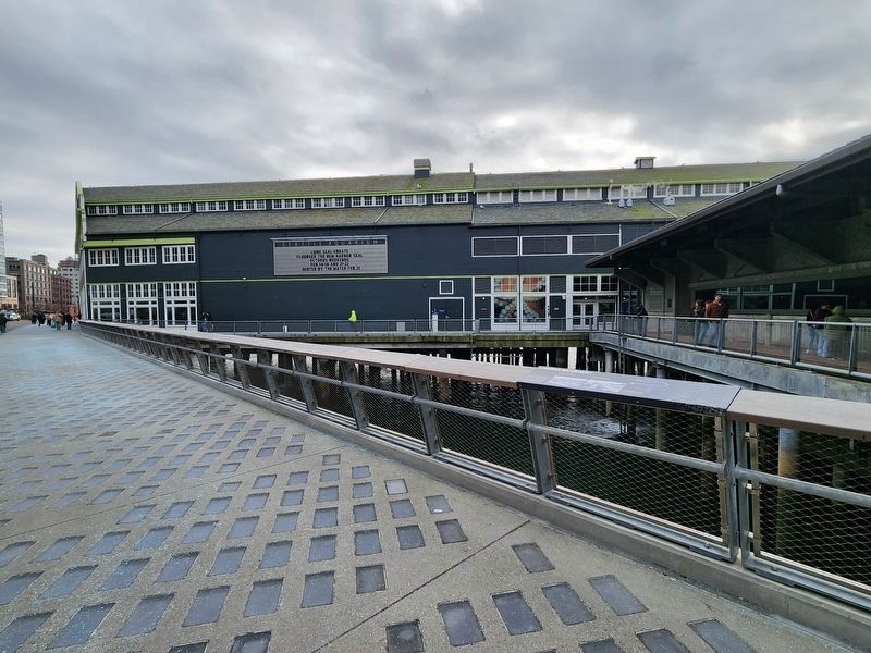
Photographed by Douglass Halvorsen, February 20, 2026
3. Missing marker location
A view of the Seattle Aquarium looking south along Alaskan Way. The marker once resided directly in front of the aquarium but has been removed, as seen in the distance.
We have been informed that this marker is no longer there and will not be replaced. This page is an archival view of what was.
Regionally, this marker was in Washington’s Puget Sound Region. It was also on the American Pacific Coast, in the Pacific Northwest, and in the Lewis & Clark Corridor. Globally, it was in North America, in the Cascade Range, in the Inside Passage, on the Ring of Fire, in the Pacific Rim, in the Western Hemisphere, in the Western World, and in the Anglosphere.

Other nearby markers. At least 8 other markers are within walking distance of this location: "This Market Is Yours" (about 600 feet away); Developing the Market (about 600 feet away); First Avenue (about 700 feet away); Elliott Bay (approx. 0.2 miles away); a different marker also named Welcome to The Public Market (approx. 0.2 miles away); Seattle Union Record (approx. 0.2 miles away); “Great White Fleet” (approx. 0.2 miles away); Seattle Union Record (1918-1928) (approx. 0.2 miles away). Touch for a list and map of all markers in Seattle.
Other markers no longer nearby. Joshua Green (was within shouting distance of this marker but has been permanently removed); The Visit of President Theodore Roosevelt’s “Great White Fleet” (was within shouting distance of this marker but has been permanently removed); "Ton of Gold" (was within shouting distance of this marker but has been permanently removed); ‘Miike Maru’ (was about 400 feet away, measured in a direct line but has been permanently removed); Welcome to The Public Market (was about 600 feet away but has been replaced with another marker now near it).
More about this marker. The Waterfront History marker is duplicated at several other bus stops on Alaskan Way.
This marker, along with a number of other historical markers, were removed during the major "Waterfront Seattle" reconstruction project, which included replacing the Alaskan Way Viaduct and seawall with a new park. The project began in 2013 with the seawall construction and tunnel boring. While significant portions opened throughout the early 2020s, the main, comprehensive transformation wasn't officially completed until 2025. It is not known if any of the removed markers were relocated elsewhere or will remain permanently removed.
Credits. This page was last revised on February 27, 2026. It was originally submitted on October 9, 2011, by Barry Swackhamer of Brentwood, California. This page has been viewed 1,239 times since then and 67 times this year. Last updated on February 23, 2026, by Douglass Halvorsen of Klamath Falls, Oregon. Photos: 1, 2. submitted on October 9, 2011, by Barry Swackhamer of Brentwood, California. 3. submitted on February 23, 2026, by Douglass Halvorsen of Klamath Falls, Oregon. • Devry Becker Jones was the editor who published this page.
