
Locust Grove in Orange County, Virginia — The American South (Mid-Atlantic)
Mine Run Campaign
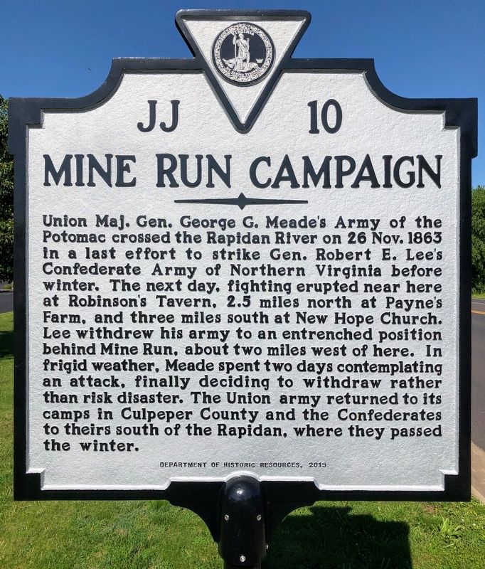
Photographed by Shane Oliver, May 30, 2020
1. Mine Run Campaign Marker
Erected 2019 by Virginia Department of Historic Resources. (Marker Number JJ-10.)
Topics and series. This historical marker is listed in this topic list: War, US Civil. In addition, it is included in the Virginia Department of Historic Resources (DHR) series list. A significant historical date for this entry is November 26, 1863.
Location. 38° 18.324′ N, 77° 48.517′ W. Marker is in Locust Grove, Virginia, in Orange County. It is at the intersection of Constitution
this page online

Regionally, this marker is in Northern Virginia and in the Piedmont. It is also in the American South and specifically in the Upper South. Globally, it is in the North Atlantic Region, North America, the Western Hemisphere, the Western World, and the Anglosphere. Historically, it finds itself in what was once the territory of the Mississippian Culture, one of the original Thirteen Colonies, one of the Confederate States of America, and the Antebellum South.
Other nearby markers. At least 8 other markers are within 3 miles of this marker, measured as the crow flies: Robinson's Tavern (a few steps from this marker); a different marker also named The Mine Run Campaign (approx. 2.1 miles away); a different marker also named The Mine Run Campaign (approx. 2.1 miles away); The Battle of Payne’s Farm (approx. 2.1 miles away); a different marker also named The Mine Run Campaign

Photographed by Evan Dwyer, January 6, 2026
2. Robinson's Tavern
Moved in 1994 to behind the gas station, this ca. 1814 home was a tavern at the intersection west of the marker during the Civil War and the site of skirmishing mentioned in the marker. It is a private residence.
Other markers no longer nearby. Face Off (was about 700 feet away, measured in a direct line but has been permanently removed); a different marker also named Mine Run Campaign (was about 700 feet away but has been permanently removed); a different marker also named Mine Run Campaign (was approx. 2.1 miles away but has been replaced with another marker now near it); a different marker also named The Mine Run Campaign (was approx. 2.1 miles away but has been permanently removed).
Also see . . . Old Marker at this Location. This marker replaced an older one near this location also titled "Mine Run Campaign". (Submitted on December 17, 2020.)

Photographed by Evan Dwyer, January 6, 2026
3. Payne's Farm Battlefield
Preserved by the American Battlefield Trust, Payne's Farm was the site of the largest fight of the Mine Run Campaign, as described on the marker. This view is from the historic farm road leading to the farm (tree line in the distance with a ruined post-battle barn crumbling at its edge) with the field the Confederates wheeled their counterattack through shown at left beyond the battlefield interpretive panel.
Credits. This page was last revised on February 24, 2026. It was originally submitted on December 16, 2020, by Shane Oliver of Richmond, Virginia. This page has been viewed 521 times since then and 31 times this year. Last updated on February 24, 2026, by Evan Dwyer of Richmond, Virginia. Photos: 1. submitted on December 16, 2020, by Shane Oliver of Richmond, Virginia. 2, 3. submitted on February 24, 2026, by Evan Dwyer of Richmond, Virginia. • Devry Becker Jones was the editor who published this page.
Editor’s want-list for this marker. Wide shot of marker and its surroundings. • Can you help?
