
Locust Grove in Orange County, Virginia — The American South (Mid-Atlantic)
The Mine Run Campaign
Meade vs. Lee

Photographed by Evan Dwyer, January 6, 2026
1. The Mine Run Campaign Marker
“The delay in the movements of the Third Corps, and, particularly the failure to affect a junction at Robertson’s Tavern, was one of the primary causes of the failure of the recent movement.” — Gen. George Gordon Meade, USA
Eager to strike Confederate Gen. Robert E. Lee’s Army of Northern Virginia before winter, Union Gen. George Gordon Meade planned a flanking movement across the Rapidan River late in 1863. Meade intended to force the Southerners to abandon their strong defensive position along the upper Rapidan. Success depended on the timely movement of the different portions of his army and their juncture at Locust Grove, south of the river.
The Mine Run Campaign began on November 26, 1863. Rain, bad roads, and an inadequate knowledge of the terrain hindered Meade’s movements. After long delays and before the Union forces could assemble at Locust Grove, elements of the Union and Confederate armies clashed here at Payne’s Farm on
this page online
Photo Captions:
The Mine Run Campaign highlighted the cultures of its armies and commanders. The relatively conservative Gen. George G. Meade (right), contrasted sharply with his daring adversary, Gen. Robert E. Lee. Courtesy Library of Congress
Union Gen. George G. Meade planned a flanking maneuver across the lightly guarded lower fords of the Rapidan River to put his Army of the Potomac squarely on Gen. Robert E. Lee’s right flank.
The site of Robinson’s Tavern (called Robertson’s Tavern by the soldiers) at Locust Grove is approximately two miles south of Payne’s Farm. The tavern building itself still stands but was moved some 250 yards north on Zoar Road (present-day State Route 611). - Courtesy Library of Congress
Erected by American Battlefield Trust, Civil War Trails.
Topics.
Photographed by Evan Dwyer, January 6, 2026
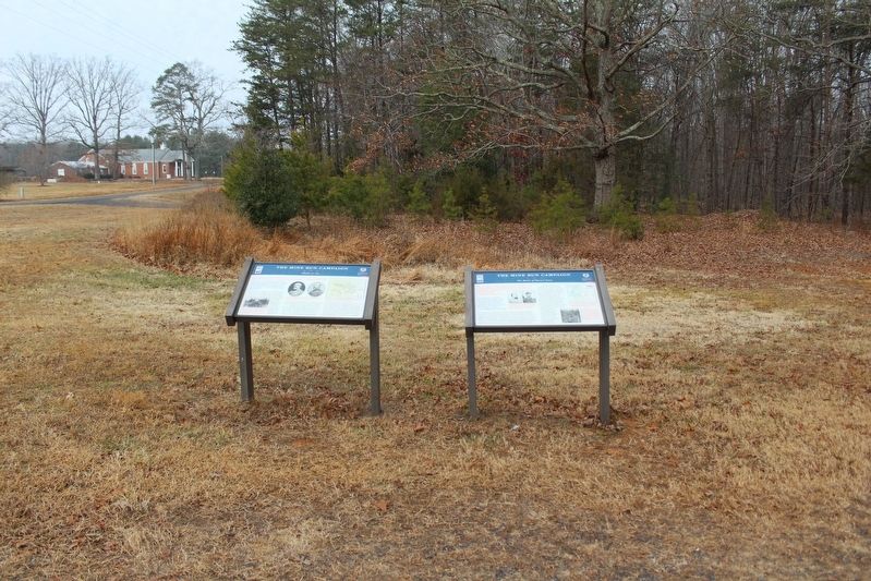
2. The Mine Run Campaign Marker
The battlefield is in the woods immediately beyond the marker, and off to the right of the frame east on the Payne farm lane, which dates to the battle.
Location. 38° 19.9′ N, 77° 49.612′ W. Marker is in Locust Grove, Virginia, in Orange County. It is on Zoar Road (Virginia Route 611) 0.1 miles south of Zoar School Road, on the right when traveling north. Touch for map. Marker is at or near this postal address: 31391 Zoar Road, Locust Grove VA 22508, United States of America. Touch for directions.

Regionally, this marker is in Northern Virginia and in the Piedmont. It is also in the American South and specifically in the Upper South. Globally, it is in North America, the Western Hemisphere, the Western World, and the Anglosphere. Historically, it finds itself in what was once the territory of the Mississippian Culture, one of the original Thirteen Colonies, one of the Confederate States of America, and the Antebellum South.
Other nearby markers. At least 8 other markers are within walking distance of this marker: A different marker also named The Mine Run Campaign (here, next to this marker); The Battle of Payne’s Farm (about 500 feet away, measured in a

Photographed by Evan Dwyer, January 6, 2026
3. Robinson's Tavern
Moved in 1994 to behind the gas station, this ca. 1814 building is the "Robertson's" tavern referenced on the marker as formerly sitting at Locust Grove. Though called "Robertson's" on Federal maps and - to this day - by locals, it was built and operated by the Robinson family. During the Civil War, it was owned by John Almond, who had married a Robinson (step)daughter - Mary Ann Robinson. It has never been owned by any "Robertson." Robinson's Tavern is its correct name. It is a private residence.
Another marker is no longer nearby. The Mine Run Campaign (was about 500 feet away but has been permanently removed).
Related marker. Click here for another marker that is related to this marker. It preceded this marker but was placed across the road by the church before the parking lot was installed.

Photographed by Evan Dwyer, January 6, 2026
4. Locust Grove
Locust Grove is the crossroads visible in the background here. The well in the foreground is the original well from Robinson's Tavern, still in its original position. Robinson's Tavern at Locust Grove was the designated junction point for each of Meade's army's elements.

Photographed by Evan Dwyer, January 6, 2026
5. Payne's Farm
This view is from the historic farm road leading to the farm (tree line in the distance with a ruined post-battle barn crumbling at its edge) with the field the Confederates wheeled their counterattack through shown at left beyond the battlefield interpretive panel. Note the marker shown is not the marker this page is for; this photograph is illustrative of the farm itself only.
Credits. This page was last revised on February 25, 2026. It was originally submitted on February 24, 2026, by Evan Dwyer of Richmond, Virginia. This page has been viewed 36 times since then. Photos: 1, 2, 3, 4, 5. submitted on February 24, 2026, by Evan Dwyer of Richmond, Virginia. • Bernard Fisher was the editor who published this page.
