Arlington View in Arlington County, Virginia — The American South (Mid-Atlantic)
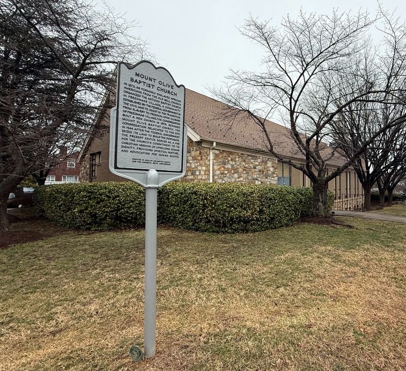
Mount Olive Baptist Church

Erected 2023 by Arlington County, Virginia, for the church's 150th anniversary.
Topics. This historical marker is listed in these topic lists: African Americans • Religion & Religious Structures • Settlements & Settlers • War, US Civil. A significant historical year for this entry is 1873.
Location. 38° 51.747′ N, 77° 4.312′ W. Marker is in Arlington, Virginia, in Arlington County. It is in Arlington View. It is at the intersection of 13th Road South and South Poe Street, on the right when
this page online

Regionally, this marker is in the Washington Metropolitan Area and in Northern Virginia. It is also in the American South, specifically in the Upper South, in the Mid-Atlantic, and on the Eastern Seaboard. Globally, it is in the North Atlantic Region, North America, the Western Hemisphere, the Western World, and the Anglosphere. Historically, it finds itself in what was once the territory of the Mississippian Culture, one of the original Thirteen Colonies, one of the Confederate States of America, and the Antebellum South.
Other nearby markers. At least 8 other markers are within walking distance of this marker: Albert I. Cassell (about 600 feet away, measured in a direct line); George Washington Carver Cooperative Apartments (about 600 feet away); History of Bocce Ball (approx. 0.2 miles away); Selina Gray (approx. ¼ mile away); Harry W. Gray House (approx. ¼ mile away); Daniel Check (approx. 0.3 miles away); Thornton Check (approx. 0.3 miles
Photographed by Devry Becker Jones (CC0)
2. Mount Olive Baptist Church Marker on the grounds of the congregation
Another marker is no longer nearby. Site of Arlington Chapel (was approx. 0.3 miles away but has been confirmed missing).
Credits. This page was last revised on March 3, 2026. It was originally submitted on March 3, 2026, by Devry Becker Jones of Washington, District of Columbia. This page has been viewed 39 times since then. Photos: 1, 2. submitted on March 3, 2026, by Devry Becker Jones of Washington, District of Columbia.
