Schnaittach in Nürnberger Land, Bavaria, Germany — Central Europe
Landjüdische Spuren auf den Friedhöfen in Schnaittach
Rural Jewish traces in the cemeteries of Schnaittach
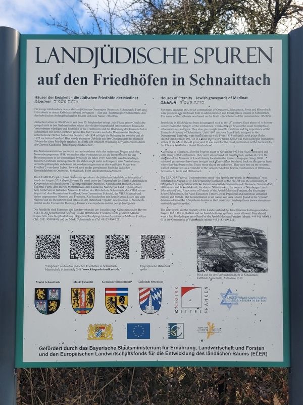
Photographed by James Hulse, February 24, 2026
1. Landjüdische Spuren auf den Friedhöfen in Schnaittach Marker

Häuser der Ewigkeit - die Jüdischen Friedhöfe der Medinat מדינת אשפ״ה OSchPaH
Für einige Jahrhunderte waren die landjüdischen Gemeinden Ottensoos, Schnaittach, Forth und Hüttenbach in einem Rabbinatsverband verbunden - Sitz und Bestattungsort Schnaittach. Aus den hebräischen Anfangsbuchstaben bildete sich sein Name: OSchPaH.
Jüdisches Leben in OSchPah ist seit dem 15. Jahrhundert belegt. Jede Phase seiner Geschichte spiegelt sich in den Grabinschriften wider, die oft über biografische Informationen hinaus die Verstorbenen würdigen und Einblicke in die Traditionen und die Bedeutung der Talmudschul in Schnaittach mit ihren Gelehrten geben. Bis 1607 wurden auch der Dompropstei Bamberg unterstehende Fürther Juden hier bestattet. Ab 1834 erfolgte die Belegung im zweiten und ab 1897 im dritten Friedhof. Hier wurde ein neues Gebäude aus den Grundmauern des früheren Tahara des alten Friedhofs errichtet; es diente der rituellen Waschung der Verstorbenen durch die Chewra Kaddischa (Beerdigungsbruderschaft).
Die Nationalsozialisten zerstörten und
this page online
Das LEADER-Projekt „Lasst Grabsteine sprechen – die jüdischen Friedhöfe in Schnaittach“ wurde im August 2019 abgeschlossen. Es stand unter der Trägerschaft des Markt Schnaittach in Kooperation mit den früheren Tochtergemeinden Ottensoos, Simmelsdorf-Hüttenbach und Eckental-Forth, dem Bezirk Mittelfranken, dem Landkreis Nürnberger Land Bildungsfond, dem Förderverein Jüdisches Museum Franken, der Mittelschule Schnaittach, der VHS Unteres Pegnitztal, dem Bayerischen Rundfunk, dem Gymnasium Eckental, der VHS Eckental und vielen ungenannten Gönnern und Freunden. Alle Inschriften mit ihren Namen, Daten und dem Nachruf

Photographed by James Hulse, February 24, 2026
2. Landjüdische Spuren auf den Friedhöfen in Schnaittach Marker
The view of the marker at the entrance to the cemetery.
Die Friedhöfe sind Eigentum des Landesverbandes der Israelitischen Kultusgemeinden Bayern K.d.ö.R. An Schabbat und Feiertag ist das Betreten der Friedhöfe nicht gestattet. Männer tragen bitte eine Kopfbedeckung. Begleitete Rundgänge bieten das Jüdische Museum Franken (Tel. 0911 950988-0) und der Markt Schnaittach an (Tel. 09153 409-121).
Blick auf die drei Verbandsfriedhöfe in Schnaittach, Luftbild (Ausschnitt), Aufnahme 1919
Houses of Eternity - Jewish graveyards of Medinat מדינת אשפ״ה OSchPaH
For many centuries the Jewish communities of Ottensoos, Schnaittach, Forth and Hüttenbach were joined in one rabbinate with its administration and burial places located in Schnaittach. The name of the rabbinate was based on the first Hebrew letters of the communities: OSchPaH.
Jewish life in OSchPah has been documented back to the 15th century. Each phase of its history is mirrored in the epitaphs
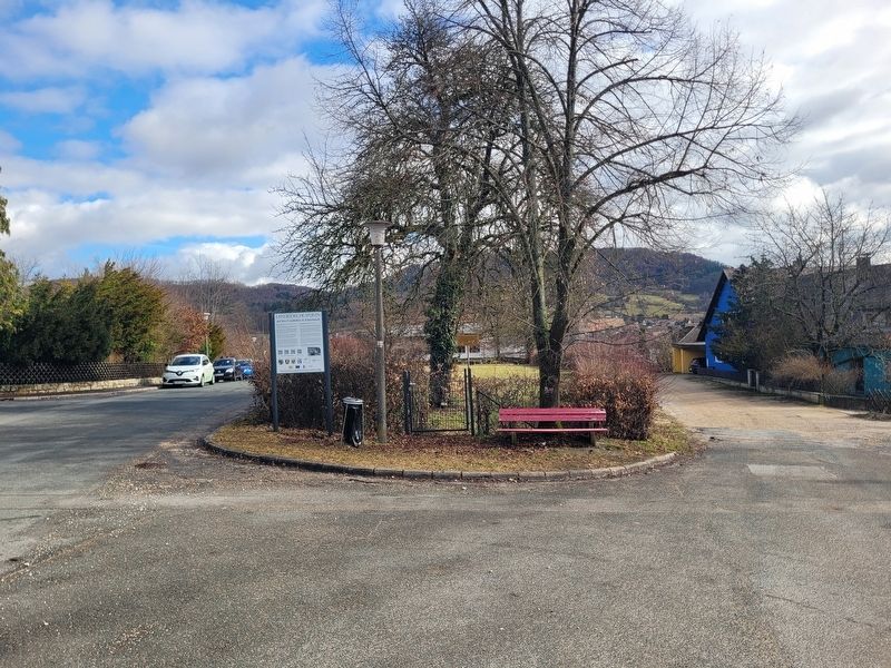
Photographed by James Hulse, February 24, 2026
3. Landjüdische Spuren auf den Friedhöfen in Schnaittach Marker
The view of the entrance to the cemetery.
According to witnesses, after the Pogrom night of November 1938 the Nazis destroyed and stole many of the tombstones. They were sold or used for construction, such as in 1939 the staircase of the Museum of Local History located in the former synagogue. Since 2000 retrieved gravestones have been brought back. They cannot be placed back on the graves from where they had been stolen. Today these places are unknown. They now rest on the western wall of section two, as a reminder of the violent end of the Jewish communities of Ottensoos, Schnaittach, Forth and Hüttenbach.
The LEADER-Project

Photographed by James Hulse, February 24, 2026
4. The view of the Jewish cemetery
The Graveyards are the property of the Landesverband der Israelitischen Kultusgemeinden Bayern K.d.ö.R. On Shabbat and on Jewish holidays entrance is not allowed. Men should wear a hat. Guided tours are offered by the Jewish Museum Franken (phone: +49 911 950988 0) or the Community of Schnaittach (phone +49 9153 409-121).
View of the three association cemeteries in Schnaittach, aerial photograph (detail), taken in 1919.
Erected by Bavarian State Ministry for Food, Agriculture and Forestry and the European Agricultural Fund for Rural Development (EAFRD).
Topics. This historical marker is listed in these topic lists: Cemeteries & Burial Sites • Religion & Religious Structures. A significant historical month for this entry is August 2019.
Location. 49° 33.675′ N, 11° 20.239′ E. Marker is in Schnaittach, Bayern (Bavaria), in Nürnberger Land. It is at the intersection of Krankenhausweg and Oberer Krankenhausweg, on the right when traveling east on Krankenhausweg. Touch for map. Marker is at or near this postal address: Krankenhausweg 9A, Schnaittach BY 91220, Germany. Touch for directions.

Regionally, this marker is in German Franconia. Globally, it is in Europe, the European Union, Atlantic Europe, Central Europe, the Schengen Area, Western Europe, and the Western World. Historically, it finds itself in what was once the Holy Roman Empire and also the former West Germany.
Other nearby markers. At least 8 other markers are within walking distance of this marker: Der Rothenberg / Fortress Hill (a few steps from this marker); Das ehemalige Kreiskrankenhaus / The Former District Hospital (about 90 meters away, measured in a direct line); Die Schulen / The Schools (about 120 meters away); Die jüdischen Friedhöfe / The Jewish Cemeteries (about 120 meters away); Das alte Gemeindekrankenhaus / The Old Municipal Hospital (about 150 meters away); Die evangelische Kirche / The Protestant Church (about 150 meters away); Das Scheunenviertel / The Barn Quarter (about 150 meters away); Die Kalvarienberganlage / Calvary Hill Complex (about 180 meters away). Touch for a list and map of all markers in Schnaittach.
Additional keywords. Holocaust
Credits. This page was last revised on March 8, 2026. It was originally submitted on March 6, 2026, by James Hulse of Medina, Texas. This page has been viewed 14 times since then. Photos: 1, 2, 3, 4. submitted on March 8, 2026, by James Hulse of Medina, Texas.
