Schnaittach in Nürnberger Land, Bavaria, Germany — Central Europe
Das ehemalige Kreiskrankenhaus
Schnaittacher Geschichtsweg
⎯⎯⎯
The Former District Hospital
Schnaittach Historical Trail
Photographed by James Hulse, February 24, 2026
1. Das ehemalige Kreiskrankenhaus / The Former District Hospital Marker

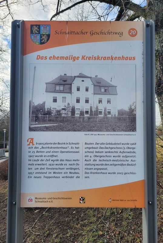
Ab 1905 plante der Bezirk in Schnaittach das „Bezirkskrankenhaus“. Es hatte 25 Betten und einen Operationssaal. 1907 wurde es eröffnet.
Im Laufe der Zeit wurde das Haus mehrmals erweitert. 1930 wurde es nach Osten um drei Fensterachsen verlängert, 1957 entstand im Westen ein Neubau. Ein neues Treppenhaus verbindet die Bauten. Der alte Gebäudeteil wurde 1968 umgebaut: Das Dachgeschoss (3. Obergeschoss) bekam senkrechte Außenwände, ein 4. Obergeschoss wurde aufgesetzt. Auch die technisch-medizinische Ausstattung wurde den zeitgemäßen Bedürfnissen angepasst.
Das Krankenhaus wurde 2003 geschlossen.
Foto R. Uibl 1917 Museums- und Geschichtsverein Schnaittach e. V.
Beginning in 1905, the district planned the construction of the “District Hospital” in Schnaittach. It had 25 beds and an operating room. The hospital opened in 1907.
Over time, the building was expanded several times. In 1930 it was extended to the east by three window bays, and in 1957 a new building was added on the west side. A new stairwell connects the buildings. The old part of the building was remodeled in 1968: the attic (third floor) received vertical exterior walls, and a fourth floor was added. The technical and medical equipment was also updated to meet contemporary needs.
The hospital was closed in 2003.
Photo: R. Uibl, 1917. Museum and Historical Society of Schnaittach (registered association).
Erected 2011 by Museum and Historical Society of Schnaittach (registered association). (Marker Number 20.)
Topics. This historical marker is listed in this topic list: Science & Medicine. A significant historical year for this entry is 1905.
Location. 49° 33.685′ N, 11° 20.158′ E. Marker is in Schnaittach, Bayern (Bavaria), in Nürnberger Land. It is at the intersection of Oberer Krankenhausweg and Krankenhausweg, on the left when traveling west on Oberer Krankenhausweg. Touch for map. Marker is at or near this postal address: Oberer Krankenhausweg 1, Schnaittach BY 91220, Germany. Touch for directions.

Regionally, this marker is in German Franconia. Globally, it is in Europe, the European Union, Atlantic Europe, Central Europe, the Schengen Area, Western Europe, and the Western World. Historically, it finds itself in what was once the Holy Roman Empire and also
this page online
Other nearby markers. At least 8 other markers are within walking distance of this marker: Der Rothenberg / Fortress Hill (about 90 meters away, measured in a direct line); Das alte Gemeindekrankenhaus / The Old Municipal Hospital (about 90 meters away); Landjüdische Spuren auf den Friedhöfen in Schnaittach (about 90 meters away); Die Kalvarienberganlage / Calvary Hill Complex (about 120 meters away); Die evangelische Kirche / The Protestant Church (about 120 meters away); Das Kriegerdenkmal / The War Memorial (about 120 meters away); Die Schulen / The Schools (about 150 meters away); Das Scheunenviertel / The Barn Quarter (about 210 meters away). Touch for a list and map of all markers in Schnaittach.
Photographed by James Hulse, February 24, 2026
2. Das ehemalige Kreiskrankenhaus / The Former District Hospital Marker
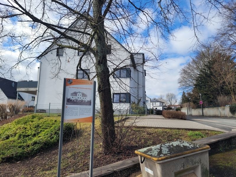
The view of the marker with the building in the background.

Photographed by James Hulse, February 24, 2026
3. Das ehemalige Kreiskrankenhaus / The Former District Hospital Marker
The view of the marker from across the street.
Credits. This page was last revised on March 9, 2026. It was originally submitted on March 6, 2026, by James Hulse of Medina, Texas. This page has been viewed 9 times since then. Photos: 1, 2, 3. submitted on March 9, 2026, by James Hulse of Medina, Texas.
