Schnaittach in Nürnberger Land, Bavaria, Germany — Central Europe
Das alte Gemeindekrankenhaus
Schnaittacher Geschichtsweg
⎯⎯⎯
The Old Municipal Hospital
Schnaittach Historical Trail
Photographed by James Hulse, February 24, 2026
1. Das alte Gemeindekrankenhaus / The Old Municipal Hospital Marker

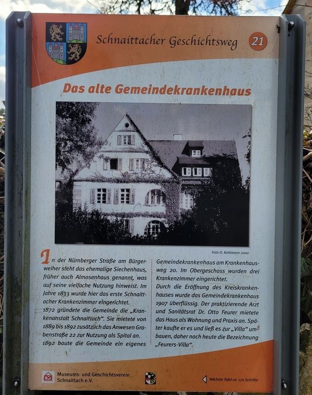
In der Nürnberger Straße am Bürgerweiher steht das ehemalige Siechenhaus, früher auch Almosenhaus genannt, was auf seine vielfache Nutzung hinweist. Im Jahre 1833 wurde hier das erste Schnaittacher Krankenzimmer eingerichtet.
1872 gründete die Gemeinde die „Krankenanstalt Schnaittach“. Sie mietete von 1889 bis 1892 zusätzlich das Anwesen Grabenstraße 22 zur Nutzung als Spital an. 1892 baute die Gemeinde ein eigenes Gemeindekrankenhaus am Krankenhausweg 20. Im Obergeschoss wurden drei Krankenzimmer eingerichtet.
Durch die Eröffnung des Kreiskrankenhauses wurde das Gemeindekrankenhaus 1907 überflüssig. Der praktizierende Arzt und Sanitätsrat Dr. Otto Feurer mietete das Haus als Wohnung und Praxis an. Später kaufte er es und ließ es zur „Villa“ umbauen, daher noch heute die Bezeichnung „Feurers-Villa“.
Foto O. Kohlmann 2000
On Nürnberger Street by the Bürgerweiher stands the former leper house, later also called the alms house, which reflects its various uses. In 1833 the first sickroom in Schnaittach was established here.
In 1872 the municipality founded the “Krankenanstalt
this page online
With the opening of the district hospital in 1907, the municipal hospital became unnecessary. The practicing physician and medical officer Dr. Otto Feurer rented the house as a residence and medical practice. Later he bought it and had it converted into a “villa,” which is why it is still known today as Feurer’s Villa.
Photo by O. Kohlmann, 2000
Erected 2011 by Museum and Historical Society of Schnaittach (registered association). (Marker Number 21.)
Topics. This historical marker is listed in this topic list: Science & Medicine. A significant historical year for this entry is 1833.
Location. 49° 33.64′ N, 11° 20.13′ E. Marker is in Schnaittach, Bayern (Bavaria), in Nürnberger Land. It is at the intersection of Krankenhausweg and Erlanger Str., on the right when traveling south on Krankenhausweg. Touch for map. Marker is at or near this postal address: Krankenhausweg
Photographed by James Hulse, February 24, 2026
2. Das alte Gemeindekrankenhaus / The Old Municipal Hospital Marker
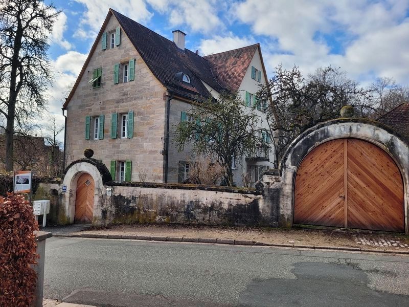
The view of the marker and building from across the street.

Regionally, this marker is in German Franconia. Globally, it is in Europe, the European Union, Atlantic Europe, Central Europe, the Schengen Area, Western Europe, and the Western World. Historically, it finds itself in what was once the Holy Roman Empire and also the former West Germany.
Other nearby markers. At least 8 other markers are within walking distance of this marker: Die evangelische Kirche / The Protestant Church (within shouting distance of this marker); Die Kalvarienberganlage / Calvary Hill Complex (within shouting distance of this marker); Das Kriegerdenkmal / The War Memorial (within shouting distance of this marker); Das ehemalige Kreiskrankenhaus / The Former District Hospital (about 90 meters away, measured in a direct line); Die Schulen / The Schools (about 120 meters away); Der Rothenberg / Fortress Hill (about 120 meters away); Landjüdische Spuren auf den Friedhöfen in Schnaittach (about 150 meters away); Das Scheunenviertel / The Barn Quarter (about 180 meters away). Touch for a list and map of all markers in Schnaittach.
Photographed by James Hulse, February 24, 2026
3. Das alte Gemeindekrankenhaus / The Old Municipal Hospital Marker
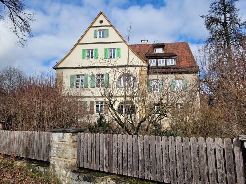
The front view of the building.
Photographed by James Hulse, February 24, 2026
4. Das alte Gemeindekrankenhaus / The Old Municipal Hospital Marker
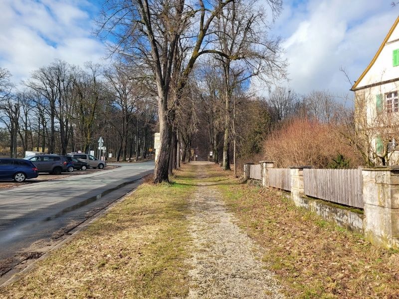
The view of the sidewalk and street along the front of the building.
Credits. This page was last revised on March 9, 2026. It was originally submitted on March 6, 2026, by James Hulse of Medina, Texas. This page has been viewed 9 times since then. Photos: 1, 2, 3, 4. submitted on March 9, 2026, by James Hulse of Medina, Texas.
