Near Thornton in Limestone County, Texas — The American South (West South Central)
Cobb Cemetery

Photographed by Jeff Leichsenring, March 8, 2026
1. Cobb Cemetery Marker
Brinkley Davis and his family, including his daughter Mary Ellen, moved to this area from Indiana in 1833. Brinkley Davis received a land grant of about 4500 acres from the Mexican government in 1835, and the surrounding area became known as Davis Prairie. A native of Alabama, Pinckney Cobb came to Texas in the early 1840s. He married Mary Ellen Davis in 1845, and they eventually had nine children. This cemetery was established on Cobb family land in the 1850s. Brinkley Davis died in 1852 and his is the earliest marked grave. William Neri, the second child of Pinckney and Mary Ellen Cobb, died at the age of six in 1855. Pinckney Cobb died at age 45 and was interred here in 1866, seven months before his youngest son was born. Another Cobb son, George Levi, was 20 when he died and was buried here in 1872.
County Judge L.B. Cobb donated a parcel of land joining the west side of the cemetery in 1887. Many early settlers of the surrounding communities are interred here. The site was cared for by family and community members until the area population decreased during World War II and it became necessary to pay for cemetery
this page online
Other burials of interest include that of Nathaniel G. Hudson, who came to Texas in 1836, joined the Santa Fe expedition in 1841 and was held prisoner in Mexico from 1841 to 1843. Nathaniel P. Hudson, a veteran of the Spanish American War, also is interred here, as are seven Confederate veterans. At the dawn of the 21st century, 964 graves (227 unidentified) graced the cemetery grounds. Many early graves are those of infants and small children, testaments to the harsh conditions of pioneer life.
Erected 2000 by Texas Historical Commission. (Marker Number 11676.)
Topics. This historical marker is listed in this topic list: Cemeteries & Burial Sites. A significant historical year for this entry is 1833.
Location. 31° 26.205′ N, 96° 32.701′ W. Marker is near Thornton, Texas, in Limestone County. It is on County Road 778 0.2 miles north of County Road 776, on the left when traveling north. Touch for map. Marker is at or near this postal address: 1233 778, Groesbeck TX 76642, United States of America. Touch for directions.

Regionally, this marker is in the Prairies & Lakes Region. It is also in the American South.
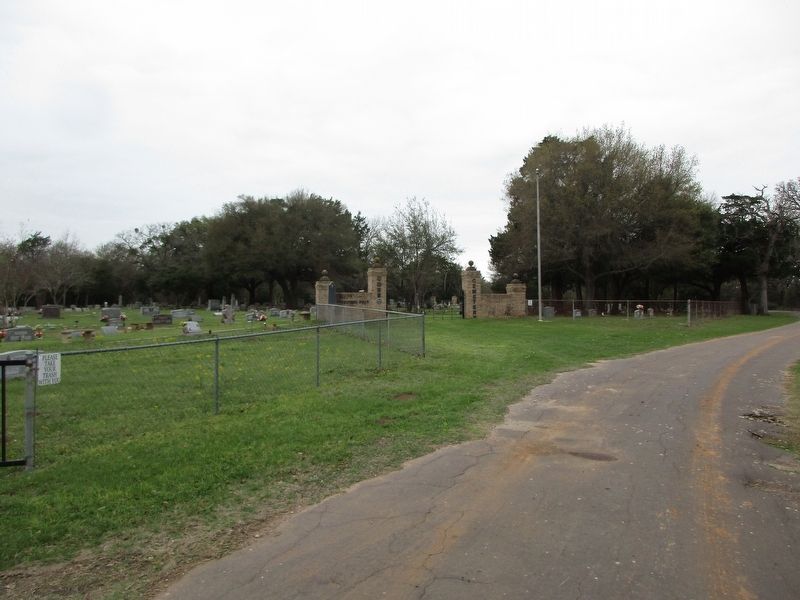
Photographed by Jeff Leichsenring, March 8, 2026
2. Cobb Cemetery and marker
Other nearby markers. At least 8 other markers are within 6 miles of this marker, measured as the crow flies: Thornton Schools (approx. 2.2 miles away); Eaton Cemetery (approx. 4.6 miles away); Tidwell (Steele Creek) Cemetery and Community (approx. 4.7 miles away); Abram Anglin (approx. 5½ miles away); Faulkenberry Cemetery (approx. 5½ miles away); Washington High School (approx. 5.6 miles away); Limestone County Courthouse (approx. 6 miles away); Home County of Lafayette Lumpkin Foster (approx. 6 miles away). Touch for a list and map of all markers in Thornton.
Credits. This page was last revised on March 10, 2026. It was originally submitted on March 9, 2026, by Jeff Leichsenring of Garland, Texas. This page has been viewed 20 times since then. Photos: 1, 2. submitted on March 9, 2026, by Jeff Leichsenring of Garland, Texas. • James Hulse was the editor who published this page.
