Goose Creek in Berkeley County, South Carolina — The American South (South Atlantic)
Boochawee Hall
Photographed by Cindy Bullard, March 29, 2010
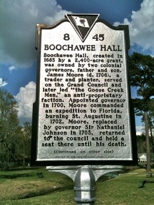
1. Boochawee Hall Marker (front)
Boochawee Hall, created in 1683 by a 2,400-acre grant, was owned by two colonial governors, father and son. James Moore (d. 1706), a trader and planter, served on the Grand Council and later led “the Goose Creek Men,” an anti-proprietary faction. Appointed governor in 1700, Moore commanded an expedition to Florida, burning St. Augustine in 1702. Moore, replaced as governor by Sir Nathaniel Johnson in 1703, returned to the council and held a seat there until his death.
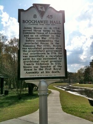
Marker Reverse:
James Moore Jr. (d. 1724) served three terms in the Commons House of Assembly and as an officer in the Tuscarora War (1711-13) before commanding the provincial forces in the Yemassee War (1715). Moore was appointed governor when the proprietary government was overthrown in 1719. He was essentially a caretaker until he was succeeded by provisional royal governor Francis Nicholson in 1721. Moore was Speaker of the House in the first Royal Assembly at his death.
Erected 2007 by the City of Goose Creek. (Marker Number 8-45.)
Topics. This historical marker is listed in this topic list: Colonial Era. A significant historical year for this entry is 1683.
Location. 32° 59.759′ N,
this page online

Regionally, this marker is in the Lowcountry and in Santee Cooper Country. It is also in the American South, specifically in the Deep South, and on the Eastern Seaboard. Globally, it is in the North Atlantic Region, North America, the Western Hemisphere, the Western World, and the Anglosphere. Historically, it finds itself in what was once the territory of the Mississippian Culture, one of the original Thirteen Colonies, one of the Confederate States of America, and the Antebellum South.
Other nearby markers. At least 8 other markers are within 2 miles of this marker, measured as the crow flies: Button Hall (approx. 0.7 miles away); Goose Creek / City of Goose Creek (approx. ¾ mile away); Howe Hall Plantation / Howe Hall (approx. 0.9 miles away); The Oaks (approx. 0.9 miles away); Eighteen Mile House Tavern (approx. 0.9 miles away); Liberty Hall Plantation
Photographed by cindy Bullard, March 29, 2010
2. Boochawee Hall Marker (reverse)
Photographed by Cindy Bullard, March 29, 2010
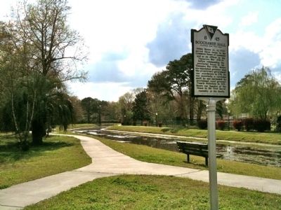
3. Lake Greenview Park
Credits. This page was last revised on June 16, 2016. It was originally submitted on April 4, 2010, by David Bullard of Seneca, South Carolina. This page has been viewed 4,325 times since then and 138 times this year. Photos: 1, 2, 3. submitted on April 4, 2010, by David Bullard of Seneca, South Carolina. • Kevin W. was the editor who published this page.
