Columbia Heights in Arlington in Arlington County, Virginia — The American South (Mid-Atlantic)
Fort Richardson

Photographed by Evan Dwyer, January 17, 2026
1. Fort Richardson Marker
A critical part of the Civil War Defenses of Washington, D.C., Fort Richardson defended the high ground that Confederate artillery could have commanded to shell the nation's capital across the Potomac River. Located on a plateau overlooking Columbia Turnpike, the fort defended a main access point from Virginia to Washington, D.C. via Long Bridge.
Defenses of Washington
Fort Richardson was one of 164 Civil War forts and batteries—and one of 68 enclosed forts—that formed the Defenses of Washington, which created a nearly 37-mile defensive perimeter around the Union capital.
Protecting the Arlington Line
Fort Richardson was on The Arlington Line, which comprised the Defenses of Washington south of the Potomac River. These fortifications formed a double line. Located on the outer rim, Fort Richardson acted as a first line of defense for forts to its east.
Union Troops Cross the Potomac
Virginia seceded from the Union on May 23, 1861. In the wee hours of May 24, Union troops stationed in Washington, D.C. crossed the Potomac River and occupied what is now Arlington County. The following day, construction of fortifications
this page online
(caption) The Advance Guard of the Grand Army of the United States Crossing Long Bridge over the Potomac, at 2 A.M. on May 24, 1861 from Harper's Weekly, June 8, 1861.
Abraham Lincoln
In late May 1861, President Lincoln approved his generals' plans to build fortifications in strategic areas of northern Virginia across the Potomac River from the nation's capital. Fort Richardson's construction began on September 1, 1861. Library of Congress
Display provided by the ANCC Foundation
Erected 2019 by Army Navy Country Club Foundation.
Topics and series. This historical marker is listed in these topic lists: Forts and Castles • War, US Civil. In addition, it is included in the Defenses of Washington series list. A significant historical date for this entry is September 1, 1861.
Location. 38° 51.454′ N, 77° 4.714′ W. Marker is in Arlington, Virginia, in Arlington County. It is in Columbia Heights. It is on Army Navy Country Club Access Road 0.4 miles east of South Edgewood Steret, on the left when traveling east. The marker is located within the private Army Navy Country Club. Touch for map. Marker is at or
Photographed by Evan Dwyer, January 17, 2026
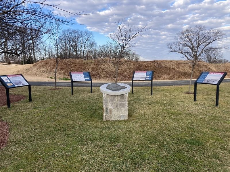
2. Fort Richardson Marker
Marker is one of four. It is shown at left.

Regionally, this marker is in the Washington Metropolitan Area and in Northern Virginia. It is also in the American South, specifically in the Upper South, in the Mid-Atlantic, and on the Eastern Seaboard. Globally, it is in the North Atlantic Region, North America, the Western Hemisphere, the Western World, and the Anglosphere. Historically, it finds itself in what was once the territory of the Mississippian Culture, one of the original Thirteen Colonies, one of the Confederate States of America, and the Antebellum South.
Other nearby markers. At least 8 other markers are within walking distance of this marker: The Fort (here, next to this marker); The Soldiers (here, next to this marker); The Artillery (here, next to this marker); a different marker also named Fort Richardson (within shouting distance of this marker); Our Lady Queen of Peace (approx. 0.3 miles away); Arlington Village (approx. 0.4 miles away); Selina Gray (approx. 0.4 miles away); History of Bocce Ball (approx. 0.4 miles away). Touch for a list and map
Photographed by Evan Dwyer, January 17, 2026
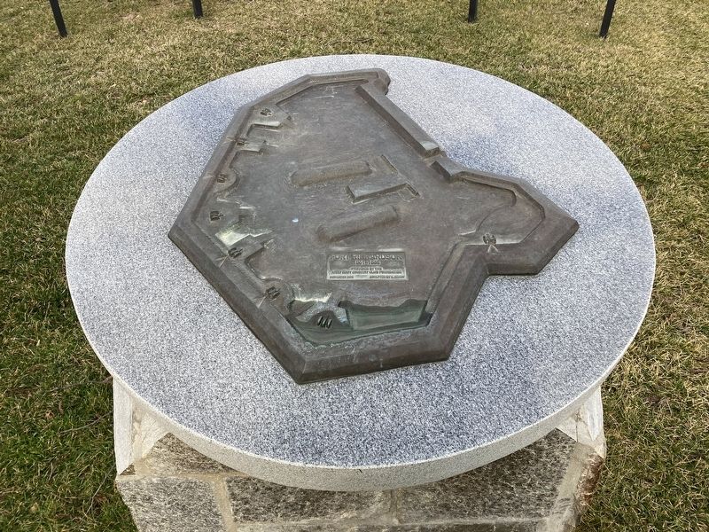
3. Fort Richardson Relief
This relief model of the fort was installed in 2019 with the markers.
More about this marker. Country Club access is limited to members, their guests, and registered attendees of club events.
Related markers. Click here for a list of markers that are related to this marker. These accompany this marker and combine to tell the reader the context of the fort.

Photographed by Evan Dwyer, January 17, 2026
4. Fort Richardson
Exterior of the southeast parapet of Fort Richardson, seen from the access road about 250' east of the marker.
Credits. This page was last revised on March 10, 2026. It was originally submitted on March 10, 2026, by Evan Dwyer of Richmond, Virginia. This page has been viewed 23 times since then. Photos: 1, 2, 3, 4. submitted on March 10, 2026, by Evan Dwyer of Richmond, Virginia. • Bernard Fisher was the editor who published this page.
