Bellevue in Southwest Washington in Washington, District of Columbia — The American Northeast (Mid-Atlantic)
Defending the Capital
Fort Greble
| — | Civil War Defenses of Washington | — |

Photographed by Evan Dwyer, circa 2025
1. Defending the Capital Marker
Slave states and Confederate sympathizers surrounded the District of Columbia when the Civil War broke out. Every road, bridge, and waterway leading into the capital needed defending. Union troops built a 37-mile-long circle of forts and trenches around the city. They called theses earthen fortifications the "Defenses of Washington." Today you can learn aout this history, find natural settings, and enjoy strolling, hiking, biking, and watching and learning about Washington's native plants and animals.
Fort Greble
Observing the Ridge and Rivers
A heavily armed fort with sweeping views of Washington once occupied this area. Made mostly of earth, Fort Greble included wood structures built with lumber cut from the forested hillside. The open landscape helped Union soldiers see he cavalry depot on the Potomac and guard the southern approaches to the city.
Although no battles occurred here, troops kept busy with training, inspections, guarding camp, and writing letters. Former slaves visited the fort to sell fresh fruits and vegetables to the soldiers.
[Captions:]
Fort Greble overlooked the Giesboro Cavalry Depot on the banks of the Potomac.
Giesboro Cavalry Depot during the Civil War.
To
this page online
Erected by National Park Service, U.S. Department of the Interior.
Topics and series. This historical marker is listed in these topic lists: Forts and Castles • War, US Civil. In addition, it is included in the Defenses of Washington series list. A significant historical year for this entry is 1861.
Location. 38° 49.565′ N, 77° 0.85′ W. Marker is in Southwest Washington in Washington, District of Columbia. It is in Bellevue. It is on Elmira Street Southwest 0.1 miles west of Martin Luther King Jr. Avenue Southwest, on the right when traveling west. The marker stands at the entrance to Fort Greble Park. Touch for map. Marker is at or near this postal address: 250 Elmira Street Southwest, Washington DC 20032, United States of America. Touch for directions.

Regionally, this marker is in the Washington Metropolitan Area. It is also in the American Northeast, in the Upper South, in the Mid-Atlantic, in the Tidewater, and in the Chesapeake Bay Region. Globally, it is in North America, the Western Hemisphere, the Western World, and the Anglosphere.
Other nearby markers. At

Photographed by Evan Dwyer, circa 2025
2. Defending the Capital Marker
Another marker is no longer nearby. Fort Greble (was here, next to this marker but has been replaced with another marker now near it).
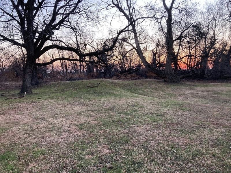
More about this marker. The marker is at the north end of the surviving remains of Fort Greble. If the viewer turns to the south, the eroded, angular remains of the interior, namely the earthen magazines, are evident in the topography of the park's central clearing. The bottom of the slope is the interior ground level
Photographed by Evan Dwyer, circa 2025
3. Eroded Remains of Fort Greble
This is the remnant of the magazines and bombproof in the middle of the fort.
Related marker. Click here for another marker that is related to this marker. This marker has replaced the linked marker.
Also see . . . Fort Greble - Wikipedia Page. Fort Greble was an American Civil War-era Union fortification constructed as part of the defenses of Washington, D.C. during that war. Named for First Lieutenant John Trout Greble, the first West Point graduate killed in the U.S. Civil War, it protected the junction of the Anacostia and Potomac rivers. It was supported by Fort Carroll to the northeast and Fort Foote to the south and never fired a shot during the war. (Submitted on March 12, 2026, by Bradley Owen of Morgantown, West Virginia.)
National Archives
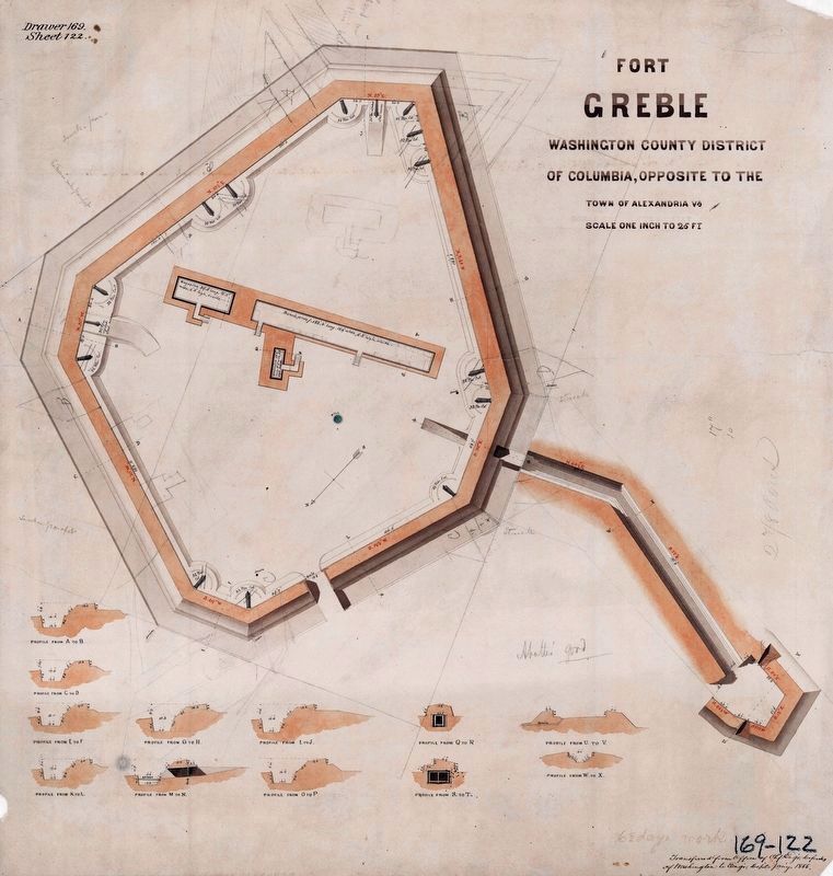
4. Fort Greble, Washington County District of Columbia
Engineering drawing of the fort. Note it is not oriented North South. See following graphic for orientation according to the arrow drawn within the fort.
NAID: 117886653, Drawer 169, Sheet 122 Maps and Charts

courtesy U.S. Geological Survey, U.S. Department of the Interior
5. Fort Greble Remains
USGS 3DEP Viewer aerial view of the fort using LiDAR, as compared to the fort's engineering drawing. The general surviving shape is patterned in red within the fort's parapet on this graphic to orient the viewer. The angled yellow rectangle shows the area photographed and shown with this marker's database entry here on this page.
Credits. This page was last revised on March 12, 2026. It was originally submitted on March 12, 2026, by Evan Dwyer of Richmond, Virginia. This page has been viewed 39 times since then. Photos: 1, 2, 3. submitted on March 12, 2026, by Evan Dwyer of Richmond, Virginia. 4. submitted on March 12, 2026. 5. submitted on March 12, 2026, by Evan Dwyer of Richmond, Virginia. • Devry Becker Jones was the editor who published this page.
