Bellevue in Southwest Washington in Washington, District of Columbia — The American Northeast (Mid-Atlantic)
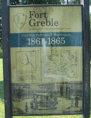
Fort Greble
Civil War Defenses of Washington
| — | 1861-1865 | — |
Photographed by Craig Swain, August 7, 2008
1. Fort Greble Marker
Appearing rather worn and weathered.
Earthworks of Fort Greble are visible beyond this exhibit.
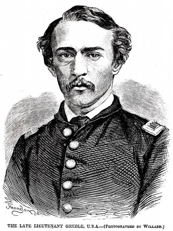
Fort Greble was named in honor of Lt. John T. Greble, slain at the Battle of Big Bethel, June 10, 1861, the first U.S. Military Academy graduate killed in the Civil War.
Erected by National Park Service, U.S. Department of the Interior.
Topics and series. This historical marker is listed in these topic lists: Forts and Castles • War, US Civil. In addition, it is included in the Defenses of Washington series list. A significant historical date for this entry is June 10, 1855.
Location. This marker has been replaced by another marker nearby. It was located near 38° 49.565′ N, 77° 0.849′ W. Marker was in Southwest Washington in Washington, District of Columbia. It was in Bellevue. It was at the intersection of Elmira Street Southwest and Martin Luther King Jr. Avenue Southwest, on the right when traveling west on Elmira Street Southwest. The marker stands at the entrance to Fort Greble Park. Touch for map. Marker was at or near this postal address: 208 Elmira Street Southwest, Washington DC 20032, United States of America. Touch for directions.

Regionally, this
this page online
Other nearby markers. At least 8 other markers are within 2 miles of this location, measured as the crow flies: Defending the Capital (here, next to this marker); Original Federal Boundary Stone, District of Columbia, Southeast 7 (approx. 0.8 miles away in Maryland); a different marker also named Defending the Capital (approx. 0.8 miles away); Fort Carroll (approx. 0.9 miles away); In Memory of Col. Raynal C. Bolling (approx. one mile away); Original Federal Boundary Stone, District of Columbia, Southeast 8 (approx. one mile away in Maryland); Holocaust Memorial (approx. 1.2 miles away); Bolling Air Force Base (approx. 1.2 miles away). Touch for a list and map of all markers in Southwest Washington.
More about this marker. The marker displays a plan of Fort Greble from U.S. Army Corps of Engineers drawing. A map shows other Civil War fortifications
Photographed by Craig Swain, August 7, 2008
2. Fort Greble Marker
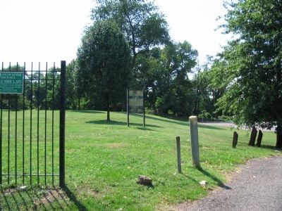
Remains of Fort Greble stand just behind the marker.
Related marker. Click here for another marker that is related to this marker. To better understand the relationship, study each marker in the order shown.
Also see . . .
1. Fort Greble. Additional information on the fort and the service history. (Submitted on August 22, 2008, by Craig Swain of Leesburg, Virginia.)
2. Battery Carroll and Fort Greble. National Park Service page on the fort and nearby Battery Carroll. (Submitted on August 22, 2008, by Craig Swain of Leesburg, Virginia.)
3. Lt. John Trout Greble. (Submitted on March 13, 2011, by Richard E. Miller of Oxon Hill, Maryland.)
Additional commentary.
1. Fort Greble Particulars
From "Mr. Lincoln's Forts: A Guide to the Civil War Defenses of Washington," by Benjamin Franklin Cooling III and Walton H. Owen II:
Fort Greble had a perimeter of 327 feet and was octagonal in shape. The Fort's armament included six 12-pdr field guns, six 32-pdr, seacoast guns, two 8-in siege
Photographed by Craig Swain, August 7, 2008
3. Fort Greble Remains
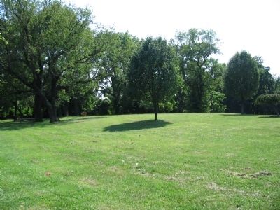
A few rises in the ground are all that remain to be seen of Fort Greble.
Units that garrisoned the fort at different times included elements of the 4th and 10th New York Heavy Artillery, 17th and 19th Maine Volunteer Infantry, 2nd U.S. Infantry, 3rd Massachusetts Heavy Artillery, 14th Michigan Battery, and 12th U.S. Infantry (post war).
The fort was constructed largely with civilian labor from northern cities, paid at rates between 40 and 90 cents per day, with carpenters and other specialists receiving up to $3.00.
After the war, the fort was retained for use as a signal station. But after 1867 the ground was returned to the original owners. In the opinion of the Army, the lumber and shingles remaining in the fort's structures was ample compensation for the use of the land. The property's trustee, a Thomas W. Berry of Baltimore, was less impressed. He responded, "We are not disposed to accept the proposition because with the Fort it would be like a Man with an Eliphant."
— Submitted August 22, 2008, by Craig Swain of Leesburg, Virginia.
National Archives
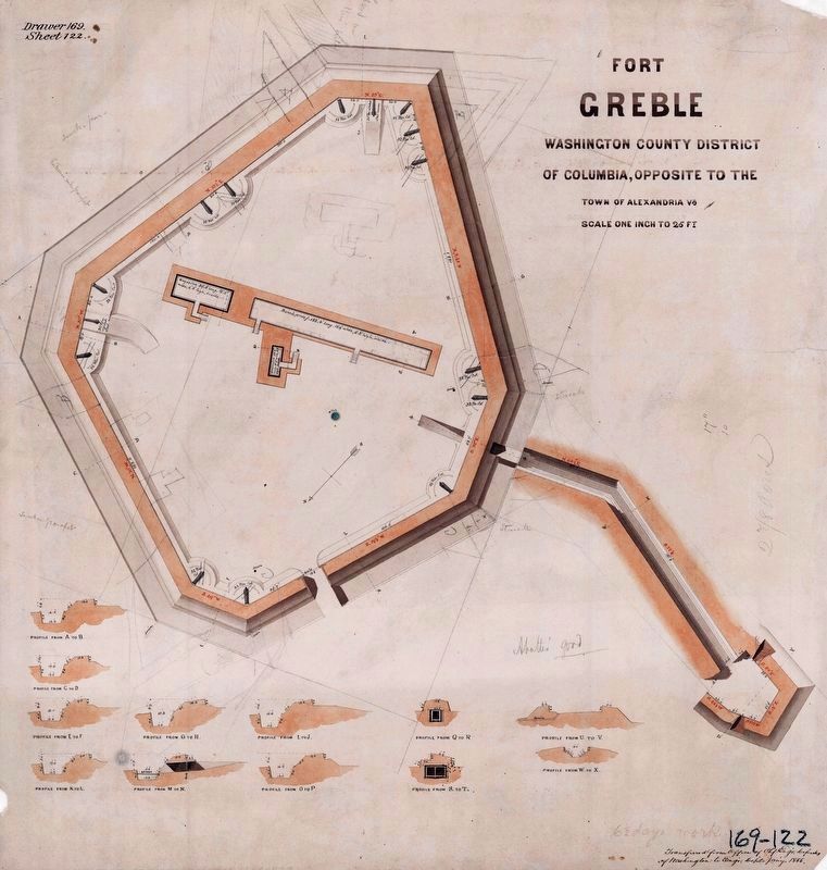
4. Fort Greble,
Washington County District of Columbia
Washington County District of Columbia
“Transferred from Office of Chf. Engr. Defenses of Washington to Engr. Dept. Jan’y. 1866”
NAID: 117886653, Drawer 169, Sheet 122 Maps and Charts
NAID: 117886653, Drawer 169, Sheet 122 Maps and Charts
Internet Archive
5. The Late Lieutenant Greble, U.S.A.
From Harper's Weekly June 26, 1861, Page 413.
Photographed by Richard E. Miller, February 16, 2012
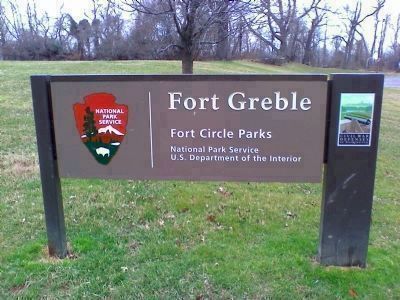
6. Fort Greble - Fort Circle Parks
Credits. This page was last revised on March 12, 2026. It was originally submitted on August 22, 2008, by Craig Swain of Leesburg, Virginia. This page has been viewed 3,611 times since then and 59 times this year. Last updated on March 12, 2026, by Evan Dwyer of Richmond, Virginia. Photos: 1, 2, 3. submitted on August 22, 2008, by Craig Swain of Leesburg, Virginia. 4, 5. submitted on March 11, 2024, by Allen C. Browne of Silver Spring, Maryland. 6. submitted on February 17, 2012, by Richard E. Miller of Oxon Hill, Maryland. • Devry Becker Jones was the editor who published this page.
