
Dudley in Goldsboro in Wayne County, North Carolina — The American South (South Atlantic)
River Road and Pontoon Bridges
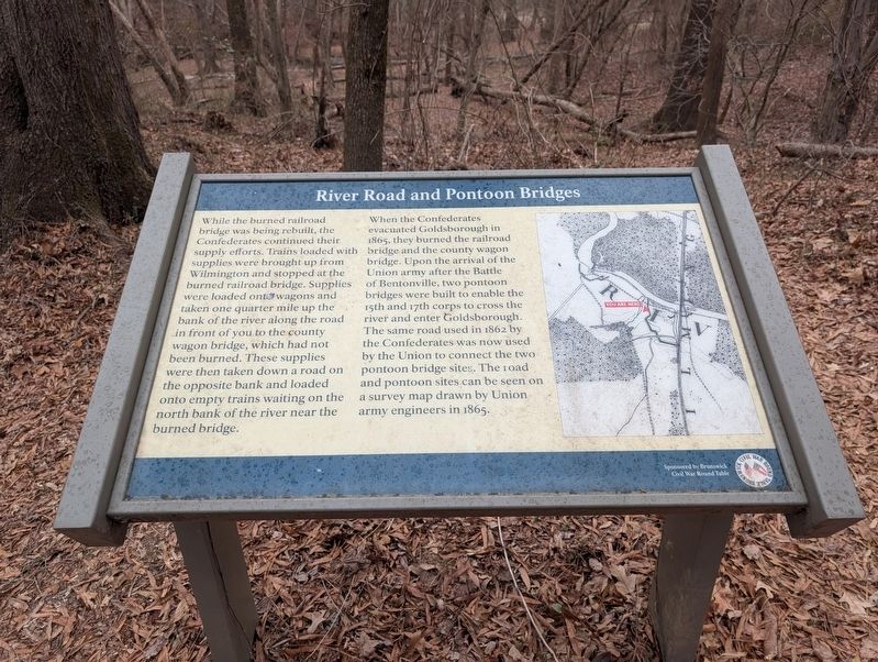
Photographed by Mark P. Brock-Cancellieri, February 15, 2026
1. River Road and Pontoon Bridges Marker
When the Confederate evacuated Goldsborough in 1865, they burned the railroad bridge and the county wagon bridge. UPon arrival of the Union army, after the Battle of Bentonville, two pontoon bridges were built to enable the 15th and 17th corps to cross the river and enter Goldsborough. The same road used in 1862 by the Confederates was now used by the Union to connect the two pontoon bridge sites. The road and pontoon sites can be seen on the survey map drawn by Union army engineers in 1865.
Erected by Brunswick Civil War Round Table.
Topics. This historical marker is listed in these topic lists:
this page online
Location. 35° 20.38′ N, 78° 1.629′ W. Marker is in Goldsboro, North Carolina, in Wayne County. It is in Dudley. It can be reached from Old Mount Olive Highway 0.3 miles south of Bypass U.S. 117, on the left when traveling south. Touch for map. Marker is at or near this postal address: 225371 Old Mt Olive Hwy, Dudley NC 28333, United States of America. Touch for directions.

Regionally, this marker is in North Carolina’s Coastal Plain and in the Piedmont. It is also in the American South and specifically in the Upper South. Globally, it is in North America, the Western Hemisphere, the Western World, and the Anglosphere. Historically, it finds itself in what was once the territory of the Mississippian Culture, one of the original Thirteen Colonies, one of the Confederate States of America, and the Antebellum South.
Other nearby markers. At least 8 other markers are within walking distance of this marker: Confederate and Union Earthworks (about 300 feet away, measured in a direct line); Confederate Counterattack (about 300 feet away); Confederate Earthworks (about 400 feet away); Battle Of Goldsborough Bridge (about 400 feet away); Battle of Goldsborough Bridge (about 400 feet away); Attack of the 17th Massachusetts (about 700 feet away); Earthwork Cross-Section (about 700 feet away); Defense of the Bridge (about 800 feet away). Touch for a list and map of all markers in Goldsboro.
Another marker is no longer nearby. Battle of Goldsboro Bridge (was about 400 feet away but has been replaced with another marker now near it).
Credits. This page was last revised on March 16, 2026. It was originally submitted on March 14, 2026, by Mark P. Brock-Cancellieri of Baltimore, Maryland. This page has been viewed 40 times since then. Photo 1. submitted on March 14, 2026, by Mark P. Brock-Cancellieri of Baltimore, Maryland. • Bernard Fisher was the editor who published this page.
