Near Fredericksburg in Spotsylvania County, Virginia — The American South (Mid-Atlantic)
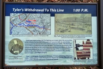
Tyler’s Withdrawal To This Line
1:00 P.M.
Photographed by Bernard Fisher, December 13, 2014
1. Tyler’s Withdrawal To This Line Marker
“Until near noon on May 3rd, the fighting was severe, when the ammunition of the infantry having been exhausted and repeated calls for more being unanswered, the line was forced to retire to the breast-works. The dead and most of the wounded were left upon the field. To screen his movements, the enemy set the forest on fire where many lay, perished miserably in the flames. The enemy followed up and had reached the edge of the wood just in front of the works, when the batteries opened on him a murderous fire, causing him to recoil.” - Col. Edgert Gregory
Tyler's 1st Brigade, Humphrey's Division, V Corps, consisting of the 91st, 126th, 129th and the 134th Pennsylvania Regiments and the effective use of the artillery finally halted the Confederate attack.
[Captions:]
Map of Chancellorsville by 1st Lieutenant B. L. Blackford, CSA Engineers-1863
Colonel Edgert Mantlebert Gregory, Commander, 91st PA. Infantry
Near this spot Edwin Forbes sketched the Union's last line of defense along Ely Ford Road. Waterman's Rhode Island and Martin’s and Phillips Massachusetts Artillery aided and assisted stopping the Confederate assault.
Remnants 91st PA. Flag Courtesy of Pa. State Flag Collection
Erected 2014.
this page online
Topics. This historical marker is listed in this topic list: War, US Civil. A significant historical month for this entry is May 1928.
Location. 38° 19.382′ N, 77° 38.723′ W. Marker is near Fredericksburg, Virginia, in Spotsylvania County. It is on Elys Ford Road (County Route 610) 0.4 miles north of US Ford Road (County Route 616), on the right when traveling north. Touch for map. Marker is at or near this postal address: 13414 5th Corps Ln, Fredericksburg VA 22407, United States of America. Touch for directions.

Regionally, this marker is in the Washington Metropolitan Area, in Northern Virginia, and in the Piedmont. It is also in the American South, specifically in the Upper South, in the Mid-Atlantic, and on the Eastern Seaboard. Globally, it is in the North Atlantic Region, North America, the Western Hemisphere, the Western World, and the Anglosphere. Historically, it finds itself in what was once the territory of the Mississippian Culture, one of the original Thirteen Colonies, one of the Confederate States of America, and the Antebellum South.
Other nearby markers. At least 8 other markers are within walking distance
Photographed by Bernard Fisher
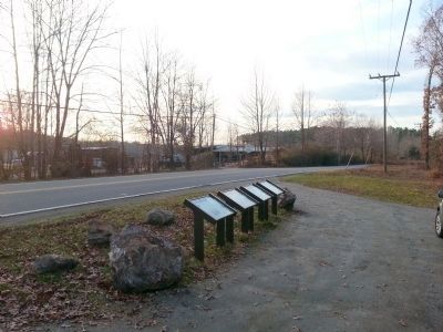
2. Elys Ford Rd (facing north)
Also see . . . Fredericksburg & Spotsylvania National Military Park. National Park Service (Submitted on December 14, 2014.)
Photographed by Bernard Fisher
3. Elys Ford Rd (facing south)
Credits. This page was last revised on March 15, 2026. It was originally submitted on December 14, 2014, by Bernard Fisher of Richmond, Virginia. This page has been viewed 674 times since then and 16 times this year. Last updated on March 14, 2026, by Evan Dwyer of Richmond, Virginia. Photos: 1, 2, 3. submitted on December 14, 2014, by Bernard Fisher of Richmond, Virginia. • Devry Becker Jones was the editor who published this page.
