Near Fredericksburg in Spotsylvania County, Virginia — The American South (Mid-Atlantic)
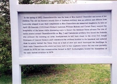
Chancellorsville Home of Mrs. Sanford Chancellor
Photographed by Don Morfe, March 20, 2000
1. Chancellorsville home of Mrs. Sanford Chancellor Marker
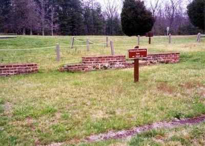
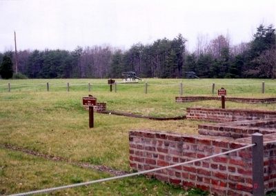
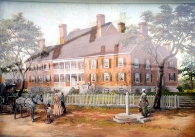
In the spring of 1863, Chancellorsville was the home of Mrs. Sanford Chancellor and seven of her children. The old inn hosted a steady flow of Southern military men as soldiers and officers from Lee’s army stopped to pay their compliments to Mrs. Chancellor’s six unmarried daughters. As late as April 29, Generals J.E.B. Stuart, Richard Anderson, William Mahone, and Carnot Posey enjoyed the hospitality of the house while discussing ways to thwart the imminent Union advance. The tide of battle crested around Chancellorsville on May 3 and Confederate artillery fire forced the Federals who utilized the building as army headquarters to fall back closer to the river. Col. Joseph Dickerson of General Hooker's staff remembered the civilians huddled to the basement and ushered them to safety behind the Union lines as a hail of shot and shell destroyed the dwellings in their wake. Chancellorsville which had been built in four segments before the war was partially rebuilt in 1870, but this reconstruction burned in 1927. Archeologists located foundations of the ante-bellum structure in 1976.
Erected by National Park Service,
this page online
Topics. This historical marker is listed in this topic list: War, US Civil. A significant historical date for this entry is May 3, 1863.
Location. Marker has been permanently removed. It was located near 38° 18.525′ N, 77° 38.08′ W. Marker was near Fredericksburg, Virginia, in Spotsylvania County. It was at the intersection of Elys Ford Road (County Route 610) and Plank Road (Virginia Route 3), on the left when traveling north on Elys Ford Road. Touch for map. Marker was at or near this postal address: 8840 Elys Ford Rd, Fredericksburg VA 22407, United States of America.
We have been informed that this marker is no longer there and will not be replaced. This page is an archival view of what was.
Regionally, this marker was in the Washington Metropolitan Area, in Northern Virginia, and in the Piedmont. It was also in the American South, specifically in the Upper South, in the Mid-Atlantic, and on the Eastern Seaboard. Globally, it was in the North Atlantic Region, North America, the Western Hemisphere, the Western World, and the Anglosphere. Historically, it found itself in what was once the territory

Photographed by Don Morfe, March 20, 2000
2. Chancellorsville Inn-1815-Foundation staked
Other nearby markers. At least 8 other markers are within walking distance of this location: The Chancellor Slaves (here, next to this marker); Civilians in the Crossfire (here, next to this marker); Climactic Struggle (within shouting distance of this marker); Lee's Greatest Triumph (within shouting distance of this marker); The Chancellorsville Intersection (within shouting distance of this marker); a different marker also named Battle of Chancellorsville (about 400 feet away); Chancellorsville Clearing (about 700 feet away); Chancellorsville Campaign (approx. 0.2 miles away). Touch for a list and map of all markers in Fredericksburg.
Other markers no longer nearby. Battle of Chancellorsville (was within shouting distance of this marker but has been permanently removed); Chancellorsville (was within shouting distance of this marker but has been permanently removed); a different marker also named Battle of Chancellorsville (was about 300 feet away, measured in a direct line but has been
Photographed by Don Morfe, March 30, 2000
3. Chancellorsville Inn-1815-Foundation staked
Also see . . . Fredericksburg & Spotsylvania National Military Park. National Park Service (Submitted on April 4, 2016.)
Photographed by Don Morfe, March 20, 2000
4. Chancellorsville Inn-painting on marker
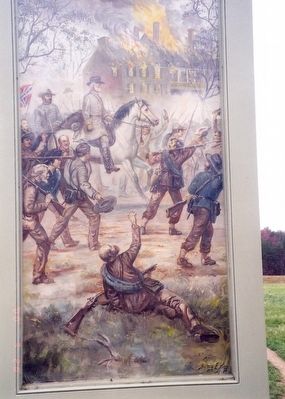
Photographed by Don Morfe, March 20, 2000
5. Chancellorsville home of Mrs. Sanford Chancellor Marker
Chancellorsville home is burning-painting on a marker
Credits. This page was last revised on March 15, 2026. It was originally submitted on April 2, 2016. This page has been viewed 1,119 times since then and 70 times this year. Last updated on March 14, 2026. Photos: 1, 2, 3, 4, 5. submitted on April 2, 2016, by Don Morfe of Baltimore, Maryland. • Devry Becker Jones was the editor who published this page.
