Near Spotsylvania Courthouse in Spotsylvania County, Virginia — The American South (Mid-Atlantic)
Chancellorsville Clearing
Photographed by Craig Swain, November 10, 2007
1. Chancellorsville Clearing Marker
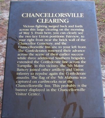
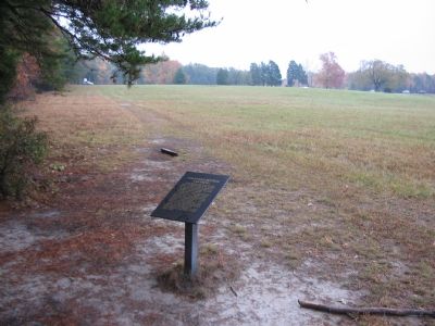
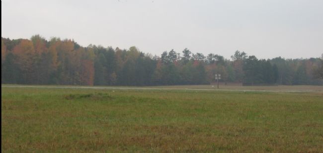
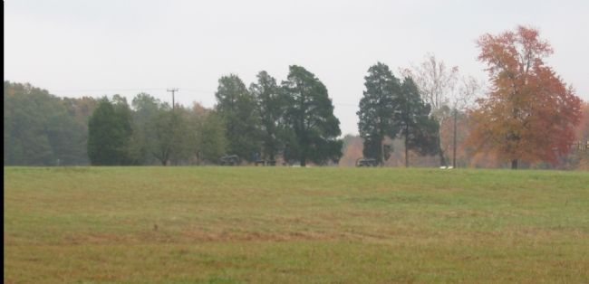
Vicious fighting surged back and forth across this large clearing on the morning of May 3. From here, you can clearly see the two key Union positions; Fairview, to your right front near the brick wall of the Chancellor Cemetery; and the Chancellorsville Inn site to your left front. The Confederates renewed their advance across the scene of their earlier success while three additional Southern brigades extended the Confederate line across the Turnpike. In this vicinity, the 5th Maine Battery joined other artillery and Union infantry to repulse again the Confederate assaults. The flag of the 5th Alabama was captured on earthworks near the Chancellorsville Inn. This probably is the banner displayed in the Chancellorsville Visitors Center.
Topics. This historical marker is listed in this topic list: War, US Civil. A significant historical date for this entry is May 3, 1937.
Location. 38° 18.602′ N, 77° 38.191′ W. Marker is near Spotsylvania Courthouse, Virginia, in Spotsylvania County. It is at the intersection of Plank Road (State Highway 3) and Elys Ford Road (County Road 610), on the right when traveling west on Plank Road. Located
this page online

Regionally, this marker is in the Washington Metropolitan Area, in Northern Virginia, and in the Piedmont. It is also in the American South, specifically in the Upper South, in the Mid-Atlantic, and on the Eastern Seaboard. Globally, it is in the North Atlantic Region, North America, the Western Hemisphere, the Western World, and the Anglosphere. Historically, it finds itself in what was once the territory of the Mississippian Culture, one of the original Thirteen Colonies, one of the Confederate States of America, and the Antebellum South.
Other nearby markers. At least 8 other markers are within walking distance of this marker: A different marker also named Battle of Chancellorsville (about 500 feet away); The Chancellorsville Intersection (about 600 feet away); Climactic Struggle (about 600 feet away); Lee's Greatest Triumph (about 600 feet
Photographed by Craig Swain, November 10, 2007
2. Chancellorsville Clearing Marker
Other markers no longer nearby. Battle of Chancellorsville (was about 500 feet away, measured in a direct line but has been replaced with another marker now near it); Chancellorsville (was about 600 feet away but has been permanently removed); Chancellorsville Home of Mrs. Sanford Chancellor (was about 700 feet away but has been permanently removed); a different marker also named Battle of Chancellorsville (was about 700 feet away but has been permanently removed).
Regarding Chancellorsville Clearing. This is one of several markers for the Battle of Chancellorsville at the Chancellorsville Intersection, scene of considerable fighting in the battle. See the Chancellorsville Intersection Virtual Tour by Markers in the links section for a listing of related markers on the tour.
Also see . . .
1. Battle of Chancellorsville. National Parks Service website entry (Submitted on November 28, 2007, by Craig Swain of Leesburg, Virginia.)
2. Chancellorsville Intersection Virtual Tour by Markers.
Photographed by Craig Swain, November 10, 2007
3. From the Marker Looking toward Fairview
Photographed by Craig Swain, November 10, 2007
4. From the Marker Looking toward the Chancellorsville Inn Site
Credits. This page was last revised on March 15, 2026. It was originally submitted on November 28, 2007, by Craig Swain of Leesburg, Virginia. This page has been viewed 1,681 times since then and 33 times this year. Last updated on March 14, 2026, by Evan Dwyer of Richmond, Virginia. Photos: 1, 2, 3, 4. submitted on November 28, 2007, by Craig Swain of Leesburg, Virginia. • Devry Becker Jones was the editor who published this page.
