Near Fredericksburg in Spotsylvania County, Virginia — The American South (Mid-Atlantic)
Wounding of Jackson
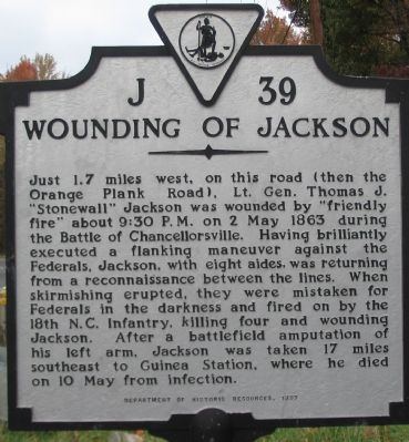
Photographed by Craig Swain, November 10, 2007
1. Wounding of Jackson Marker
Just 1.7 miles west, on this road (then the Orange Plank Road), Lt. Gen. Thomas J. "Stonewall" Jackson was wounded by "friendly fire" about 9:30 P.M. on 2 May 1863 during the Battle of Chancellorsville. Having brilliantly executed a flanking maneuver against the Federals, Jackson, with eight aides, was returning from a reconnaissance between the lines. When skirmishing erupted, they were mistaken for Federals in the darkness and fired on by the 18th N.C. Infantry, killing four and wounding Jackson. After a battlefield amputation of his left arm, Jackson was taken 17 miles southeast to Guinea Station, where he died on 10 May from infection.
Erected 1997 by Virginia Department of Historic Resources. (Marker Number J-39.)
Topics and series. This historical marker is listed in this topic list: War, US Civil. In addition, it is included in the Virginia Department of Historic Resources (DHR) series list. A significant historical date for this entry is May 2, 1863.
Location. 38° 18.238′ N, 77° 37.27′ W. Marker is near Fredericksburg, Virginia, in Spotsylvania County. It is on Plank Road (State Highway 3) west of Rensselaer Court,
this page online

Regionally, this marker is in the Washington Metropolitan Area, in Northern Virginia, and in the Piedmont. It is also in the American South, specifically in the Upper South, in the Mid-Atlantic, and on the Eastern Seaboard. Globally, it is in the North Atlantic Region, North America, the Western Hemisphere, the Western World, and the Anglosphere. Historically, it finds itself in what was once the territory of the Mississippian Culture, one of the original Thirteen Colonies, one of the Confederate States of America, and the Antebellum South.
Other nearby markers. At least 8 other markers are within walking distance of this marker: CVBT at Chancellorsville (about 600 feet away, measured in a direct line); Clash Along Nine Mile Run (about 600 feet away); Attack and Defense (about 700 feet away); McLaws Trail (approx. 0.4 miles away); Chancellorsville Campaign (approx. 0.4 miles away); First Day at Chancellorsville (approx. 0.4 miles away); a
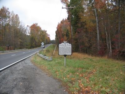
Photographed by Craig Swain, November 10, 2007
2. Jackson's Wounding Marker along the Plank Road
Regarding Wounding of Jackson. This marker replaced a previous J-39 also titled "Wounding of Jackson" but which stood to the west of the Chancellorsville intersection (with Ely's Ford Road), at the present day visitors center next to the Jackson Monument. The original was removed in the 1980s with the widening of Virginia Highway 3. It read, Stonewall Jackson, coming from the west, surprised Howard's Corps of the Army of the Potomac, May 2, 1863. Howard retreated along this road toward Chancellorsville, pursued by the Confederates. Here, Jackson, in the early evening, moving in front of his line of battle to reconnoitre, fell, mortally wounded by his own men.
This marker is grouped with those along McLaws Drive, Furnace Road, Sickles Drive, and East Jackson Trail, on the east side of the battlefield. See the McLaws's Line to Catharine Furnace Virtual Tour by Markers in the links section for a listing
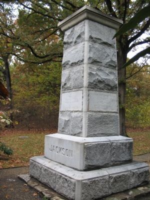
Photographed by Craig Swain, November 10, 2007
3. Jackson Monument
Further west, along the Plank Road (VA 3), next to the Chancellorsville Battlefield Visitors Center, is a monument to Jackson. Several additional markers in the vicinity detail the incident.
Also see . . .
1. General Orders No. 61 - An Eyewitness Account of Stonewall Jackson's Wounding. Virginia Museum of History and Culture website entry (Submitted on May 30, 2024, by Larry Gertner of New York, New York.)
2. McLaws's Line to Catharine Furnace Virtual Tour by Markers. Spread across a two mile segment on the east side of the battlefield, this virtual tour by markers covers action from May 1-3, 1863. (Submitted on November 18, 2007, by Craig Swain of Leesburg, Virginia.)
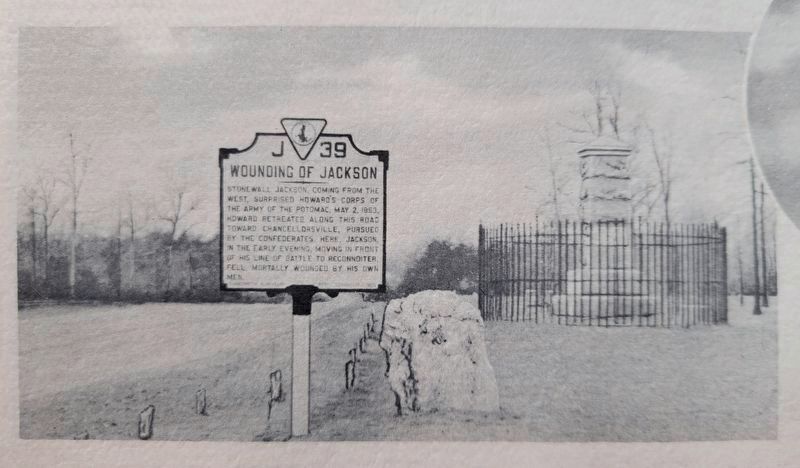
4. Original Wounding of Jackson Marker
Undated black and white photograph of the original marker. This photograph was contained in an Virginia tourist brochure.
Credits. This page was last revised on March 15, 2026. It was originally submitted on November 12, 2007, by Craig Swain of Leesburg, Virginia. This page has been viewed 2,822 times since then and 135 times this year. Last updated on March 14, 2026, by Evan Dwyer of Richmond, Virginia. Photos: 1, 2, 3. submitted on November 12, 2007, by Craig Swain of Leesburg, Virginia. 4. submitted on November 7, 2021, by Kevin W. of Stafford, Virginia. • Devry Becker Jones was the editor who published this page.
