Near Spotsylvania Courthouse in Spotsylvania County, Virginia — The American South (Mid-Atlantic)
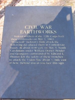
Civil War Earthworks
Photographed by Craig Swain, February 16, 2008
1. Civil War Earthworks Marker
Federal soldiers of the 12th Corps built these earthworks on May 1, 1863. "Stonewall" Jackson's flank attack the following day placed them in Confederate hands. At about 6:00 a.m. on May 3, North Carolinians under William Dorsey Pender and Georgians commanded by Edward L. Thomas left the safety of these trenches to attack the Union line about ½ mile east of here, behind you as you face this sign.
Topics. This historical marker is listed in this topic list: War, US Civil. A significant historical date for this entry is May 1, 1863.
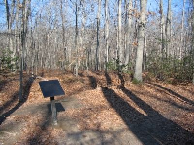
Location. 38° 18.718′ N, 77° 39.121′ W. Marker is near Spotsylvania Courthouse, Virginia, in Spotsylvania County. It can be reached from Bullock Road north of Plank Road (Virginia Route 3), on the left when traveling north. Located at trail stop one on the Chancellorsville History Trail, at the Chancellorsville Battlefield. Touch for map. Marker is at or near this postal address: 9108 Ranger Lane, Spotsylvania VA 22553, United States of America. Touch for directions.

Regionally, this marker is in the Washington Metropolitan Area, in Northern Virginia, and in the Piedmont. It is also in the American
this page online
Other nearby markers. At least 8 other markers are within walking distance of this marker: The Wilderness of Spotsylvania County (about 300 feet away, measured in a direct line); Chancellorsville Campaign (about 600 feet away); a different marker also named Chancellorsville Campaign (about 600 feet away); The Battle of Chancellorsville (about 600 feet away); Memorializing Jackson's Death (about 700 feet away); Jackson (about 700 feet away); Jackson Monuments (about 700 feet away); a different marker also named Chancellorsville Campaign (about 700 feet away). Touch for a list and map of all markers in Spotsylvania Courthouse.
Other markers no longer nearby. Chancellorsville Campaign (was about 600 feet away but
Photographed by Craig Swain, February 16, 2008
2. Trail Stop One
Related markers. Click here for a list of markers that are related to this marker. Chancellorsville History Trail Virtual Tour by Markers
Photographed by Craig Swain, February 16, 2008
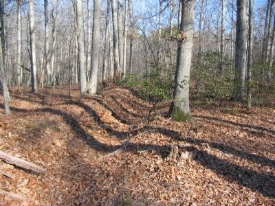
3. Section of Earthworks
Photographed by Craig Swain, February 16, 2008
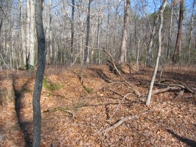
4. Earthwork Section
Between field fortifications erected during two major campaigns, the Fredericksburg-Spotsylvania National Military Park offers some of the best preserved earthworks in Central Virginia.
Credits. This page was last revised on March 15, 2026. It was originally submitted on February 17, 2008, by Craig Swain of Leesburg, Virginia. This page has been viewed 2,221 times since then and 45 times this year. Last updated on March 14, 2026, by Evan Dwyer of Richmond, Virginia. Photos: 1, 2, 3, 4. submitted on February 17, 2008, by Craig Swain of Leesburg, Virginia. • Devry Becker Jones was the editor who published this page.
