Near Fredericksburg in Spotsylvania County, Virginia — The American South (Mid-Atlantic)
The Wilderness of Spotsylvania County
Photographed by Craig Swain, February 16, 2008
1. The Wilderness of Spotsylvania County Marker
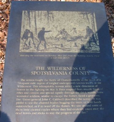
The armies fought the Battle of Chancellorsville in the heart of a 70-square-mile region of tangled undergrowth known locally as the Wilderness. This inhospitable terrain added a new dimension of horror to the fighting on May 3. Fires erupted from muzzle blasts of rifles and cannon and spread rapidly through the thick woods. Some wounded soldiers, unable to escape the flames, faced a gruesome fate. Union general John C. Caldwell described the scene: "It was pitiful to see the charred bodies hugging the trees, or with hands outstretched, as if to ward off the flames. We saw around some of them little cleared circles where they had evidently raked away the dead leaves and sticks to stay the progress of the fire."
Topics. This historical marker is listed in this topic list: War, US Civil. A significant historical month for this entry is May 1830.
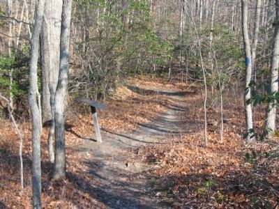
Location. 38° 18.763′ N, 77° 39.101′ W. Marker is near Fredericksburg, Virginia, in Spotsylvania County. It can be reached from Bullock Road north of Plank Road (Virginia Route 3), on the left when traveling north. The marker stands at trail stop two on the Chancellorsville History Trail,
this page online

Regionally, this marker is in the Washington Metropolitan Area, in Northern Virginia, and in the Piedmont. It is also in the American South, specifically in the Upper South, in the Mid-Atlantic, and on the Eastern Seaboard. Globally, it is in the North Atlantic Region, North America, the Western Hemisphere, the Western World, and the Anglosphere. Historically, it finds itself in what was once the territory of the Mississippian Culture, one of the original Thirteen Colonies, one of the Confederate States of America, and the Antebellum South.
Other nearby markers. At least 8 other markers are within walking distance of this marker: Civil War Earthworks (about 300 feet away, measured in a direct line); a different marker also named Chancellorsville Campaign (about 700 feet away); The Battle of Chancellorsville (about 700 feet away); a different marker also named Chancellorsville Campaign (about 700 feet away); Memorializing Jackson's Death
Photographed by Craig Swain, February 16, 2008
2. Trail Stop Two
Other markers no longer nearby. Chancellorsville Campaign (was about 600 feet away but has been permanently removed); a different marker also named Chancellorsville Campaign (was about 700 feet away but has been permanently removed).
More about this marker. The upper portion of the marker contains a drawing of "Rescuing the wounded on Sunday, May 3rd, from the burning woods, from a war-time sketch."
Also see . . . Battle of Chancellorsville. National Park Service site. (Submitted on February 17, 2008, by Craig Swain of Leesburg, Virginia.)
Photographed by Craig Swain, February 16, 2008
3. The Wilderness
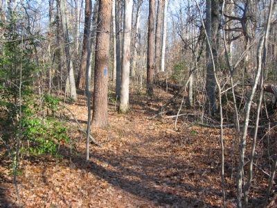
Typical of the wooded undergrowth in the Wilderness today.
Credits. This page was last revised on March 15, 2026. It was originally submitted on February 17, 2008, by Craig Swain of Leesburg, Virginia. This page has been viewed 1,300 times since then and 26 times this year. Last updated on March 14, 2026, by Evan Dwyer of Richmond, Virginia. Photos: 1, 2, 3. submitted on February 17, 2008, by Craig Swain of Leesburg, Virginia. • Devry Becker Jones was the editor who published this page.
