
Near Fredericksburg in Spotsylvania County, Virginia — The American South (Mid-Atlantic)
The Battle of Chancellorsville
Fredericksburg and Spotsylvania National Military Park
| — | National Park Service, U.S. Department of the Interior | — |
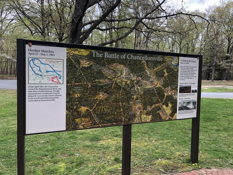
Hooker Marches
April 27 - May 1, 1863
In late April 1863, the Union army crossed the Rappahannock River, this time above Fredericksburg. Though outnumbered, Confederate General Robert E. Lee met the Union columns in the woods and fields around the crossroads at Chancellorsville.
A Clash in the Forest
May 1-6, 1863
The six-day Battle of Chancellorsville left behind a human wreckage unmatched in Virginia to that time. Lee won an unlikely victory, but lost Stonewall Jackson. The Union army (under General Joseph Hooker) retreated in a gloomy rain, but would soon be ready to fight again—at Gettysburg.
Chancellorsville—Crossroads
Chancellorsville—the home of the Chancellor family—stood at the battlefield's key crossroads. Battle and fire engulfed the house, leaving it a ruin.
Fairview—Pivot Point
No place more vividly demonstrates the shifting fortunes of the Union army at Chancellorsville than Fairview, where Union artillery struggled to stop the Confederate tide.
Erected by National Park Service, U.S. Department of the Interior.
Topics. This historical marker is listed in this topic list: War, US Civil. A significant historical date for this entry is April 27, 1863.
Location. 38° 18.682′ N,
this page online

Regionally, this marker is in the Washington Metropolitan Area, in Northern Virginia, and in the Piedmont. It is also in the American South, specifically in the Upper South, in the Mid-Atlantic, and on the Eastern Seaboard. Globally, it is in the North Atlantic Region, North America, the Western Hemisphere, the Western World, and the Anglosphere. Historically, it finds itself in what was once the territory of the Mississippian Culture, one of the original Thirteen Colonies, one of the Confederate States of America, and the Antebellum South.
Other nearby markers. At least 8 other markers are within walking distance of this marker: Chancellorsville Campaign (within shouting distance of this marker); a different marker also named Chancellorsville Campaign (within shouting distance
Other markers no longer nearby. Confederate Catastrophe (was within shouting distance of this marker but has been permanently removed); a different marker also named Chancellorsville Campaign (was within shouting distance of this marker but has been permanently removed); a different marker also named Chancellorsville Campaign (was within shouting distance of this marker but has been permanently removed).
Credits. This page was last revised on March 15, 2026. It was originally submitted on April 20, 2021, by Devry Becker Jones of Washington, District of Columbia. This page has been viewed 435 times since then and 31 times this year. Last updated on March 14, 2026, by Evan Dwyer of Richmond, Virginia. Photos: 1, 2. submitted on April 20, 2021, by Devry Becker Jones of Washington, District of Columbia.
