Near Spotsylvania Courthouse in Spotsylvania County, Virginia — The American South (Mid-Atlantic)
Chancellorsville Campaign
Photographed by Craig Swain, November 10, 2007
1. Chancellorsville Campaign Marker
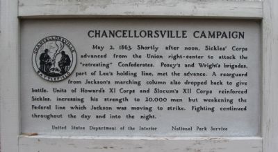
May 2, 1863. Shortly after noon, Sickles’ Corps advanced from the Union right-center to attack the "retreating" Confederates. Posey's and Wright's brigades, part of Lee's holding line, met the advance. A rear guard from Jackson's marching column also dropped back to give battle. Units of Howard's XI Corps and Slocum's XII Corps reinforced Sickles, increasing his strength to 20,000 men but weakening the Federal line which Jackson was moving to strike. Fighting continued throughout the day and into the night.
Erected by National Park Service, U.S. Department of the Interior.
Topics. This historical marker is listed in this topic list: War, US Civil. A significant historical date for this entry is May 2, 1863.
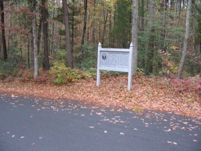
Location. 38° 17.316′ N, 77° 38.612′ W. Marker is near Spotsylvania Courthouse, Virginia, in Spotsylvania County. It is at the intersection of Furnace Road and Sickles Drive, on the right when traveling west on Furnace Road. Located between tour stops five and six on the driving tour of Chancellorsville Battlefield. Touch for map. Marker is at or near this postal address: 9001 Furnace Rd, Spotsylvania VA 22553, United States
this page online

Regionally, this marker is in the Washington Metropolitan Area, in Northern Virginia, and in the Piedmont. It is also in the American South, specifically in the Upper South, in the Mid-Atlantic, and on the Eastern Seaboard. Globally, it is in the North Atlantic Region, North America, the Western Hemisphere, the Western World, and the Anglosphere. Historically, it finds itself in what was once the territory of the Mississippian Culture, one of the original Thirteen Colonies, one of the Confederate States of America, and the Antebellum South.
Other nearby markers. At least 8 other markers are within walking distance of this marker: About a mile in the distance... (approx. 0.2 miles away); A Region of Gloom (approx. ¼ mile away); Jackson's Flank March (approx. ¼ mile away); Catharine Furnace (approx. ¼ mile away); Maury Birthplace (approx. 0.3 miles away); Birthplace of Matthew Fontaine Maury (1806-1873) (approx. 0.3 miles away); Maury House Trail (approx. 0.3 miles away); Matthew Fontaine Maury (approx. 0.3 miles away). Touch for a list and map of all markers in Spotsylvania Courthouse.
Regarding Chancellorsville Campaign. This
Photographed by Craig Swain, November 10, 2007
2. Chancellorsville Campaign Marker
Also see . . .
1. Battle of Chancellorsville. National Parks Service website entry (Submitted on November 17, 2007, by Craig Swain of Leesburg, Virginia.)
2. General Sickles' Report. In discussing the losses of his command at the battle, Sickles would report, "It is a consolation to know that they and their noble associates among the dead did not fall unrevenged, for in the loss of Jackson and Hill, and the flower of the rebel army on Saturday and Sunday, the enemy learned to respect the prowess of the Third Army Corps." (Submitted on November 17, 2007, by Craig Swain of Leesburg, Virginia.)
3. McLaws's Line to Catharine Furnace Virtual Tour by Markers. Spread across a two mile segment on the east side of the battlefield, this virtual tour by markers covers action from May 1-3, 1863. (Submitted on November 17, 2007, by Craig Swain of Leesburg, Virginia.)
Photographed by Craig Swain, November 10, 2007
3. Confederate Gunpit - Anderson's Division
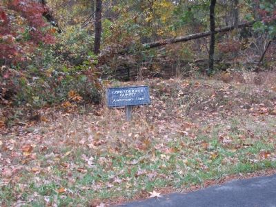
Just to the east of the marker are remains of a gun emplacement used by Anderson's Confederate division defending this segment of the lines.
Photographed by Craig Swain, November 10, 2007
4. Confederate Trenches - Posey's Line
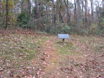
The defensive line set by Posey's Confederate Brigade defending against Sickles' advance were just across the road from the marker.
Credits. This page was last revised on March 15, 2026. It was originally submitted on November 17, 2007, by Craig Swain of Leesburg, Virginia. This page has been viewed 1,557 times since then and 44 times this year. Last updated on March 14, 2026, by Evan Dwyer of Richmond, Virginia. Photos: 1, 2, 3, 4. submitted on November 17, 2007, by Craig Swain of Leesburg, Virginia. • Devry Becker Jones was the editor who published this page.
