
Near Spotsylvania Courthouse in Spotsylvania County, Virginia — The American South (Mid-Atlantic)
Chancellorsville Campaign
Photographed by Craig Swain, November 10, 2007
1. Chancellorsville Campaign Marker
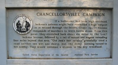
If a balloonist had been high overhead, Jackson's column might have resembled a huge serpent as it wound through the forest. Closer up, it became thousands of marchers in worn battle dress. From this point, they stretched back about six miles to the Lee-Jackson bivouac, followed by a tail of cannon and wagons extending four miles beyond that area. "Old Jack's food cavalry" gratefully trod a road neither too wet or dusty, but the dewy morning turned to hot midday. They would welcome a stream in the dry woodland.
Erected by National Park Service, U.S. Department of the Interior.
Topics. This historical marker is listed in this topic list: War, US Civil.
Location. 38° 16.218′ N, 77° 41.167′ W. Marker is near Spotsylvania Courthouse, Virginia, in Spotsylvania County. It is on Jackson Trail West south of Custers Tree, on the right when traveling north. The marker stands along the Jackson Flank March driving loop in the Chancellorsville Battlefield section of the Fredericksburg and Spotsylvania National Battlefield Park. Touch for map. Marker is at or near this postal
this page online

Regionally, this marker is in the Washington Metropolitan Area, in Northern Virginia, and in the Piedmont. It is also in the American South, specifically in the Upper South, in the Mid-Atlantic, and on the Eastern Seaboard. Globally, it is in the North Atlantic Region, North America, the Western Hemisphere, the Western World, and the Anglosphere. Historically, it finds itself in what was once the territory of the Mississippian Culture, one of the original Thirteen Colonies, one of the Confederate States of America, and the Antebellum South.
Other nearby markers. At least 8 other markers are within 2 miles of this marker, measured as the crow flies: A different marker also named Chancellorsville Campaign (approx. ¼ mile away); a different marker also named Chancellorsville Campaign (approx. 0.7 miles away); a different marker also named Chancellorsville Campaign (approx. 0.7 miles away); a different marker also named Chancellorsville Campaign (approx. 1.1 miles away); a different marker also named Chancellorsville Campaign
Photographed by Craig Swain, November 10, 2007
2. Chancellorsville Campaign Marker
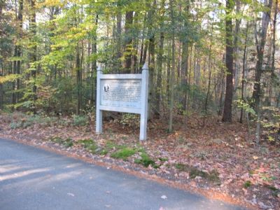
Regarding Chancellorsville Campaign. This is one of several markers for the Battle of Chancellorsville along the Jackson's Flank March and Attack trail. See the Jackson's Flank March and Attack Virtual Tour by Markers in the links section for a listing of related markers on the tour.
Also see . . .
1. Battle of Chancellorsville. National Park Service website entry (Submitted on December 2, 2007, by Craig Swain of Leesburg, Virginia.)
2. Jackson's Flank March and Attack Virtual Tour by Markers. This virtual tour covers the optional Jackson Flank Trail route of the driving tour and concludes at Jackson's Flank Attack (stop 8) of the driving tour, tracing the route of Jackson's march to deliver the decisive attack of the battle. (Submitted on December 8, 2007, by Craig Swain of Leesburg, Virginia.)
Photographed by Craig Swain, November 10, 2007
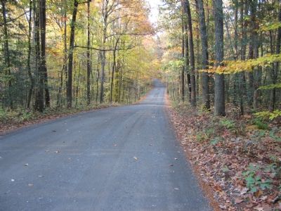
3. The Woodland Trail
Looking north from the marker's location, the trail passes through terrain not much different from that passed by Jackson's men.
Credits. This page was last revised on March 15, 2026. It was originally submitted on December 2, 2007, by Craig Swain of Leesburg, Virginia. This page has been viewed 1,229 times since then and 21 times this year. Last updated on March 15, 2026, by Evan Dwyer of Richmond, Virginia. Photos: 1, 2, 3. submitted on December 2, 2007, by Craig Swain of Leesburg, Virginia. • Devry Becker Jones was the editor who published this page.
