Rivière-Bleue in Témiscouata, Québec — Central Canada (French-Canadian)
« Rivière-Bûche »
⎯⎯⎯
“River Drive”

Photographed by Cosmos Mariner, August 2, 2019
1. « Rivière-Bûche » / “River Drive” Marker

En effet, la municipalité est sise au confluent des rivières Bleue et Saint-François. À une époque, ces cours d'eau facilitaient le transport du bois vers les scieries. De tout temps, ils se sont aussi révélés généreux d'une faune aquatique abondante et prisée des amateurs de pêche.
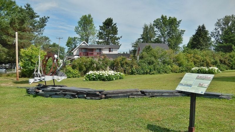
Par un habile mariage, les plaques d'ardoise rappellent les rivières; la structure métallique qui s'y dresse évoque le mouvement des grandes scies transformant les troncs bruts; le bois ranime le souvenir de la draye tout en se faisant messager d'avenir, porteur de bourgeons annonciateurs d'un développement forestier prometteur...
[légendes de photos]
• Quelques-unes des étapes de la réalisation de l'œuvre « Rivière-Bûche » : un travail qui a impliqué la participation de chaque membre de l'équipe.
• Le Circuit animé du Transcontinental comporte cinq sculptures. Pour découvrir l'emplacement des autres œuvres, consultez cette carte géographique.
this page online
Standing at the confluence of the Bleue and Saint-François rivers, the municipality thrived at the time these waterways were used to carry wood down to the sawmills. These rivers have always been an abundant source of fish and wildlife, highly prized by anglers.
In a skillful juxtaposition, the slate slabs evoke the rushing rivers; the metallic structure recalls the circular movement of the powerful saws and the wood revives the era of the river drive while conveying a message of hope for the future in the budding development of the forestry industry…
[photo captions]
• Some of me steps in the creation of "River Drive" a work that called for the participation of each team member.
• The Transcontinental Tour features five sculptures. See the map for the location of the other works.
Erected 2005 by La Corporation touristique de la route des Frontières.
Topics. This historical marker is listed in these topic lists: Arts, Letters, Music • Horticulture & Forestry • Industry & Commerce • Waterways & Vessels.
Location. 47° 26.115′ N,
2. Marker detail: Le Moulin Blue River Lumber / Blue River Lumber Mill
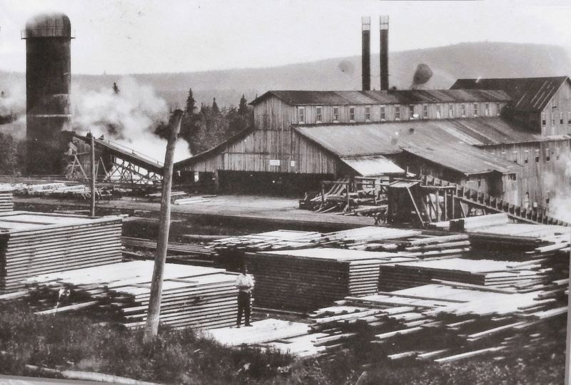
À partir de 1908, les moulins à scie poussent comme des champignons à Rivière-Bleue L'industrie du bois est alors le gagne-pain de ta majorité des familles.
• • •
As of 1908, sawmills sprung up all around Rivière-Bleue. At that time, the lumber industry provided a livelihood for the majority of families.
• • •
As of 1908, sawmills sprung up all around Rivière-Bleue. At that time, the lumber industry provided a livelihood for the majority of families.

Regionally, this marker is in Eastern Québec & Gaspésie. It is also in Central Canada. Globally, it is in North America, the Western Hemisphere, and the Western World. Historically, it finds itself in what was once a British colony, the Viceroyalty of New France, the Haudenosaunee (Iroquois) Confederacy, and Rupert’s Land.
Other nearby markers. At least 8 other markers are within 14 kilometers of this marker, measured as the crow flies: La Petit Gare Aubut (approx. 0.4 kilometers away); La gare de Rivière-Bleue / The Rivière-Bleue Train Station (approx. 0.4 kilometers away); Le Moulin Blue River Lumber / Blue River Lumber Mill (approx. 1.6 kilometers away); La croix du parc Arthur-Lepage / The Cross of Arthur-Lepage Park (approx. 1.6 kilometers away); La Chapelle évangélique baptiste de Rivière-Bleue / The Gospel Baptist Chapel of Rivière-Bleue
3. Marker detail: Le Moulin Blue River Lumber / Blue River Lumber Mill
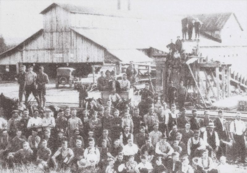
La Blue River Lumber commence ses activités en 1914. Les installations du moulin sont alors parmi les plus importantes du Témiscouata.
• • •
When Blue River Lumber opened in 1914, its sawmill was among the biggest in Témiscouata.
• • •
When Blue River Lumber opened in 1914, its sawmill was among the biggest in Témiscouata.
Also see . . . Rivière-Bleue (Wikipedia).
Excerpt: The first settlers arrived in 1860. They were in fact pioneers from Scottish descents coming from the United States and others from Saint-François-de-Madawaska, New Brunswick. The Catholic mission was founded in 1874 under the name of Saint-Joseph-de-la-Rivière-Bleue, and the postal office opened in 1910. The Catholic parish was erected and the parish municipality created officially in 1914 under the name of the mission. The National Transcontinental Railway and the station were crucial to the village’s development: travelers, goods, and forestry and agricultural products came and went by rail.(Submitted on March 16, 2026, by Cosmos Mariner of Cape Canaveral, Florida.)

4. Marker detail : Loading Lumber & River Drive
Le chargement du bois sur le chemin de fer au moulin de Pierre Landry.
• • •
Loading lumber on the train at Pierre Landry’s sawmill.———————— La drave sur la rivière Bleue en 1929.
• • •
The river drive on Rivière Bleue, circa 1929.
• • •
Loading lumber on the train at Pierre Landry’s sawmill.
• • •
The river drive on Rivière Bleue, circa 1929.
Photographed by Cosmos Mariner, August 2, 2019
5. « Rivière-Bûche » / “River Drive” Marker

Photographed by Cosmos Mariner, August 2, 2019
6. « Rivière-Bûche » / “River Drive”
Credits. This page was last revised on March 16, 2026. It was originally submitted on March 15, 2026, by Cosmos Mariner of Cape Canaveral, Florida. This page has been viewed 23 times since then. Photos: 1. submitted on March 15, 2026, by Cosmos Mariner of Cape Canaveral, Florida. 2, 3, 4, 5, 6. submitted on March 16, 2026, by Cosmos Mariner of Cape Canaveral, Florida.
