St Lawrence-East Bayfront-The Islands in Toronto, Ontario — Central Canada (North America)
The Toronto Island Community

Photographed by Caroline Record, March 15, 2026
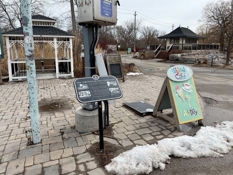
1. The Toronto Island Community Marker
The Island is part of the treaty lands and territory of the Mississaugas of the Credit First Nation. In the 1870s, settlers built the first cottages here. St. Andrew by-the-Lake church was consecrated in 1884 and a school opened in 1888. By the 1920s, about 2,000 people lived on Toronto Island and the population often swelled to more than 10,000 in summer. People were drawn to the natural environment and the thrilling rides and fairground attractions at Hanlan's Point.
Atter a 30-year political and legal battle with Metro, 262 homes near here were saved in 1993. A land trust now controls the sale of Island homes to people on a waiting list.
Today, there are no stores or private vehicles in the community. About 700 people live here year-round.
Erected 2019 by Heritage Toronto.
Topics and series. This historical marker is listed in these topic lists: Parks & Recreational Areas • Settlements & Settlers. In addition, it is
this page online
Location. 43° 37.877′ N, 79° 21.438′ W. Marker is in Toronto, Ontario. It is in St Lawrence-East Bayfront-The Islands. It is on Bayview Avenue. Touch for map. Marker is at or near this postal address: 2 Bayview Avenue, Toronto ON M5J 1Z1, Canada. Touch for directions.

Regionally, this marker is in Greater Toronto and on the Golden Horseshoe. It is also in Central Canada. Globally, it is in North America, on the Great Lakes, in the Western Hemisphere, in the Western World, and in the Anglosphere. Historically, it finds itself in what was once a British colony, the Viceroyalty of New France, the Haudenosaunee (Iroquois) Confederacy, and Rupert’s Land.
Other nearby markers. At least 8 other markers are within 3 kilometers of this marker, measured as the crow flies: The Waiting Shed (within shouting distance of this marker); Toronto Island (within shouting distance of this marker); William Ward & Ward's Hotel (about 90 meters away, measured in a direct line); The Royal Canadian Yacht Club (approx. 1.3 kilometers away);
Photographed by Caroline Record, March 15, 2026
2. The Toronto Island Community Marker
Credits. This page was last revised on April 20, 2026. It was originally submitted on March 16, 2026, by Caroline Record of Montréal, Québec. This page has been viewed 11 times since then. Photos: 1, 2. submitted on March 16, 2026, by Caroline Record of Montréal, Québec. • Andrew Ruppenstein was the editor who published this page.
