Railroad Steams into El Valle de San Luis

Secured by the U.S. Military from attacks by native peoples, new settlements and mining camps began developing in the San Luis Valley. Long used trails and wagon roads were updated and turned into toll roads.
“ 'I had a dream' wrote William Jackson Palmer to his bride in 1870. 'It was a vision of a railroad linking Denver with Mexico City.' In June of 1877, Palmer's dream, the Denver & Rio Grande Railroad, steamed into the construction town of Garland City, Colorado.”
Images of America Southern Colorado
O.T. Davis Collection
The Denver & Rio Grande Railroad (later known as the Denver & Rio Grande Western) made its way from Denver through the San Luis Valley and later to Santa Fe, New Mexico. Through affiliated railroad companies the line extended to Salt Lake City, Utah. The D&RG never reached Mexico City, its original destination.
[photo captions]
• Fort Garland was decommissioned in 1883, just a few years before the railroad entered the San Luis Valley. This 1908 photograph by O.T. Davis looking southwest towards the abandoned fort, shows the D&RG Railroad tracks in the foreground.
• Garland City, 60 Days Old (1877 or 1878).
this page online
Erected by Colorado Scenic and Historic Byways Commission, Colorado Historical Society, Colorado Department of Transportation, and The Nature Conservancy.
Topics. This historical marker is listed in these topic lists: Railroads & Streetcars • Roads & Vehicles • Settlements & Settlers. A significant historical month for this entry is June 1877.
Location. 37° 27.07′ N, 105° 22.247′ W. Marker is in Fort Garland, Colorado, in Costilla County. It is on U.S. 160 at milepost 262.2, 3.9 miles east of Miranda Avenue (State Highway 159), on the right when traveling west. The marker is in the Los Caminos Antiguos Scenic & Historic Byway interpretive kiosk on the north side of US Highway 160. Touch for map. Marker is in this post office area: Fort Garland CO 81133, United States of America. Touch for directions.

Regionally, this marker is in the San Juan Mountains and in the San Luis Valley. It is also in the American Mountain West.

[right] Incorporated in 1909, the San Luis Southern Railroad [yellow highlight], connected with the D&RG at Blanca, Colorado and traveled south to the town of Jaroso. The line served developing towns and farms in the southeastern part of the San Luis Valley, transporting local people and produce. The line ceased all operations in 1996.
Other nearby markers. At least 8 other markers are within 9 miles of this marker, measured as the crow flies: Welcome to El Valle De San Luis (here, next to this marker); Six Miles of Separation (here, next to this marker); Peacekeepers of the Frontier (here, next to this marker); Costilla County Veterans Memorial (approx. 3.2 miles away); a different marker also named Fort Garland (approx. 3.8 miles away); Fort Garland / Buffalo Soldiers (approx. 3.8 miles away); Trails Through Time (approx. 7.8 miles away); The San Luis Southern Railway (approx. 8.1 miles away). Touch for a list and map of all markers in Fort Garland.
Another marker is no longer nearby. Fort Garland (was approx. 3.8 miles away but has been permanently removed).
Related markers. Click here for a list of markers that are related to this marker.
Also see . . .
1. Denver and Rio Grande Western Railroad (Wikipedia).
Excerpt:(Submitted on March 19, 2026, by Cosmos Mariner of Cape Canaveral, Florida.)The Denver & Rio Grande Railway (D&RG) was incorporated on October 27, 1870, by General William Jackson Palmer (1836–1909), and a board of four directors. It was originally announced that the new 3 ft railroad would proceed south from Denver and travel an estimated 875 miles south to El Paso via Pueblo, westward along the Arkansas River, and continue southward through the San Luis Valley of Colorado toward the Rio Grande. Narrow gauge was chosen in part because construction and equipment costs would be relatively more affordable when weighed against that of the prevailing standard gauge.Denver Public Library3. Marker detail: Dual Gauge Railroad TracksDual gauge tracks near a sign that reads. "End of Third Rail" north of Hooper, Colorado. The D&RG was one of the first three narrow gauge railroads in the U.S. Narrow gauge (3' wide) was the original choice because of its maneuverability around tight mountain curves and lower construction costs. Later the railroad added an additional rail on some lines to accommodate more popular standard gauge (4' 8½” wide) traffic.The D&RG also pushed west from Walsenburg, Colorado, over La Veta Pass by 1877. The railroad reached Alamosa by 1878. From Alamosa, a line was pushed south through Antonito eventually reaching Santa Fe, New Mexico. A line containing one of the longest narrow-gauge tangent tracks in U.S. railroading (52.82 miles) also linked Alamosa with Salida to the north. A line was also constructed in 1902 as a standard-gauge line, perhaps in anticipation of possible standard gauging of the entire line, south from Durango to Farmington, New Mexico.

2. Southern San Luis Valley Railroad (Wikipedia).
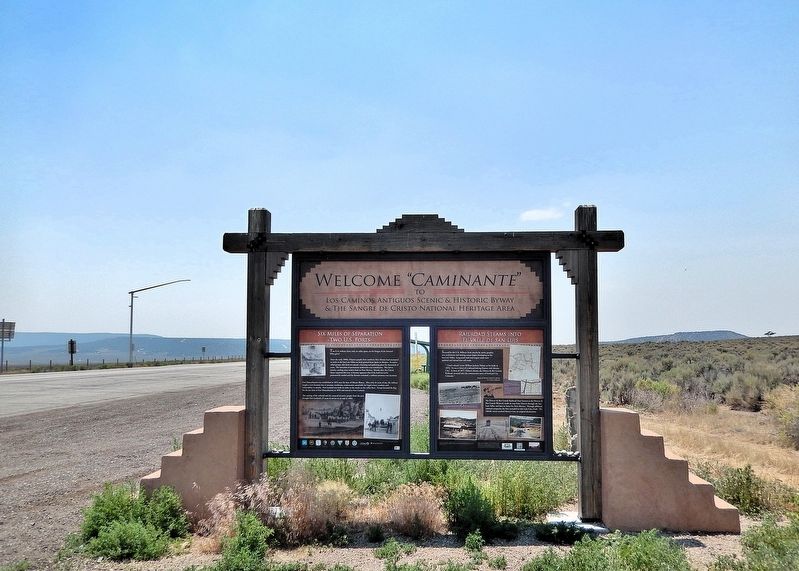
This marker is the rightmost of two interpretive panels on the east side of the Los Caminos Antiguos Scenic & Historic Byway kiosk in Fort Garland.
Looking west; U.S. Highway 160 is on the left.
Excerpt: The Southern San Luis Valley Railroad is a fallen flag shortline railroad that was located in Southern Colorado. Best known in its final years of operation, it served a connection with the Denver and Rio Grande Western Railroad at Blanca, Colorado. The diminutive railroad in its final form was approximately 1.53 miles in length. During its life freight traffic included farm produce, fertilizer and volcanic scoria (lava rock). The railroad, as it was originally built, was 31 miles long and besides freight it operated passenger service between Blanca and Jaroso, Colorado, until 1946. The railroad formally ceased all operations December 31, 1996.(Submitted on March 19, 2026, by Cosmos Mariner of Cape Canaveral, Florida.)
Credits. This page was last revised on March 19, 2026. It was originally submitted on March 18, 2026, by Cosmos Mariner of Cape Canaveral, Florida. This page has been viewed 17 times since then. Photos: 1. submitted on March 18, 2026, by Cosmos Mariner of Cape Canaveral, Florida. 2, 3, 4. submitted on March 19, 2026, by Cosmos Mariner of Cape Canaveral, Florida.
