Stonewall in Gillespie County, Texas — The American South (West South Central)
Lydon Baines Johnson State Park
Photographed by Dave W, March 6, 2026
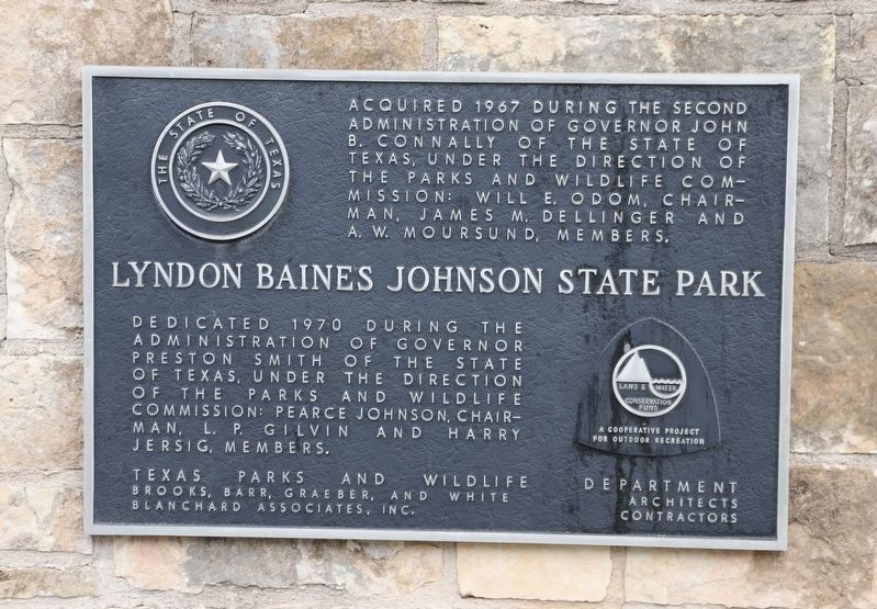
1. Lydon Baines Johnson State Park Marker
Acquired 1967 during the second administration of Governor John B. Connally of the State of Texas, under the direction of the Parks and Wildlife Commission: Will E. Odom, Chairman, James M. Dellinger and A. W. Moursund, members.
Lyndon Baines Johnson State Park
Dedicated 1970 during the administration of Governor Preston Smith of the State of Texas, under the direction of the Parks and Wildlife Commission: Pearce Johnson, Chairman, l. P. Gilvin and Harry Jersig, members. Texas Parks and Wildlife Brooks, Barr, Graeber, and White Blanchard Associates, Inc.
Erected by State of Texas.
Topics. This historical marker is listed in this topic list: Parks & Recreational Areas. A significant historical year for this entry is 1967.
Location. 30° 14.097′ N, 98° 37.737′ W. Marker is in Stonewall, Texas, in Gillespie County. It is at the intersection of U.S. 290 and State Park Rd 52, on the right when traveling west on U.S. 290. Touch for map. Marker is at or near this postal address: 16619 US-290, Stonewall TX 78671, United States of America. Touch for directions.

Regionally, this marker is in the Hill Country. Globally, it
this page online
Other nearby markers. At least 8 other markers are within walking distance of this marker: Veterans Memorial Poles and Flags (within shouting distance of this marker); Within These Walls / Small Spaces, Many Faces (approx. ¼ mile away); Farm History (approx. ¼ mile away); What is the President pointing to anyway? (approx. 0.3 miles away); Sauer-Beckmann Living History Farm (approx. 0.3 miles away); A Grand Entrance (approx. 0.4 miles away); Longhorn Cattle and White-Tail Deer (approx. 0.4 miles away); Triumphing Over Tragedy – The Danz Family Story (approx. 0.4 miles away). Touch for a list and map of all markers in Stonewall.
Photographed by Dave W, March 6, 2026
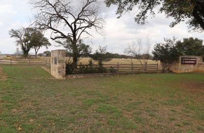
2. Lydon Baines Johnson State Park Marker
Marker in the wall to the left.
Credits. This page was last revised on March 20, 2026. It was originally submitted on March 19, 2026, by Dave W of Co, Colorado. This page has been viewed 18 times since then. Photos: 1, 2. submitted on March 19, 2026, by Dave W of Co, Colorado. • James Hulse was the editor who published this page.
