Near Antonito in Archuleta County, Colorado — The American Mountains (Southwest)
This is Our land
Photographed by Cosmos Mariner, July 13, 2025
1. This is Our land Marker
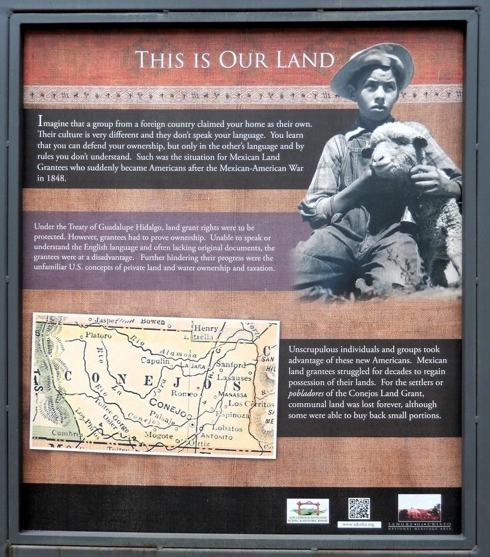
Imagine that a group from a foreign country claimed your home as their own. Their culture is very different and they don't speak your language. You learn that you can defend your ownership, but only in the other's language and by rules you don't understand. Such was the situation for Mexican Land Grantees who suddenly became Americans after the Mexican-American War in 1848.
Under the Treaty of Guadalupe Hidalgo, land grant rights were to be protected. However, grantees had to prove ownership. Unable to speak or understand the English language and often lacking original documents, the grantees were at a disadvantage. Further hindering their progress were the unfamiliar U.S. concepts of private land and water ownership and taxation.
Unscrupulous individuals and groups took advantage of these new Americans. Mexican land grantees struggled for decades to regain possession of their lands. For the settlers or pobladores of the Conejos Land Grant, communal land was lost forever, although some were able to buy back small portions.
Erected by Colorado Scenic and Historic Byways Commission, Colorado Historical Society, Colorado
this page online
Topics. This historical marker is listed in these topic lists: Hispanic Americans • Settlements & Settlers. A significant historical year for this entry is 1848.
Location. 36° 59.948′ N, 106° 29.421′ W. Marker is near Antonito, Colorado, in Archuleta County. It is on State Highway 17 at milepost 0.7, on the left when traveling south. The marker is 0.7 miles north of the Colorado/New Mexico state line. Touch for map. Marker is in this post office area: Antonito CO 81120, United States of America. Touch for directions.

Regionally, this marker is on the Continental Divide. It is also in the American Mountain West and at the Four Corners. Globally, it is in North America, the Rocky Mountains, the Western Hemisphere, the Western World, and the Anglosphere. Historically, it finds itself in what was once the territory of the Ancestral Puebloans.
Other nearby markers. At least 8 other markers are within 4 miles of this marker, measured as the crow flies: Welcome to El Valle de San Luis (here, next to this marker); Who Owns This Land? (here, next to this marker); Nurturing Forest
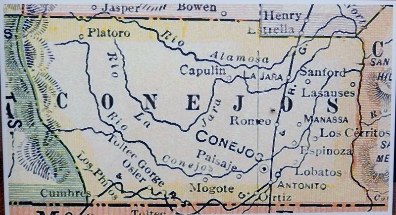
2. Marker detail: Conejos Land Grant
Also see . . . Mexican Land Grants in Colorado (History Colorado).
(by Ricardo Simmonds) Excerpt: From the sixteenth century to the mid-nineteenth, the king of Spain and the Mexican government awarded land grants to individuals and communities throughout the American Southwest. All seven of Colorado’s land grants, comprising more than 8 million acres, were awarded by the Mexican government after 1821. They are all near the state’s southern border, with three lying in the San Luis Valley and five sharing territory with New Mexico. Land grants in Colorado and throughout the southwestern United States have fostered shared identity, cultural heritage, and conflict that extend into present-day debates about race, language, ancestry, and land ownership.(Submitted on March 20, 2026, by Cosmos Mariner of Cape Canaveral, Florida.)The history of land grants in
the American Southwest was transformed by the Mexican-American War and the Treaty of Guadalupe Hidalgo. In 1845 the United States annexed Texas, which included parts of today’s Colorado. Soon thereafter, boundary disputes with Mexico led the American government to provoke the Mexican-American War in 1846. In 1848 the United States won the war, and in the resulting Treaty of Guadalupe Hidalgo it gained control of thousands of square miles of northwest Mexico, which eventually formed part or all of the states of California, Nevada, Utah, Arizona, New Mexico, and Colorado.Photographed by Cosmos Mariner, July 13, 20253. This is Our land MarkerWelcome “Caminante” — to Los Caminos Antiguos Scenic & Historic Byway and The Sangre de Cristo National Heritage Area
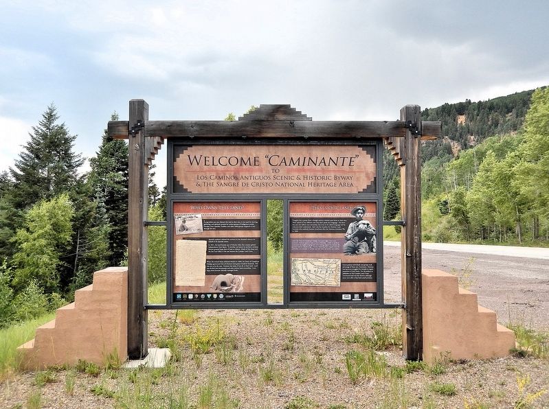
This marker is the rightmost of two interpretive panels on the north side of the Los Caminos Antiguos Scenic & Historic Byway kiosk just north of the Colorado/New Mexico state line.
Looking south; Colorado Highway 17 is on the right.Almost entirely in Colorado, the Conejos Land Grant spanned from northern New Mexico into the San Luis Valley. The grant was petitioned in 1832 on behalf of forty families, approved in 1833, and later revalidated and possessed by eighty-three families in 1842. The grant encompassed 2.5 million acres, making it Colorado’s second largest. Under the US government, the grant was eventually rejected entirely in 1900.
Credits. This page was last revised on August 24, 2026. It was originally submitted on March 19, 2026, by Cosmos Mariner of Cape Canaveral, Florida. This page has been viewed 22 times since then. Photos: 1, 2, 3. submitted on March 20, 2026, by Cosmos Mariner of Cape Canaveral, Florida.
