Tuscumbia in Colbert County, Alabama — The American South (East South Central)
Belle Mont
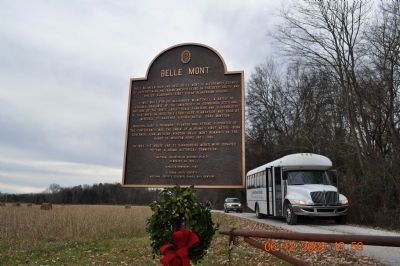
Photographed by Sandra Hughes, December 6, 2009
1. Belle Mont Mansion Marker
It was build for Dr. Alexander W. Mitchell, a native of Virginia, and a graduate of the University of Edinburgh, Scotland, and one of the first large scale~ planters and slaveholders in this area.
In 1833 this 1,680~ acre plantation was sold by Mitchell to another Virginian Native, Isaac Winston. Winston, also a prominent planter and strong supporter of the Confederacy, was the uncle of Alabama's first native born Governor, John Anthony Winston. Belle Monte remained in the hands of Winston heirs until 1941.
In 1983 the house and 33 surrounding acres were donated to the Alabama Historical Commission.
National Register of Historic Places February 23, 1982
Erected 1992 by Alabama State Society National Society Colonial Dames XVII Century.
Topics and series. This historical marker is listed in these topic lists: Agriculture • Architecture • Government & Politics. In addition, it is included in the The Colonial Dames XVII Century, National Society
this page online
Location. 34° 39.957′ N, 87° 40.051′ W. Marker is in Tuscumbia, Alabama, in Colbert County. It is on Cook Lane. Touch for map. Marker is at or near this postal address: 1569 Cook Lane, Tuscumbia AL 35674, United States of America. Touch for directions.

Regionally, this marker is in North Alabama and in the Shoals. It is also in the American South, specifically in the Deep South, in Appalachia, and specifically in Southern Appalachia. Globally, it is in North America, a Gulf of Mexico state, the Western Hemisphere, the Western World, and the Anglosphere. Historically, it finds itself in what was once the territory of the Mississippian Culture, one of the Confederate States of America, and the Antebellum South.
Other nearby markers. At least 8 other markers are within 5 miles of this marker, measured as the crow flies: The Blues Trail: Mississippi to Alabama (approx. 4 miles away); Tuscumbia's Oakwood Cemetery (approx. 4.2 miles away); Trenholm High School (approx. 4½ miles away); “William Mansel Long, Sr. Memorial Drive” (approx. 4.6 miles away); Shady Dell (approx.
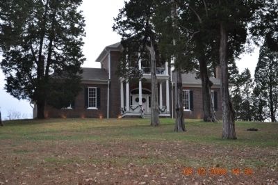
Photographed by Sandra Hughes, December 6, 2009
2. Belle Mont Mansion
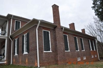
Photographed by Sandra Hughes, December 6, 2009
3. Belle Mont Mansion~Side View
Side View
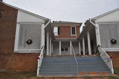
Photographed by Sandra Hughes, December 6, 2009
4. Belle Mont Mansion ~Back of Mansion
Credits. This page was last revised on October 31, 2019. It was originally submitted on April 6, 2010, by Sandra Hughes Tidwell of Killen, Alabama, USA. This page has been viewed 2,977 times since then and 50 times this year. Photos: 1, 2, 3, 4. submitted on April 6, 2010, by Sandra Hughes Tidwell of Killen, Alabama, USA. • Craig Swain was the editor who published this page.
