Wompatuck State Park in Hingham in Plymouth County, Massachusetts — The American Northeast (New England)
US Military History
Photographed by G.W.Bartlett
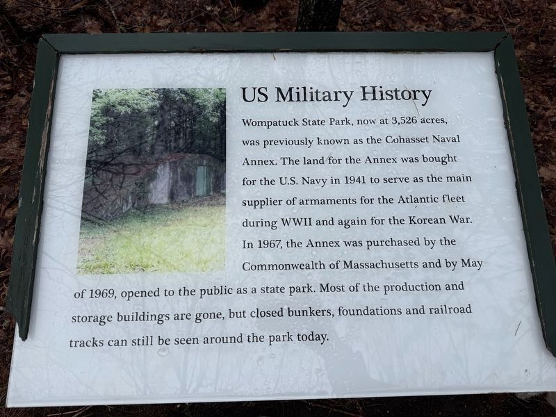
1. US Military History Marker
Wompatuck State Park, now at 3,526 acres, was previously known as the Cohasset Naval Annex. The land for the Annex was bought for the U.S. Navy in 1941 to serve as the main supplier of armaments for the Atlantic fleet during WWII and again for the Korean War. In 1967, the Annex was purchased by the Commonwealth of Massachusetts and by May of 1969, opened to the public as a state park. Most of the production and storage buildings are gone, but closed bunkers, foundations and railroad tracks can still be seen around the park today.
Erected by Massachusetts Department of Conservation and Recreation (DCR).
Topics. This historical marker is listed in these topic lists: Parks & Recreational Areas • War, World II. A significant historical month for this entry is May 1869.
Location. 42° 13.023′ N, 70° 51.445′ W. Marker is in Hingham, Massachusetts, in Plymouth County. It is in Wompatuck State Park. It is on Healthy Heart Trail half a mile east of Union Street, on the left when traveling west. Park in second parking lot on left after entering park. Proceed down wide paved Healthy Heart Trail. Proceed to trail intersection marker
this page online

Regionally, this marker is on the South Shore. It is also in the American Northeast, in New England, and on the Eastern Seaboard. Globally, it is in the North Atlantic Region, North America, the Western Hemisphere, the Western World, and the Anglosphere. Historically, it finds itself in what was once one of the original Thirteen Colonies.
Other nearby markers. At least 8 other markers are within 2 miles of this marker, measured as the crow flies: General History (about 300 feet away, measured in a direct line); Chief Wompatuck (approx. ¼ mile away); The Mill at Triphammer Pond (approx. 0.6 miles away); Hingham Second Parish Church (approx. 1.4 miles away); Second Almshouse (approx. 1½ miles away); Korean War (approx. 1½ miles away); These Trees and This Stone (approx. 1½ miles away); In Memoriam to Hingham’s War Dead (approx. 1½ miles away). Touch for a list and map of all markers
Photographed by G.W.Bartlett
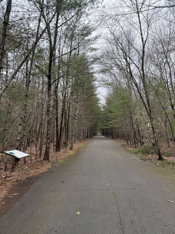
2. U.S. Military History Marker
U.S. Military History is to the left of the path on the opposite side from the Accord Brook.
Also see . . . Wompatuck Park Maps. <blockquote>Access this interactive map at Wompy.org/Map from any smart phone via your phone's web browser. While in the park, open the map and locate the menu in the upper-right corner. Click the drop-down menu to view all map features. The interactive map can show: Your real-time location in the park, Points of interest [including military artifacts], Suggested hiking & walking routes, Mountain bike trail ratings and guide (Submitted on March 23, 2026, by G.W.Bartlett of Hingham, Massachusetts.)
Credits. This page was last revised on March 25, 2026. It was originally submitted on March 21, 2026, by G.W.Bartlett of Hingham, Massachusetts. This page has been viewed 21 times since then. Photos: 1, 2. submitted on March 21, 2026, by G.W.Bartlett of Hingham, Massachusetts. • Devry Becker Jones was the editor who published this page.
