Parma in Cuyahoga County, Ohio — The American Midwest (Great Lakes)
Henninger Homestead
Photographed by Craig Doda, March 7, 2026
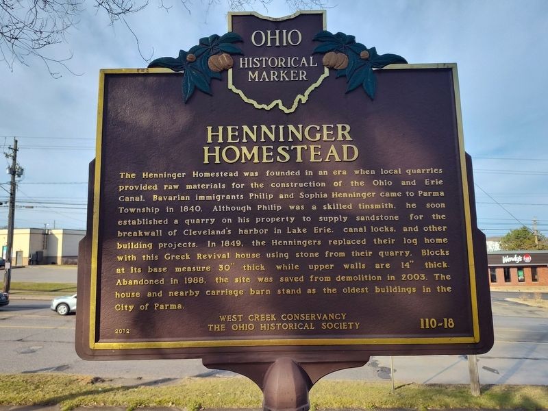
1. Henninger Homestead Marker
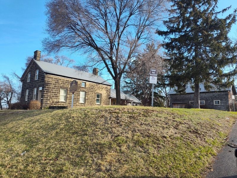
The Henninger Homestead was founded in an era when local quarries provided raw materials for the construction of the Ohio and Erie Canal. Bavarian immigrants Philip and Sophia Henninger came to Parma Township in 1840. Although Philip was a skilled tinsmith, he soon established a quarry on his property to supply sandstone for the breakwall of Cleveland's harbor in Lake Erie, canal locks, and other building projects. In 1849, the Henningers replaced their log home with this Greek Revival house using stone from their quarry. Blocks at its base measure 30" thick while upper walls are 14" thick. Abandoned in 1988, the site was saved from demolition in 2003. The house and nearby carriage barn stand as the oldest buildings in the City of Parma.
Erected 2012 by West Creek Conservancy; The Ohio Historical Society. (Marker Number 110-18.)
Topics and series. This historical marker is listed in these topic lists: Architecture • Industry & Commerce • Waterways & Vessels. In addition, it is included in the Ohio Historical Society / The Ohio History Connection series list. A significant historical year for this entry is 1840.
Location. 41° 24.37′ N,
this page online

Regionally, this marker is in Greater Cleveland, on the Lake Erie Shore, and in the Western Reserve. It is also in the American Midwest. Globally, it is in North America, on the Great Lakes, in the Western Hemisphere, in the Western World, and in the Anglosphere. Historically, it finds itself in what was once the Haudenosaunee (Iroquois) Confederacy, the territory of the Mississippian Culture, and the Northwest Territory.
Other nearby markers. At least 8 other markers are within 3 miles of this marker, measured as the crow flies: A different marker also named Henninger Homestead (within shouting distance of this marker); Brooklyn Heights (approx. 1.3 miles away); POW-MIA Day (approx. 2 miles away); Old Brooklyn Veterans Memorial (approx. 2 miles away); Veterans Memorial (approx. 2.1
Photographed by Craig Doda, March 7, 2026
2. Henninger Homestead Marker
Credits. This page was last revised on March 22, 2026. It was originally submitted on March 21, 2026, by Craig Doda of Napoleon, Ohio. This page has been viewed 35 times since then. Photos: 1, 2. submitted on March 21, 2026, by Craig Doda of Napoleon, Ohio. • Devry Becker Jones was the editor who published this page.
