Downtown in Cleveland in Cuyahoga County, Ohio — The American Midwest (Great Lakes)
Ohio and Erie Canal
Photographed by Christopher Busta-Peck, April 12, 2009
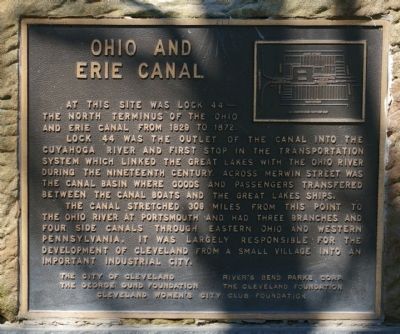
1. Ohio and Erie Canal Marker
At this site was lock 44, the north terminus of the Ohio and Erie Canal from 1829 to 1872.
Lock 44 as the outlet of the canal into the Cuyahoga River and the first stop in the transportation system which linked the Great Lakes with the Ohio River during the nineteenth century. Across Merwin Street was the canal basin where goods and passengers transferred between the canal boats and the Great Lakes ships.
The canal stretched 309 miles from this point to the Ohio River at Portsmouth and had three branches and four side canals through eastern Ohio and western Pennsylvania. It was largely responsible for the development of Cleveland from a small village into an important industrial city.
Erected by the City of Cleveland, River's Bend Parks Corp, the George Gund Foundation, the Cleveland Foundation, and the Cleveland Women's City Club Foundation.
Topics. This historical marker is listed in these topic lists: Industry & Commerce • Settlements & Settlers • Waterways & Vessels. A significant historical year for this entry is 1829.
Location. Marker is missing. It was located near 41° 29.733′ N, 81° 42.108′ W.
this page online

Regionally, this marker was on Ohio’s Lake Erie Shore and in the Western Reserve. It was also in the American Midwest. Globally, it was in North America, on the Great Lakes, in the Western Hemisphere, in the Western World, and in the Anglosphere. Historically, it found itself in what was once the Haudenosaunee (Iroquois) Confederacy, the territory of the Mississippian Culture, and the Northwest Territory.
Other nearby markers. At least 8 other markers are within walking distance of this location: Alexis de Tocqueville (within shouting distance of this marker); A River Reborn (about 400 feet away); Celebrating 50 years of progress on the Cuyahoga River (about 400 feet away); Irish Famine Memorial (about 400 feet away); Ohio & Erie Canalway (about 400 feet away); The Canal (about 500 feet away); Moses Cleaveland Survey
Photographed by Christopher Busta-Peck
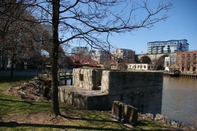
2. Marker location, by the Cuyahoga River
Other markers no longer nearby. John D. Rockefeller / The Standard Oil Company (was about 300 feet away, measured in a direct line but has been confirmed missing); Moses Cleaveland’s “Capital Town” (was about 400 feet away but has been confirmed missing).
Photographed by Craig Doda, March 8, 2026
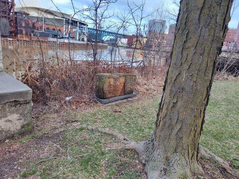
3. Ohio and Erie Canal Marker
Credits. This page was last revised on March 31, 2026. It was originally submitted on April 12, 2009, by Christopher Busta-Peck of Shaker Heights, Ohio. This page has been viewed 1,737 times since then and 32 times this year. Last updated on March 22, 2026, by Craig Doda of Napoleon, Ohio. Photos: 1, 2. submitted on April 12, 2009, by Christopher Busta-Peck of Shaker Heights, Ohio. 3. submitted on March 22, 2026, by Craig Doda of Napoleon, Ohio. • Devry Becker Jones was the editor who published this page.
