Near Courtland in Southampton County, Virginia — The American South (Mid-Atlantic)
General Thomas' Birthplace
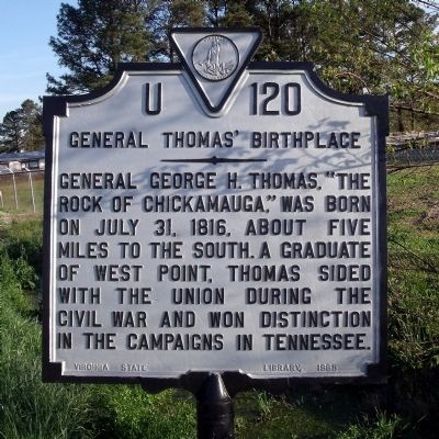
Photographed by Bernard Fisher, April 18, 2009
1. General Thomas' Birthplace Marker
Erected 1965 by Virginia State Library. (Marker Number U-120.)
Topics and series. This historical marker is listed in this topic list: War, US Civil. In addition, it is included in the Virginia Department of Historic Resources (DHR) series list. A significant historical month for this entry is July 1885.
Location. Marker is missing. It was located near 36° 41.458′ N, 77° 1.782′ W. Marker was near Courtland, Virginia, in Southampton County. It was on Southampton Parkway (U.S. 58) 0.7 miles east of Jerusalem Road, on the right when traveling east. Touch for map. Marker was at or near this postal address: 28158 Southampton Pkwy, Courtland VA 23837, United States of America. Touch for directions.

Regionally, this marker was in Coastal Virginia and in the Hampton Roads Metropolitan Area. It was also in the American South, specifically in the Upper South, and in the Tidewater. Globally,
this page online
Other nearby markers. At least 8 other markers are within 3 miles of this location, measured as the crow flies: Virginia Native Tribes/First Americans (approx. 0.8 miles away); Slave Revolts (approx. 2.1 miles away); Slavery's Roots (approx. 2.1 miles away); Conditions of Slavery (approx. 2.1 miles away); Rebecca Vaughan House (approx. 2.1 miles away); The 1831 Insurrection (approx. 2.1 miles away); Marle Hill (approx. 2.4 miles away); St. Luke's Church (approx. 2½ miles away). Touch for a list and map of all markers in Courtland.
Another marker is no longer nearby. The Rebecca Vaughan House (was approx. 2.1 miles away but has been replaced with another marker now near it).
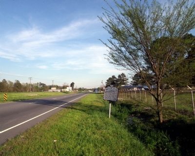
Photographed by Bernard Fisher, April 18, 2009
2. General Thomas' Birthplace Marker on US Rte 58 (facing east)
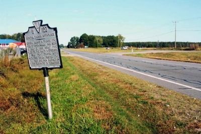
Photographed by Mike Stroud, October 15, 2011
3. General Thomas' Birthplace Marker, looking west along US 58
Credits. This page was last revised on March 22, 2026. It was originally submitted on April 21, 2009, by Bernard Fisher of Richmond, Virginia. This page has been viewed 2,168 times since then and 66 times this year. Last updated on March 22, 2026, by Evan Dwyer of Richmond, Virginia. Photos: 1, 2. submitted on April 21, 2009, by Bernard Fisher of Richmond, Virginia. 3. submitted on October 25, 2011, by Mike Stroud of Bluffton, South Carolina. • Devry Becker Jones was the editor who published this page.
