Pullman in Chicago in Cook County, Illinois — The American Midwest (Great Lakes)
Lake Vista

Photographed by Daniel Barriball, March 21, 2026
1. Lake Vista Marker
Lake Vista's winding park paths and low walls gave beauty to power.
Architect Solon Beman designed the Pullman Palace Car Works in the Romanesque Revival style as the centerpiece of George Pullman's model company town. Landscape architect Nathan Barrett sited Lake Vista in front of the building and surrounded it with meandering paths and lush gardens. While Lake Vista provided an idyllic foreground for the elegant, imposing Car Works, it also served an important function, as it cooled wastewater from the Pullman steam plant.
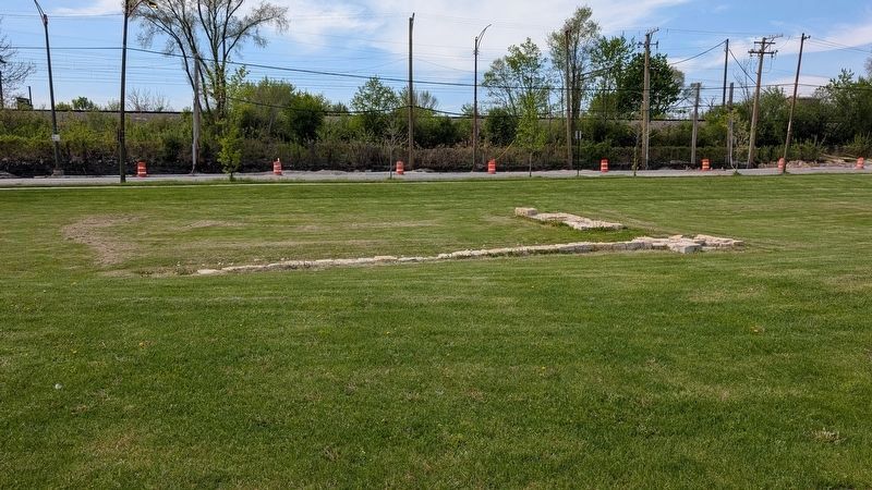
By 1892, Lake Vista's southern limestone wall was removed, and in 1899, the Pullman Company filled in the lake as it continued expanding the factory's production. During a 2020 restoration of the site, the foundations of the south wall and pier were discovered. They were documented, stabilized, and carefully preserved in place.
"Pullman, as an object of interest to the visitor from abroad and as a show place to the traveler coming and going on the Illinois Central, is doomed. Radical changes embodying the destruction of the 'model town's' most distinctive features—the beauty of lake and lawn, of shrubbery and flowers—have already been decreed."
"PullmanIs Doomed," Chicago Inter-Ocean, 29 April 1899
Click or scan to see
this page online
[Captions:]
Top Left Lake Vista in 1883 with its curved walls and paths. The foundations of the pier and wall in the center of this aerial photograph survive.
Left By 1892, the above-ground portion of the curved wall had been removed.
Bottom Left In the winter of 1893, Lake Vista froze and was transformed into an ice-skating rink.
Bottom In the summer of 1899, laborers filled Lake Vista with sand. Pullman station was moved across the tracks.
Topics. This historical marker is listed in these topic lists: Anthropology & Archaeology • Architecture • Industry & Commerce • Railroads & Streetcars. A significant historical date for this entry is April 29, 1899.
Location. 41° 41.597′ N, 87° 36.556′ W. Marker is in Chicago, Illinois, in Cook County. It is in Pullman. It is on South Cottage Grove Avenue north of East 11th Street, on the right when traveling north. The marker stands in Pullman National Historical Park. Touch for map. Marker is at or near this postal address: 11057 S Cottage Grove Ave, Chicago IL 60628, United States of America. Touch for directions.

Regionally, this marker
Photographed by Daniel Barriball, April 26, 2026
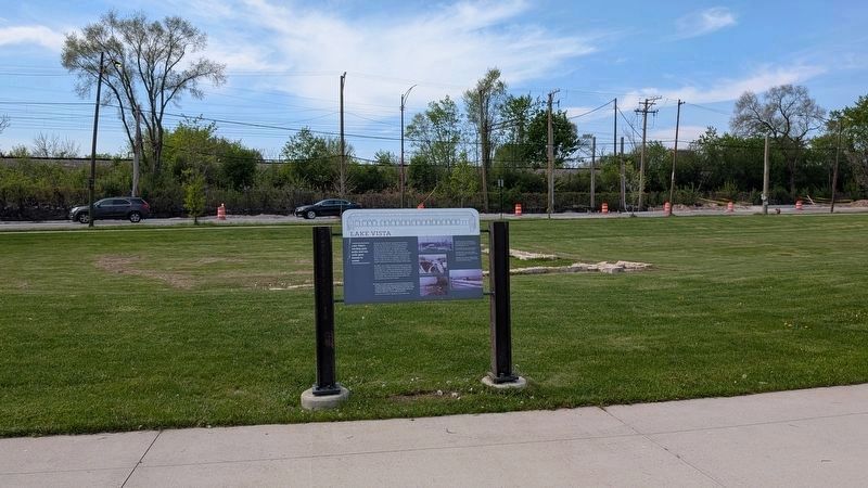
2. Lake Vista Marker in context
The foundations of Lake Vista's south wall and pier are behind the marker.
Other nearby markers. At least 8 other markers are within walking distance of this marker: Image and Reality (here, next to this marker); The Town of Pullman (a few steps from this marker); Welcome to Pullman (a few steps from this marker); People-Powered (within shouting distance of this marker); From Wood to Steel (within shouting distance of this marker); Machines and Workers (within shouting distance of this marker); The Workers' Main Gate (within shouting distance of this marker); a different marker also named Welcome to Pullman (about 300 feet away, measured in a direct line). Touch for a list and map of all markers in Chicago.
Photographed by Daniel Barriball, April 26, 2026
3. Foundations of Lake Vista's south wall and pier
The foundations were uncovered during a 2020 site restoration and left in place.
Credits. This page was last revised on May 4, 2026. It was originally submitted on March 22, 2026, by Daniel Barriball of Chesterton, Indiana. This page has been viewed 22 times since then. Photos: 1. submitted on March 22, 2026, by Daniel Barriball of Chesterton, Indiana. 2, 3. submitted on April 27, 2026, by Daniel Barriball of Chesterton, Indiana. • Devry Becker Jones was the editor who published this page.
