Mineral Wells in Palo Pinto County, Texas — The American South (West South Central)
Elmwood Cemetery
Photographed by Jeff Leichsenring, March 22, 2026
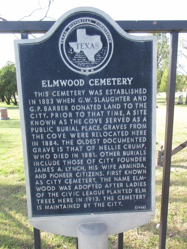
1. Elmwood Cemetery Marker
This cemetery was established in 1883 when G. W. Slaughter and G. P. Barber donated land to the city. Prior to that time, a site known as The Cove served as a public burial place. Graves from The Cove were relocated here in 1884. The oldest documented grave is that of Nellie Crump, who died in 1881. Other burials include those of city founder James A. Lynch, his wife Arminda, and pioneer citizens. First known as City Cemetery, the name Elmwood was adopted after ladies of the civic league planted elm trees here in 1913. The cemetery is maintained by the city.
Erected 1988 by Texas Historical Commission. (Marker Number 1468.)
Topics. This historical marker is listed in this topic list: Cemeteries & Burial Sites. A significant historical year for this entry is 1883.
Location. 32° 48.556′ N, 98° 6.075′ W. Marker is in Mineral Wells, Texas, in Palo Pinto County. It is at the intersection of East Hubbard Street (U.S. 180) and SE 13th Ave, on the right when traveling west on East Hubbard Street. Touch for map. Marker is at or near this postal address: 1401 East Hubbard St, Mineral Wells TX 76067, United States of America.
this page online

Regionally, this marker is in the Prairies & Lakes Region. Globally, it is in North America, a Gulf of Mexico state, the Western Hemisphere, the Western World, and the Anglosphere. Historically, it finds itself in what was once New Spain, the Comanchería, the Republic of Texas, and one of the Confederate States of America.
Other nearby markers. At least 8 other markers are within walking distance of this marker: Old Mineral Wells Post Office (approx. 0.6 miles away); First Mineral Water Well (approx. 0.7 miles away); Mineral Wells (approx. 0.7 miles away); Weatherford, Mineral Wells & Northwestern Railway Depot (approx. 0.7 miles away); Famous Mineral Water Company (approx. 0.8 miles away); First Baptist Church of Mineral Wells (approx. 0.9 miles away); Dr. H.H. Milling (approx. one mile away); The Rock Schoolhouse (approx. one mile away). Touch for a list and map of all markers in Mineral Wells.

Photographed by Jeff Leichsenring, March 22, 2026
2. Elmwood Cemetery and marker
Credits. This page was last revised on March 23, 2026. It was originally submitted on March 22, 2026, by Jeff Leichsenring of Garland, Texas. This page has been viewed 33 times since then. Photos: 1, 2. submitted on March 22, 2026, by Jeff Leichsenring of Garland, Texas. • James Hulse was the editor who published this page.
