Near Ranger in Eastland County, Texas — The American South (West South Central)
Bullock Cemetery
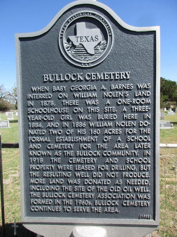
Photographed by Jeff Leichsenring, March 22, 2026
1. Bullock Cemetery Marker
When baby Georgia A. Barnes was interred on William Nolen's land in 1878, there was a one-room schoolhouse on this site. A three-year-old girl was buried here in 1884, and in 1886 William Nolen donated two of his 160 acres for the formal establishment of a school and cemetery for the area later known as the Bullock community. In 1918 the cemetery and school property were leased for drilling, but the resulting well did not produce. More land was donated as needed, including the site of the old oil well. The Bullock Cemetery Association was formed in the 1960s. Bullock Cemetery continues to serve the area.
Erected 1998 by Texas Historical Commission. (Marker Number 11851.)
Topics. This historical marker is listed in this topic list: Cemeteries & Burial Sites.
Location. 32° 30.873′ N, 98° 41.183′ W. Marker is near Ranger, Texas, in Eastland County. It is at the intersection of Farm to Market Road 717 and County Road 117, on the right when traveling north on Road 717. Touch for map. Marker is at or near this postal address: 913 FM 717, Ranger TX 76470, United States
this page online

Regionally, this marker is in Big Country. Globally, it is in North America, a Gulf of Mexico state, the Western Hemisphere, the Western World, and the Anglosphere. Historically, it finds itself in what was once New Spain, the Comanchería, the Republic of Texas, and one of the Confederate States of America.
Other nearby markers. At least 8 other markers are within 6 miles of this marker, measured as the crow flies: Ranger Vietnam Veterans Memorial (approx. 3.1 miles away); Roaring Ranger (approx. 3.1 miles away); Well Number 19 (approx. 3.1 miles away); Site of First Oil Well Drilled in Eastland County (approx. 3.1 miles away); The Bankhead Highway (approx. 3.1 miles away); Ranger Municipal Airport (approx. 4.1 miles away); Site of J.H. McCleskey No. 1 (approx. 4.4 miles away); Mount Zion Cemetery (approx. 5.4 miles away). Touch for a list and map of all markers in Ranger.

Photographed by Jeff Leichsenring, March 22, 2026
2. Bullock Cemetery and marker
Credits. This page was last revised on March 23, 2026. It was originally submitted on March 22, 2026, by Jeff Leichsenring of Garland, Texas. This page has been viewed 36 times since then. Photos: 1, 2. submitted on March 22, 2026, by Jeff Leichsenring of Garland, Texas. • James Hulse was the editor who published this page.
