Clifton Forge in Alleghany County, Virginia — The American South (Mid-Atlantic)
Green Pastures Recreation Area
Photographed by Stephen Escalera
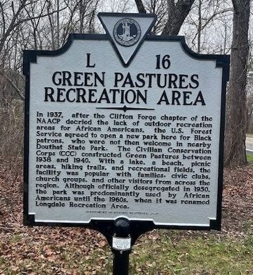
1. Green Pastures Recreation Area Marker
In 1937, after the Clifton Forge chapter of the NAACP decried the lack of outdoor recreation areas for African Americans, the U.S. Forest Service agreed to open a new park here for Black patrons, who were not then welcome in nearby Douthat State Park. The Civilian Conservation Corps (CCC) constructed Green Pastures between 1938 and 1940. With a lake, a beach, picnic areas, hiking trails, and recreational fields, the facility was popular with families, civic clubs, church groups, and other visitors from across the region. Although officially desegregated in 1950, the park was predominantly used by African Americans until the 1960s, when it was renamed Longdale Recreation Area.
Erected 2021 by Department of Historic Resources. (Marker Number L-16.)
Topics and series. This historical marker is listed in these topic lists: African Americans • Charity & Public Work • Parks & Recreational Areas. In addition, it is included in the Civilian Conservation Corps (CCC), and the Virginia Department of Historic Resources (DHR) series lists. A significant historical year for this entry is 1937.
Location. 37° 47.828′ N, 79° 42.459′ W.
this page online

Regionally, this marker is in the Mountain Region, in the Alleghany Highlands, and specifically in the Potomac Highlands. It is also in the American South, specifically in the Upper South, in Appalachia, and specifically in Southern Appalachia. Globally, it is in North America, the Western Hemisphere, the Western World, and the Anglosphere. Historically, it finds itself in what was once the territory of the Mississippian Culture, one of the original Thirteen Colonies, one of the Confederate States of America, and the Antebellum South.
Other nearby markers. At least 8 other markers are within 7 miles of this marker, measured as the crow flies: Lucy Selina Furnace (approx. 1.4 miles away); a different marker also named Lucy Selina Furnace (approx. 1.8 miles away); Australia Furnace (approx. 1.8 miles away); Alleghany County / Botetourt County (approx. 4.3 miles away); Douthat State Park (approx. 5.1 miles away); Robert Gallaspy Land Grant (approx. 6½ miles away); Roger Arliner Young (approx. 6½ miles away); Veterans Memorial (approx. 6½ miles away). Touch for a list and map of all markers in Clifton Forge.
Credits. This page was last revised on March 24, 2026. It was originally submitted on March 23, 2026, by Stephen Escalera of Roanoke, Virginia. This page has been viewed 35 times since then. Photo 1. submitted on March 23, 2026, by Stephen Escalera of Roanoke, Virginia. • Devry Becker Jones was the editor who published this page.
Editor’s want-list for this marker. A wide shot of the marker in context. • Can you help?
