Johns Island in Charleston County, South Carolina — The American South (South Atlantic)
Federal Expedition on John's Island
⎯⎯⎯
Battle of Burden's Causeway
Photographed by Mike Stroud, 2010
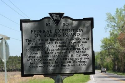
1. Federal Expedition on John's Island Marker
Federal Expedition on John's Island
The Battle of Burden’s Causeway was the climax of a Federal expedition against John’s Island, July 2-9, 1864. 5000 Federals under Brig. Gen. John P. Hatch crossed the Stono River and advanced along it. By July 6th they occupied a strong position here, where a bridge on Burden’s Causeway crossed Burden’s Creek.
(Reverse text)
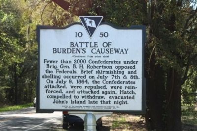
Battle of Burden's Causeway
Fewer than 2000 Confederates under Brig. Gen. B.H. Robertson opposed the Federals. Brief skirmishing and shelling occurred on July 7th and 8th. On July 9, 1864, the Confederates attacked, were repulsed, were reinforced, and attacked again. Hatch, compelled to withdraw, evacuated John’s Island late that night.
Erected 2006 by The Carolina Historical Site Preservation Foundation, Inc., and Secession Camp #4, Sons of Confederate Veterans. (Marker Number 10-50.)
Topics and series. This historical marker is listed in this topic list: War, US Civil. In addition, it is included in the Sons of Confederate Veterans/United Confederate Veterans series list. A significant historical month for this entry is July 1740.
Location. 32° 43.108′ N, 80° 1.295′ W.
this page online

Regionally, this marker is in the Lowcountry. It is also in the American South, specifically in the Deep South, and on the Eastern Seaboard. Globally, it is in the North Atlantic Region, North America, the Western Hemisphere, the Western World, and the Anglosphere. Historically, it finds itself in what was once the territory of the Mississippian Culture, one of the original Thirteen Colonies, one of the Confederate States of America, and the Antebellum South.
Other nearby markers. At least 8 other markers are within 5 miles of this marker, measured as the crow flies: The Progressive Club (approx. 3.1 miles away); Hunter's Volunteers (approx. 3.1 miles away); St. John’s Episcopal Church (approx. 3.7 miles away); Battery Number 5 (approx. 4 miles away); Battle of Sol-Legare Island
Photographed by Mike Stroud, April 6, 2010
2. Battle of Burden's Causeway Marker
Also see . . . John Porter Hatch. In 1864, he was assigned to the Department of the South, where he had charge of the coast division. He was in charge of operations on John's Island, South Carolina, in July and led the Federal forces at the Battle of Honey Hill in November. (Submitted on April 8, 2010, by Mike Stroud of Bluffton, South Carolina.)
Photographed by Mike Stroud, April 6, 2010
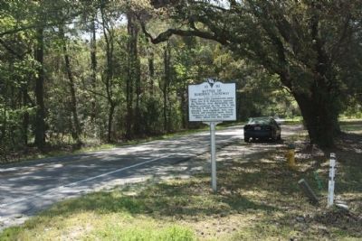
3. Federal Expedition on John's Island / Battle of Burden's Causeway Marker
Seen looking south along River Road, John's Island
Photographed by Mike Stroud, April 6, 2010
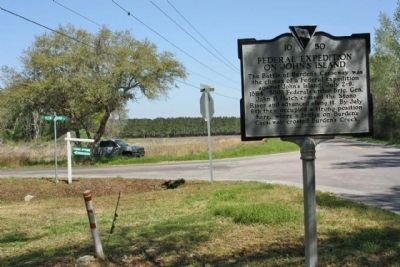
4. Federal Expedition on John's Island / Battle of Burden's Causeway Marker
at the intersection of River Road and Plow Ground Road
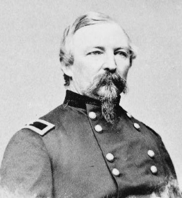
Civil War Photograph Collection, Library of Congress
5. Gen. John Porter Hatch , USA

Civil War Photograph Collection, Library of Congress
6. General Beverly Holcombe Robertson
Credits. This page was last revised on December 5, 2020. It was originally submitted on April 8, 2010, by Mike Stroud of Bluffton, South Carolina. This page has been viewed 5,284 times since then and 268 times this year. Photos: 1, 2, 3, 4, 5. submitted on April 8, 2010, by Mike Stroud of Bluffton, South Carolina. 6. submitted on April 9, 2010, by Michael Sean Nix of Spartanburg, South Carolina. • Craig Swain was the editor who published this page.
