Short North Arts District in Columbus in Franklin County, Ohio — The American Midwest (Great Lakes)
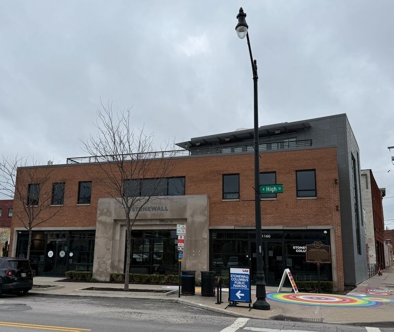
Stonewall Union
Stonewall Columbus

Stonewall Union (later Stonewall Columbus) was founded in 1981 by central Ohio LGBTQ+ activists. The organization focused on activism on behalf of the LGBTQ+ community, as well as providing physical spaces where that community could prosper. Deriving its name from the 1969 Stonewall Uprisings in New York City, Stonewall Union formed with the goals of bringing legislative reform, community building, and education to Columbus for the benefit of the LGBTQ+ community. Stonewall Union organized its first Pride March, on June 26, 1982, with over 500 participants. Additionally, Stonewall Union launched such community-building initiatives as the 1982 television program Gay Pride Report and the 1984 Lavender Listings business guide. In 1985, Stonewall Union moved into its first building.
Stonewall Union was integral in advancing LGBTQ+ equity measures in Ohio. In 1983, Stonewall Union aided in developing the Governor's Executive Order that banned discrimination based on sexual orientation in state employment. Lobbying continued to extend employment discrimination bans into the private sector and, as a result, Columbus amended
this page online
Erected 2024 by Stonewall Columbus; Ohio History Connection. (Marker Number 142-25.)
Topics and series. This historical marker is listed in these topic lists: Civil Rights • Communications • Government & Politics • Industry & Commerce. In addition, it is included in the Ohio Historical Society / The Ohio History Connection series list. A significant historical date for this entry is June 26, 1982.
Location. 39° 59.158′ N, 83° 0.309′ W. Marker is in Columbus, Ohio, in Franklin County. It is in the Short North Arts District. It is at the intersection of North High Street and East 4th Avenue, on the right when traveling north on North High Street.


Regionally, this marker is in Ohio’s Scioto Valley. It is also in the American Midwest and in the Corn Belt. Globally, it is in North America, the Western Hemisphere, the Western World, and the Anglosphere. Historically, it finds itself in what was once the Haudenosaunee (Iroquois) Confederacy, the territory of the Mississippian Culture, and the Northwest Territory.
Other nearby markers. At least 6 other markers are within walking distance of this marker: Pride Circles (here, next to this marker); The Fireproof Building (approx. 0.2 miles away); The Makers Monument (approx. half a mile away); She Moves With Color (approx. half a mile away); Father Rocco Petrarca (approx. 0.7 miles away); Chiesa Italiana u San Giovanni Battista (approx. 0.7 miles away). Touch for a list and map of all markers in Columbus.
Other markers no longer nearby. Garden Theatre (was within shouting distance of this marker but has been permanently removed); Gallery Hop (was within shouting distance
Additional keywords. 🏳️🌈, LGBT, LGBTQ
Credits. This page was last revised on March 27, 2026. It was originally submitted on March 27, 2026, by Devry Becker Jones of Washington, District of Columbia. This page has been viewed 11 times since then. Photos: 1, 2, 3. submitted on March 27, 2026, by Devry Becker Jones of Washington, District of Columbia.
