Ballajá in San Juan in Municipio de San Juan, Puerto Rico — The Caribbean (The West Indies)
The Dutch Attack of 1625
Ataque holandés de 1625
| — | San Juan National Historic Site | — |
Photographed by Bradley Owen, March 18, 2026
1. The Dutch Attack of 1625 Marker
(English):
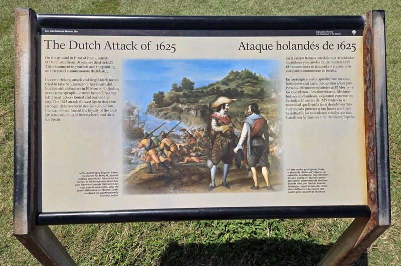
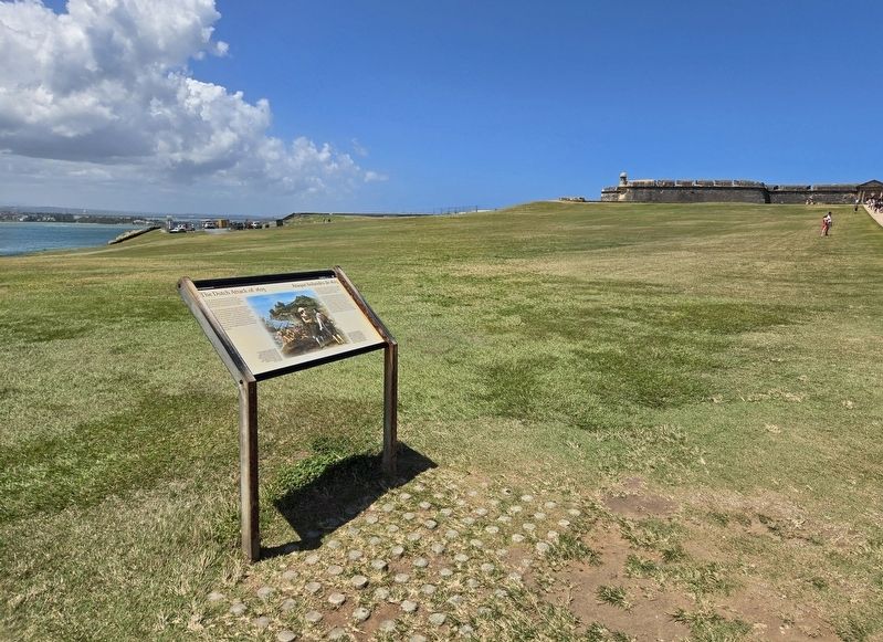
On the ground in front of you hundreds of Dutch and Spanish soldiers died in 1625. The monument to your left and the painting on this panel commemorate their battle.
In a month-long attack and siege Dutch forces tried to take San Juan, and they nearly did. But Spanish defenders in El Morro-including many townspeople drove them off. As they left, the attackers looted and burned the city. The 1625 attack showed Spain that even stronger defenses were needed to hold San Juan, and it confirmed the loyalty of the local citizens, who fought fiercely here, and died, for Spain.
(Spanish):
En el campo frente a usted cientos de soldados holandeses y españoles murieron en el 1625. El monumento a su izquierda y el cuadro en este panel conmemoran su batalla.
En un ataque y asedio que duró un mes, los holandeses casi lograron capturar a San Juan. Pero los defensores españoles en El Morro-y los ciudadanos-los ahuyentaron. Mientras huían los holandeses, saquearon y quemaron la ciudad. El ataque de 1625 evidenció la necesidad que España tenía de defensas más fuertes para proteger a San Juan y confirmó la lealtad de
this page online
(English and Spanish Captions):
In this painting by Eugenio Caxes, royal artist for Philip III, Spanish soldiers drive Dutch forces into the harbor. In the foreground stand San Juan Governor Juan de Haro and Cap-tain Juan de Amézquita, who led Spain's defenders in El Morro. Caxes rendered the painting shortly after the battle.
En este cuadro por Eugenio Caxés, el pintor de cámara de Felipe III, los españoles expulsan las fuerzas holan-desas al puerto. En el primer plano aparecen el gobernador de San Juan, Juan de Haro, y el Capitán Juan de Amézquita, quien dirigió a los defen-sores del Morro. Caxés pintó este cuadro poco después de la batalla.
Erected by National Park Service, U.S. Department of the Interior.
Topics. This historical marker is listed in this topic list: Wars, Non-US. A significant historical year for this entry is 1625.
Location. 18° 28.15′ N, 66° 7.335′ W. Marker is in San Juan in Municipio de San Juan, Puerto Rico. It is in Ballajá. It is on Calle del Morro north of Calle Norzagaray, on the left when traveling north. Marker is
Photographed by Bradley Owen, March 18, 2026
2. The Dutch Attack of 1625 Marker

Regionally, it is one of the Greater Antilles on the Caribbean Sea, on in the Atlantic Ocean, in North America, in the Western Hemisphere, in the Western World, and in the Anglosphere. Historically, it finds itself in what was once a Spanish colony.
Other nearby markers. At least 8 other markers are within walking distance of this marker: Kites (about 400 feet away, measured in a direct line); A Defense of the 1st Order (about 600 feet away); Plaza del Cuartel (approx. 0.2 kilometers away); The Main Plaza / Plaza principal (approx. 0.3 kilometers away); Juan Ponce de Leon (approx. half a kilometer away); La Rogativa (approx. half a kilometer away); Anna de Lanzos de Villate (approx. 0.6 kilometers away); Felisa Rincon de Gautier (approx. 0.6 kilometers away). Touch for a list and map of all markers in San Juan.
Another marker is no longer nearby. Defending San Juan / Defensa de San Juan (was about 500 feet away but has
Photographed by Bradley Owen, March 18, 2026
3. Castillo San Felipe del Morro
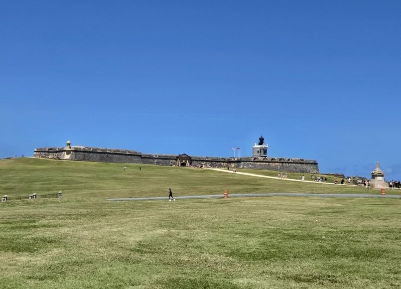
The monument mentioned on the marker can be seen at the far right of the photo.
Credits. This page was last revised on March 28, 2026. It was originally submitted on March 28, 2026, by Bradley Owen of Morgantown, West Virginia. This page has been viewed 51 times since then. Photos: 1, 2, 3. submitted on March 28, 2026, by Bradley Owen of Morgantown, West Virginia.
